East Europe (1684–1827 CE): Imperial Frontiers, Cossack…
1684 CE to 1827 CE
East Europe (1684–1827 CE): Imperial Frontiers, Cossack Borderlands, and the Making of a Black Sea Corridor
Geography & Environmental Context
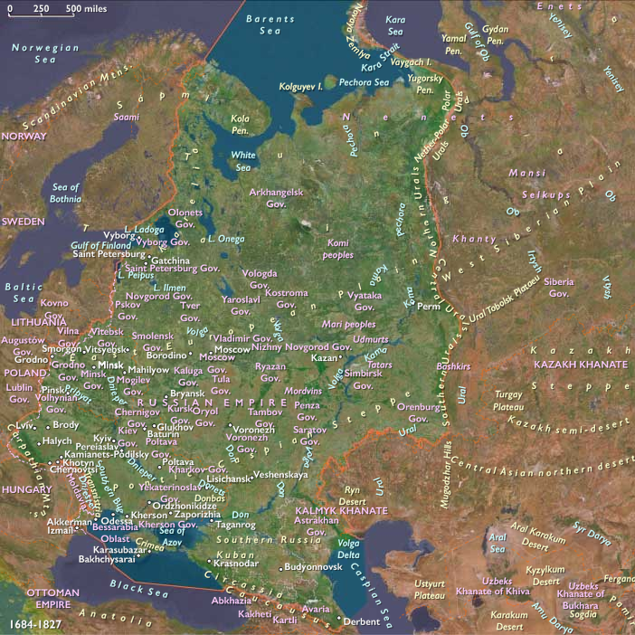
East Europe comprises Belarus, Ukraine, the European portion of Russia, and the sixteen Russian republics west of the Urals. Anchors include the Belarusian Plain and Polesia wetlands; the Dnieper, Dniester, Don, Volga–Okaupper and middle basins; the Forest–Steppe and Pontic Steppe belts; the Black Sea littoral from the Dniester estuary to the Sea of Azov; the Carpathian foothills (western Ukraine); and the Baltic access via St. Petersburg on the Neva. Soils ranged from chernozem steppe to mixed-forest podzols and peat marsh, shaping distinct agrarian and pastoral zones.
Climate & Environmental Shifts
The tail of the Little Ice Age brought sharp winters (notably the Great Frost of 1709) and intermittent droughts or wet years across the steppe. Harvest crises struck in the 1690s and 1816–1817 (the “Year Without a Summer,” after Tambora), stressing grain markets from the Volga to the Dnieper. Steppe aridity alternated with grassland fires; marshlands in Polesia expanded and contracted with precipitation cycles. River freeze-up and spring floods governed transport calendars on the Dnieper, Volga, and Don.
Subsistence & Settlement
-
Forest & Forest–Steppe (Belarus, central Russia): Peasant communes (mir / obshchina) practiced cereal rotations of rye, oats, barley, wheat, with flax and hemp; dairying and swine husbandry complemented mixed farming.
-
Pontic Steppe & Southern Ukraine: Rapid 18th–early 19th c. colonization (Novorossiya) introduced large estate grain, sheep, and horse herding; Odessa (1794) rose as a grain port.
-
Cossack borderlands: The Left-Bank and Zaporozhian lands balanced river fishing, apiaries, horse breeding, and mobile farming under semi-military communities; the Zaporozhian Sich was dissolved (1775).
-
Volga–Oka heartlands: Densely nucleated villages supplied state grain stores and urban markets; cottage linen and metalwork spread around river towns.
-
Carpathian piedmont: Smallholdings mixed rye, potatoes (increasingly after the late 18th c.), and pastoralism.
Technology & Material Culture
Wooden ard and iron-tipped ploughs coexisted; scythes, flails, and windmills/watermills processed grain. State-fostered industry expanded in European Russia (iron foundries at the Ural forelands, textile districts near Moscow). River craft—dubrovy, strugi, and barges—moved bulk goods; road stations (yam) supported courier lines. Orthodox ecclesiastical art (icon-painting, wood churches), Cossack arms and dress, Ukrainian baroque church façades, Belarusian weaving, and folk instruments (bandura, gusli) marked regional styles.
Movement & Interaction Corridors
Major corridors knitted the region into Eurasia:
-
River highways: Dnieper to the Black Sea; Volga north–south between the Upper Volga and Caspian; Don–Volga portages tied steppe to heartland.
-
Black Sea corridor: After the Russo-Ottoman wars, seizure and settlement of the Northern Black Sea opened export fronts through Kherson, Mykolaiv, and Odessa, linking chernozem grain to Mediterranean markets.
-
Baltic window: St. Petersburg (founded 1703) funneled timber, hemp, tar, and flax to northern Europe; canals linked Neva–Volga basins.
-
Steppe routes: Former Tatar and Cossack trails converted to postal and military roads as fort lines advanced.
Cultural & Symbolic Expressions
Orthodox Christianity remained the dominant frame (cathedrals, pilgrimage networks), alongside Greek-Catholic (Uniate) parishes in parts of Right-Bank Ukraine and Belarus. Cossack lore, dumy epics, and kobzar song carried frontier memory; Russian byliny and Old Believer hymnody persisted in forests and river towns. Kyiv-Mohyla intellectual circles and St. Petersburg/Moscow academies shaped elite culture; vernacular printing and parish schooling widened literacy slowly. Urban baroque and neoclassicism recast capitals, while folk wood architecture and embroidery sustained local aesthetics.
Technology & Material Culture (State & War)
Gun foundries, uniforms depots, and road/bridge building followed imperial logistics. Fortified lines stepped southward; naval yards on the Neva and Black Sea built fleets. The agrarian export complex—estate granaries, threshing barns, and river ports—scaled up with customs houses and brokers.
Movement & Interaction Corridors (War & Diplomacy)
-
Partitions of the Polish–Lithuanian Commonwealth (1772, 1793, 1795): Brought Belarus and Right-Bank territories under imperial rule, reorganized as guberniya administrations.
-
Crimean Khanate annexation (1783): Cleared the path for steppe colonization and Black Sea ports.
-
Russo-Ottoman wars (e.g., 1768–1774, 1787–1792, 1806–1812) shifted the Danube–Black Sea balance (bold frontiers, new fortresses).
-
French invasion of Russia (1812): Battle of Borodino, burning of Moscow, Berezina—devastation and mass mobilization reshaped supply systems and peasant obligations.
Environmental Adaptation & Resilience
Peasant communes shared risk through land repartition and labor exchange; estate managers diversified with sheep (merino booms), flax, and distilling. Steppe settlers planted shelterbelts and timed sowings to spring moisture; riverine granaries and state stores buffered dearth years. Fishing, beekeeping, and woodland foraging supplied protein and calories during shortfalls; rebuilding after wartime scorched-earth relied on communal labor and state grain loans.
Transition
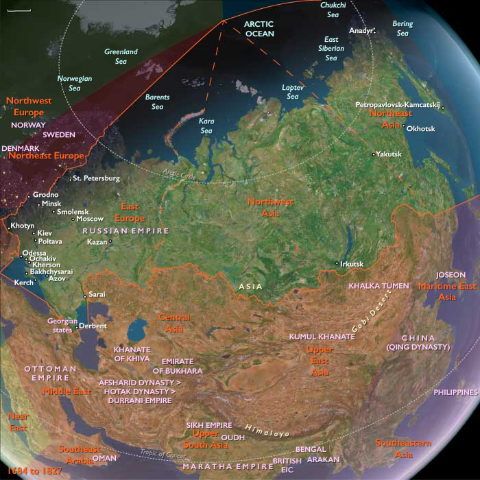
From 1684 to 1827, East Europe shifted from marsh-and-frontier mosaics to an imperial agrarian–export region tied to the Baltic and, crucially, to the Black Sea. The Cossack order was incorporated and dismantled; partitions, annexations, and wars with the Ottomans redrew maps; 1812 forged a continental wartime economy. By the 1820s, chernozem grain, new ports, and canalized river systems bound the region to global markets—while village mirinstitutions, Orthodox ritual calendars, and steppe colonization rhythms still governed everyday life.
People
Groups
Subjects
Regions
Northeastern Eurasia
View →Subregions