Mount Mazama erupts around 5,677 (± 150) …
Years: 5805BCE - 5662BCE
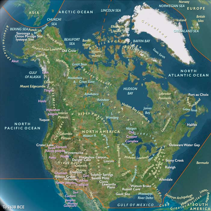
Mount Mazama erupts around 5,677 (± 150) BCE, reducing the stratovolcano's approximate twelve thousand-foot (thirty-seven hundred meters) height by around a mile (sixteen hundred meters).
Material ejected from the collapse and associated eruption destroys hundreds of square kilometers of the surrounding countryside in the Oregon part of the Cascade Volcanic Arc and the Cascade Range.
One pyroclastic flow travels forty miles (sixty-four kilometers) from Mazama down Rogue River Valley while another moves north in-between Mount Bailey and Mount Thielsen, moving over Diamond Lake (it finally comes to rest in North Umpqua River valley).
Winds carry tephra (ash and pumice) from Mazama northeast, where it covers over five hundred thousand square miles (one million three hundred thousand square kilometers) including nearly all of Oregon, Washington, northern California, Idaho, western Montana, and parts of Utah, Nevada, Wyoming, Alberta, British Columbia, and Saskatchewan.
The eruption had a Volcanic Explosivity Index (VEI) of 7, and it remains the largest single Holocene eruption, but the Global Volcanism Program lists it as VEI: 6. There's conflicting information in the sources, with VEI 7 appearing in more recent USGS sources.
The Klamath Native Americans of the area believed that Llao, their god of the underworld, inhabited the mountain.
After the mountain destroyed itself, the Klamaths recounted the events as a great battle between Llao and his rival Skell, their sky god.
The volcano's collapsed caldera will eventually fill with water from snowmelt and rain to create Crater Lake; the entire mountain is located within today’s Crater Lake National Park.
Locations
Groups
Topics
Subjects
Regions
Subregions
Years: 5805BCE - 5662BCE
Locations
Groups
Topics
Subjects
Regions
Subregions