Maritime East Asia (49,293 – 28,578 BCE): …
Years: 49293BCE - 28578BCE
Maritime East Asia (49,293 – 28,578 BCE): River Plains, Coastal Shelves, and Temperate Forests
Geographic and Environmental Context
-
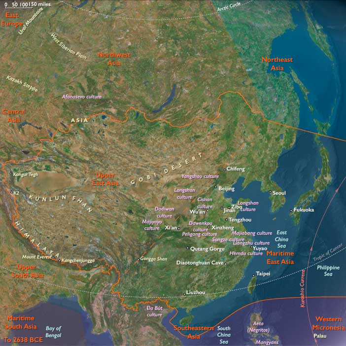
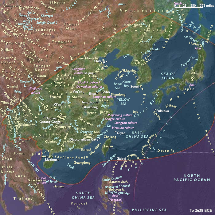
During this period, sea levels ~60–90 m lower exposed wide coastal plains along the Yellow Sea, East China Sea, and Taiwan Strait, linking Taiwan to the mainland.
-
Major rivers — the Yangtze, Yellow (Huang He), and Liao — extended far onto the exposed shelf, forming extensive estuarine wetlands.
-
The Japanese islands of Honshu, Shikoku, and Kyushu were joined in a single landmass with much broader coastal lowlands; they were separated from the mainland by narrower but still significant straits.
Climate and Environmental Shifts
-
The region lay under the influence of the East Asian monsoon, which fluctuated with Dansgaard–Oeschger warm phases and Heinrich cold/dry events.
-
Wetter interstadials strengthened the summer monsoon, expanding broadleaf forests and enhancing river productivity.
-
Drier stadials weakened the monsoon, expanding steppe and open woodland into lowland plains; dust from inland deserts increased.
-
Winters were colder, especially in northern China and Korea, with more frequent frost and snow.
Subsistence and Settlement
-
Lowland foragers hunted red deer, sika deer, boar, and wild cattle; fished and gathered shellfish in estuaries and tidal flats.
-
Upland and inland groups targeted sika and red deer, serow, and smaller mammals; gathered nuts, fruits, and tubers.
-
Coastal populations harvested marine fish, shellfish, and seaweeds year-round, especially in more sheltered bays.
-
Seasonal movements linked river valleys with uplands and coastal resource zones.
Technology and Material Culture
-
Lithic industries included flake tools, blades, and in some areas, early microblade traditions, particularly in northern parts of the region.
-
Stone raw materials varied: fine chert, quartzite, and volcanic rock from uplands; coastal gravels supplied cobbles.
-
Bone points and fish gorges likely used in coastal settings.
-
Ochre fragments and shell ornaments suggest symbolic use.
Movement and Interaction Corridors
-
Coastal routes linked populations along the exposed Yellow and East China Sea shelves, easing movement between mainland China, Taiwan, and southern Japan.
-
River corridors (especially the Yangtze and Yellow) connected interior and coastal zones, supporting seasonal migration and exchange.
-
Narrower sea gaps may have facilitated occasional crossings between the Korean Peninsula and the Japanese archipelago.
Cultural and Symbolic Expressions
-
Ornament production using perforated shells and animal teeth; ochre used for body decoration or hide treatment.
-
Possible early rock engravings or markings in caves and rock shelters.
Environmental Adaptation and Resilience
-
Dual reliance on terrestrial hunting and aquatic foraging buffered against monsoon variability.
-
Seasonal exploitation of multiple habitats — coastal, riverine, and upland — increased resilience.
-
Storage or preservation of nuts, fish, and meat may have been practiced to bridge winter shortages.
Toward the Last Glacial Maximum
By 28,578 BCE, Maritime East Asian foragers had mastered a range of environments from temperate forests to exposed coastal shelves, maintaining mobility and cultural connections across land–sea transitions as the region edged toward colder, drier LGM conditions.
Topics
Commodoties
Subjects
Regions
Subregions
Related Events
Showing 10 events out of 69706 total
Years: 49293BCE - 28578BCE
Topics
Commodoties
Subjects
Regions
Subregions