Colonist John Hunt had drawn a map …
Years: 1607 - 1607
October
Colonist John Hunt had drawn a map of the colony on October 8, 1607, showing eighteen buildings including the admiral's house, a chapel, a storehouse, a cooperage, and a guardhouse.
Hunt was listed in the colony register as "draughtsman".
It is not known if all the buildings were completed at the time.
Hunt's map will be discovered in 1888 in the Spanish national archives.
A spy had sold it to a Spanish ambassador who had sent it to Spain.
It might be a copy of the now-lost original map, and is the only known plan of the original layout of any early English colony.
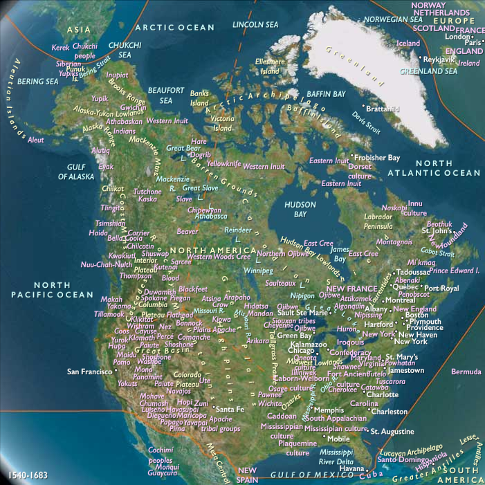
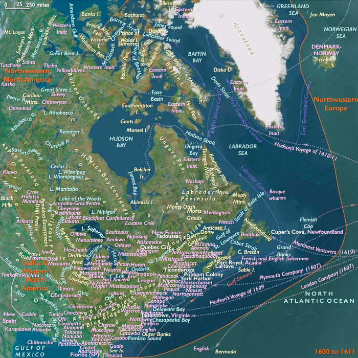
Popham and Gilbert have sent survey expeditions up the river and contacted the Abenaki, a tribe of Native Americans/First Nations belonging to the Algonquian peoples of northeastern North America.
In a letter to the King, Popham had written that the natives had told them that the area was full of easily exploitable resources.
However, the colony fails to establish cooperation with the tribe; they are suspicious because earlier expeditions had kidnapped natives to show at home.
Late summer arrival meant that there was no time to farm for food.
Half of the colonists return to Great Britain in December 1607 aboard the Gift of God.
Others face a cold winter during which the Kennebec River will freeze.
Locations
Groups
- Abenaki people (Amerind tribe)
- England, (Stuart) Kingdom of
- Plymouth Company, The (also called the Virginia Company of Plymouth)
- Popham Colony (English)
Topics
Commodoties
Subjects
Regions
Subregions
Years: 1607 - 1607
October
Locations
Groups
- Abenaki people (Amerind tribe)
- England, (Stuart) Kingdom of
- Plymouth Company, The (also called the Virginia Company of Plymouth)
- Popham Colony (English)
Topics
Commodoties
Subjects
Regions
Subregions