Uluru and Kata Tjuta had been first …
Years: 1873 - 1873
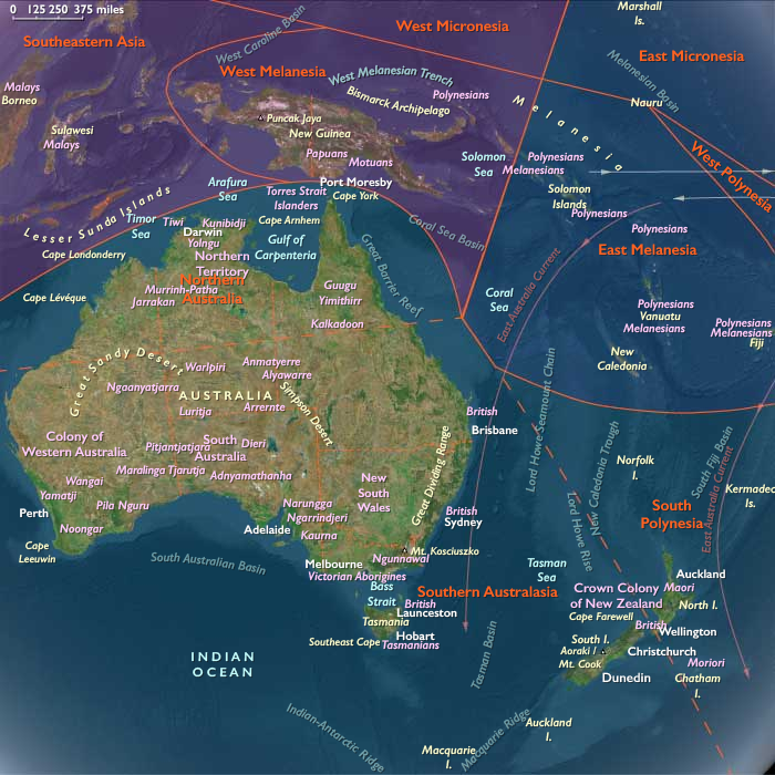
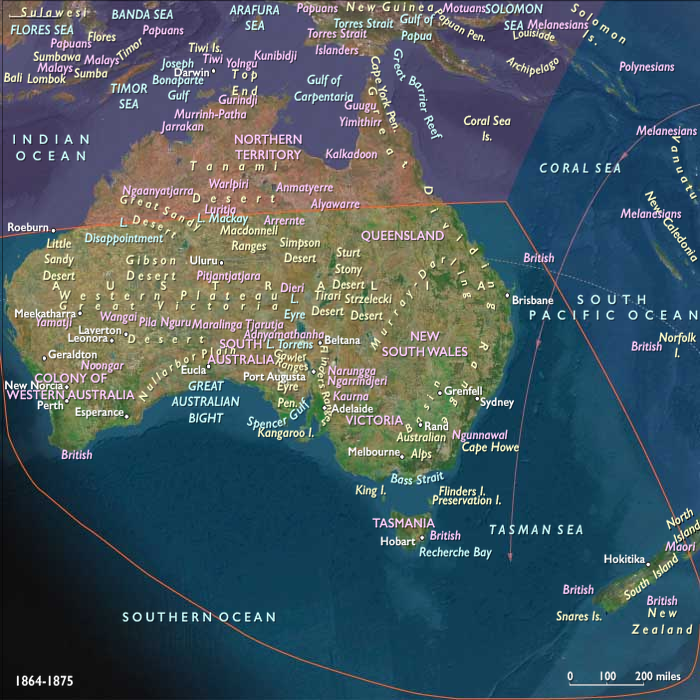
Uluru and Kata Tjuta had been first mapped by Europeans in 1872 during the expeditionary period made possible by the construction of the Australian Overland Telegraph Line.
In separate expeditions, Giles and Gosse are the first European explorers to this area.
While exploring the area in 1872, Giles had sighted Kata Tjuta from a location near Kings Canyon and called it Mount Olga, while the following year Gosse observes Uluru and nameda it Ayers Rock, in honor of the Chief Secretary of South Australia, Sir Henry Ayers.
These barren desert lands of Central Australia disappoint the Europeans as unpromising for pastoral expansion, but will later come to be appreciated as emblematic of Australia.

Aerial of Kata Tjuta/The Olgas (4 January 2007, Imagegallery Tourism NT)
Locations
People
Groups
- Australia, British
- Britain (United Kingdom of Great Britain and Ireland)
- Western Australia (British colony)
- South Australia (British colony)
Topics
Commodoties
Subjects
Regions
Subregions
Years: 1873 - 1873
Aerial of Kata Tjuta/The Olgas (4 January 2007, Imagegallery Tourism NT)
Locations
People
Groups
- Australia, British
- Britain (United Kingdom of Great Britain and Ireland)
- Western Australia (British colony)
- South Australia (British colony)
Topics
Commodoties
Subjects
Regions
Subregions