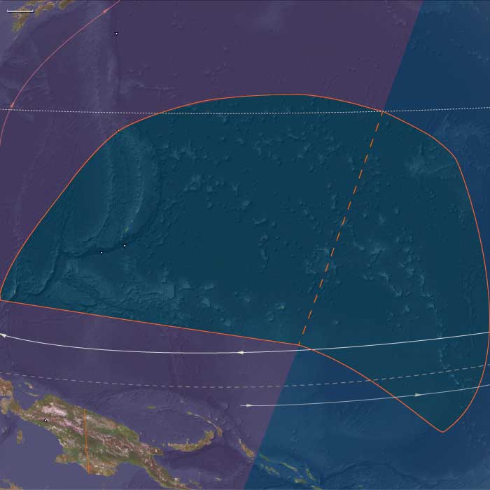
Micronesia
Related Events
Filter results
Showing 10 events out of 90 total
The Far East, one of the twelve divisions of the Earth, encompasses northern Australia, the entire Indonesian archipelago (excluding Aceh and Sumatra), the Philippines, the island of New Guinea, mainland Southeast Asia, the Malay Peninsula, eastern and southern China (China proper), Taiwan, the Korean Peninsula, the southern portion of the Russian Far East, and most of the Japanese archipelago, except for Hokkaido.
The southeastern boundary runs through Micronesia and Melanesia, dividing these regions into eastern and western subregions.
The northwestern boundary follows a line that separates Mongolia from China and delineates the division between Xinjiang and Tibet from China proper. It extends from its northernmost point, just beyond the northern arc of the Amur River—which marks China’s border with Russia—to its westernmost point, at the tri-border junction of Burma, India, and the Bay of Bengal.
The northeastern boundary distinguishes the extreme southern portion of the Russian Far East from the rest of the district and separates most of Hokkaido from Honshu, Kyushu, and Shikoku.
The southwestern boundary encompasses nearly all of Southeast Asia, with the exception of Aceh, which juts into the Indian Ocean and forms the southern shore of the Strait of Malacca, historically the key maritime gateway to the East.
HistoryAtlas contains 4,553 entries for The Far East from the Paleolithic period to 1899.
Narrow results by searching for a word or phrase or select from one or more of a dozen filters.
Micronesia (49,293 – 28,578 BCE): Upper Pleistocene I — Submerged Ridges, Atoll Seeds, and the Empty Reefs of a Cooler Pacific
Geographic & Environmental Context
During the later Pleistocene, Micronesia stretched across a vast mid-Pacific sweep of volcanic highs, raised limestone plateaus, and nascent atoll rims poised atop the Pacific Plate. The region was already divided into its two enduring structural arcs:
-
West Micronesia: the Mariana Islands (Guam, Saipan, Tinian, Rota, and the northern seamount chain), Palau(Babeldaob, Koror, Rock Islands), and Yap with its surrounding low atolls (Ulithi–Woleai arc).
These islands formed along ancient volcanic and tectonic arcs rising from deep basins—rugged highlands and carbonate terraces that stood above a narrow shelf. -
East Micronesia: the Marshall Islands (Ralik and Ratak chains), the Gilberts (Kiribati), Nauru, and the eastern Carolines (Kosrae)—a realm of reefed ridges, uplifted limestones, and isolated volcanic cones surrounded by wide lagoon systems.
At this time, sea level lay roughly 100 meters below modern, exposing reef flats and submerged coastal terraces across the entire Pacific basin. Many of today’s lagoons and passes existed only as broad intertidal plains or dry benches. The exposed reefs baked under strong trade winds and saline spray, while the high islands of Palau, Yap, and Kosrae maintained forested uplands and perennial streams under cooler, drier skies.
Climate & Environmental Shifts
The Late Pleistocene Pacific was a cooler, windier world, governed by strengthened trade winds and steeper thermal gradients between equator and subtropics:
-
Temperature & Ocean Circulation: Sea-surface temperatures dropped 2–3 °C below present. The west Pacific warm pool contracted eastward, reducing rainfall over central Micronesia.
-
Rainfall & Storms: Monsoon and intertropical convergence zones shifted northward; dry seasons lengthened, and cyclone frequency declined under a more stable, cooler ocean–atmosphere regime.
-
Sea Level & Geomorphology: Reef accretion slowed or paused; many atoll rims stood high and dry as limestone terraces. Submerged seamounts, ridges, and banks—future Ralik–Ratak, Palau–Yap, and Ulithi–Woleai chains—were transformed into low scrub islands or bare carbonate plains.
-
Volcanism: Kosrae, Palau, and the northern Marianas remained volcanically active, releasing ash that enriched soils and supported cloud forest pockets.
Biota & Baseline Ecology (No Human Presence)
Though entirely uninhabited, the Micronesian region supported vibrant marine and avian ecosystems, organized along windward–leeward contrasts and high–low island gradients.
-
Marine Systems:
• Coral diversity contracted but persisted on outer slopes below the lowered sea level.
• Exposed flats hosted intertidal mollusks, crabs, and urchins, while submerged reef slopes remained refuges for reef fish and sharks.
• Cooler waters and upwelling zones favored planktonic blooms around high islands and seamount edges, sustaining pelagic fish and turtles. -
Terrestrial & Avian Life:
• Seabird supercolonies dominated the low atolls and terraces—boobies, terns, frigatebirds, petrels—depositing guano that enriched emerging soils.
• Turtles nested on extensive beaches exposed by low sea stands.
• On volcanic high islands (Yap, Palau, Kosrae), montane forests of ferns, pandanus, and palms persisted, harboring endemic birds, fruit bats, and invertebrates.
• Nauru’s elevated plateau supported scrub adapted to aridity and phosphate-rich soils.
Environmental Processes & Dynamics
-
Reef Morphodynamics: Exposed reefs weathered and fractured; their margins became the foundation for the Holocene reef rims and lagoon systems that would later define Micronesian atolls.
-
Hydrological Cycles: Reduced rainfall limited freshwater lenses on low islands, while high islands retained groundwater-fed streams and crater lakes.
-
Wind and Sediment: Persistent trades reworked coral rubble into beach ridges and dunes—landforms that fossilized as Pleistocene terraces visible in many modern atolls.
-
Ocean Productivity: The combination of cooler waters and intensified upwelling sustained rich pelagic ecosystems around all major island arcs, even as shallow reefs lay dormant.
Symbolic & Conceptual Dimensions
No humans yet traversed this ocean. For tens of millennia, Micronesia existed only as a biological archipelago—reef to reef, wind to current—its atolls forming unseen scaffolds for the civilizations to come. Every island was a silent nursery: for coral larvae drifting on trade winds, for seabird colonies seeding future soils, for volcanic ridges waiting to host human voyagers millennia hence.
Environmental Adaptation & Resilience
The ecosystems of both western and eastern Micronesia demonstrated striking resilience:
-
Coral frameworks survived exposure and reemerged once seas rose.
-
Guano fertilization jump-started terrestrial soil development.
-
Volcanic renewal on Palau, Yap, and Kosrae maintained forest refugia during dry glacial phases.
-
Ocean circulation ensured continual nutrient renewal even during climatic downturns.
These processes collectively prepared Micronesia for the Holocene transgression, when reefs would again flourish and lagoons fill—a transformation that would give the region its modern face.
Long-Term Significance
By 28,578 BCE, Micronesia was already architecturally complete in geological terms:
-
Reef platforms, high-island watersheds, and carbonate terraces had all been established.
-
The region’s biological endemism and reef frameworks were in place, awaiting Holocene recolonization by corals, forests, and, eventually, humans.
-
Its position at the confluence of the equatorial currents and trade-wind belts had fixed the environmental patterns that would later shape Micronesian navigation, settlement, and subsistence.
In essence, the glacial Micronesian world was a prelude in stone and coral—the formation of the reefs, lagoons, and winds that would one day become the foundation of the Pacific’s smallest yet most interconnected oceanic realm.
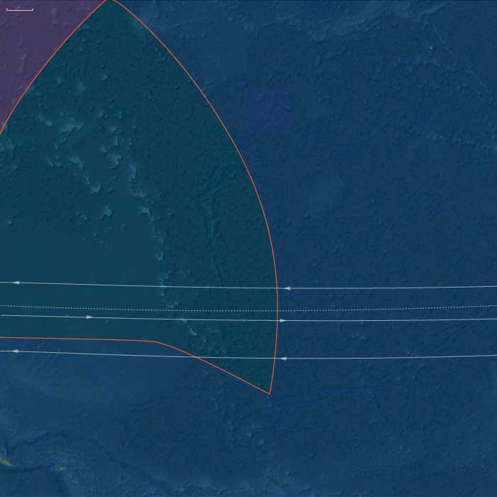
East Micronesia (49,293 – 28,578 BCE): Upper Pleistocene — Reef Platforms, Windward Rims, and Seabird Realms (No Human Presence)
Geographic & Environmental Context
East Melanesia includes Kiribati (Gilbert Islands), the Marshall Islands (Ralik and Ratak chains), Nauru (uplifted phosphatic limestone island), and Kosrae (high, volcanic island on the eastern Caroline arc).
-
Sea level sat ~100 m below modern, exposing broad reef flats and terrace benches on the future Ralik–Ratak and Gilbert atolls; Nauru stood as a higher limestone mesa; Kosrae loomed as a steep volcanic high island with deep valleys.
Climate & Environmental Shifts
-
Last Glacial Maximum: cooler SSTs, stronger trades and winter swell; slower coral accretion but wide intertidal zones.
Baseline Ecology
-
Seabird supercolonies nested on outer cays; turtles used broad beaches; lagoonal microhabitats were incipient.
-
Kosrae’s montane forest and unmodified streams sustained high freshwater biodiversity.
Long-Term Significance
These lowstand landscapes fixed the reef foundations and high-island watersheds that later support Micronesian arboriculture, taro pondfields, and lagoon fisheries.
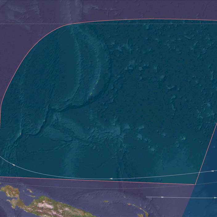
West Micronesia (49,293 – 28,578 BCE): Upper Pleistocene — Lowstand Reef Terraces, Seabird Kingdoms (No Human Presence)
Geographic & Environmental Context
West Micronesia includes the Mariana Islands (Guam, Saipan, Tinian, Rota, and the northern chain), Palau (Babeldaob, Koror, Rock Islands), and Yap (Yap proper and its outer atolls).
-
Anchors: Guam–Saipan–Tinian–Rota (limestone platforms with fringing reefs), Babeldaob–Koror (Palau’s volcanic/limestone high islands and the Rock Islands lagoon), Yap proper (raised reef islands) and the outer Yap atolls (Ulithi–Woleai arc).
-
Sea level lay ~100 m below modern, exposing wide limestone benches and reef flats around Marianas, Palau, and Yap; lagoons were shallower, passes narrower.
-
Palau combined volcanic uplands with emergent limestone rims; Marianas and Yap presented high-standing reef platforms.
Climate & Environmental Shifts
-
Last Glacial Maximum: cooler SSTs, stronger trades; reef accretion slowed, but intertidal foraging niches (future) expanded geomorphically.
Baseline Ecology
-
Seabird supercolonies nested on outer cays; turtles used broad beaches; giant clams and reef fish populated nearshore flats.
-
On Palau, montane forests fed clear streams into mangrove-lined embayments.
Long-Term Significance
Glacial lowstand set the reef foundations and coastal benches later engineered by settlers into canoe landings, fish weirs, and garden soils.
East Micronesia (28,577 – 7,822 BCE): Deglaciation — Drowning Shelves, Lagoon Formation, and Reef “Catch-Up” (No Human Presence)
Geographic & Environmental Context
East Melanesia includes Kiribati (Gilbert Islands), the Marshall Islands (Ralik and Ratak chains), Nauru (uplifted phosphatic limestone island), and Kosrae (high, volcanic island on the eastern Caroline arc).
-
Rapid sea-level rise flooded glacial benches, carving pass channels and back-reef lagoons across the Ralik–Ratak and Gilbert platforms; Nauru became a ringed limestone island; Kosrae gained new fringing reef flats.
Climate & Environmental Shifts
-
Bølling–Allerød warmth boosted coral growth; Younger Dryas slowed it briefly; Early Holocene warmth stabilized reef accretion and lagoon development.
Baseline Ecology
-
Mature lagoons supported mullet, surgeonfish, parrotfish; outer reefs grew spur-and-groove structures.
-
Dune–strand forests stabilized cays; Kosrae’s wet windward slopes fed productive estuaries.
Long-Term Significance
The lagoon–reef architecture that later anchors fish weirs, clam gardens, and canoe passes took recognizable form in this era.
Micronesia (28,577 – 7,822 BCE): Late Pleistocene–Early Holocene — Rising Seas, Reef Builders, and Islands Beyond Human Reach
Geographic & Environmental Context
During the Late Pleistocene and early Holocene, Micronesia—spanning the Marianas, Palau, Yap, the Caroline arc, and the Gilberts and Marshalls—was a vast expanse of reefs and islands slowly emerging into their modern form.
At the Last Glacial Maximum (26,500–19,000 BCE), sea levels lay more than 100 m below present, enlarging volcanic islands and exposing broad limestone terraces across the Marianas and Yap. As global ice sheets melted, rising seas drowned coastal shelves, carved lagoon passes, and transformed former uplands into rings of atolls and reef-rimmed embayments.
By the end of this period, Micronesia’s archipelagic geometry—chains of high volcanic islands interlaced with low coral platforms—had taken shape, but it remained entirely beyond human knowledge or navigation.
-
West Micronesia: the Marianas, Palau, and Yap, a mix of volcanic high islands, raised limestone plateaus, and emerging atolls.
-
East Micronesia: the Gilberts (Kiribati), Marshalls (Ralik–Ratak), Nauru, and Kosrae, where low coral plains and volcanic headlands framed nascent lagoons.
Climate & Environmental Shifts
Across these millennia, Micronesia oscillated between glacial austerity and interglacial abundance:
-
Last Glacial Maximum: cooler seas and weaker monsoons lowered rainfall and slowed coral accretion; broad coastal plains expanded on high islands.
-
Bølling–Allerød warming (14,700–12,900 BCE): warmer seas and renewed precipitation revived reefs and forests; lagoons deepened.
-
Younger Dryas (12,900–11,700 BCE): a short cooling pulse reduced coral growth rates but had limited ecological disruption.
-
Early Holocene (after 11,700 BCE): warming stabilized, and coral “catch-up” growth filled drowned basins with vibrant reef life.
By 7,800 BCE, the modern climatic regime of steady trades, wet monsoons, and stable sea temperatures was established.
Flora, Fauna, and Baseline Ecology
Without human disturbance, Micronesia’s ecosystems thrived in pristine isolation:
-
High islands (Marianas, Palau, Kosrae) supported dense tropical rainforests—palms, hardwoods, tree ferns, and lianas—enclosing fertile volcanic soils.
-
Low coral islands (Marshalls, Gilberts, Yap outer arc) bore salt-tolerant scrub, pandanus, and grasses stabilized by guano-enriched sands.
-
Lagoons and reefs teemed with parrotfish, surgeonfish, mullet, turtles, and reef invertebrates; seabird colonies nested on rocky headlands.
-
Nauru’s uplifted limestone retained small freshwater pockets sustaining hardy shrubs and seabird rookeries.
-
Estuaries of Kosrae and Palau formed wetlands fed by volcanic runoff—hubs of biodiversity that would one day support human wet-field cultivation.
Geomorphic and Oceanic Dynamics
The transformation from continental shelves to island reefs defined Micronesia’s emergence:
-
Rapid deglacial sea-level rise flooded glacial terraces, producing lagoonal amphitheaters and pass channelsstill visible today in the Marshalls and Gilberts.
-
Reefs “caught up” to the rising sea, accreting vertically to preserve light access.
-
Volcanic activity in the Marianas arc renewed soils and reshaped coasts.
-
Cyclones and monsoon floods reworked beaches, continually redistributing sediments and forming the foundations of future atoll chains.
Through these processes, Micronesia’s reef–lagoon–islet system reached near-modern configuration long before any human sails appeared on the horizon.
Movement & Interaction Corridors
No human networks yet crossed this oceanic space.
Instead, natural circulations dominated:
-
The North Equatorial Current and its Countercurrent sculpted nutrient flows across the Caroline arc.
-
Migratory seabirds and turtles traced seasonal loops from the Philippines and Melanesia to Micronesian rookeries.
-
Driftwood, seeds, and pumice arrived via the Kuroshio and equatorial gyres, seeding plant life on newly formed cays.
In this epoch, wind and wave were the only navigators, the ocean itself the sole agent of exchange.
Symbolic and Conceptual Role
To late Pleistocene humans living along the western Pacific rim, Micronesia lay entirely beyond the conceivable horizon—neither seen nor imagined.
These island chains, thousands of kilometers from the nearest continental coast, existed only as natural monuments to isolation—the unvisited heart of the Pacific that would, much later, become the ocean’s crossroads.
Environmental Adaptation & Resilience
Ecosystems displayed profound resilience:
-
Coral growth kept pace with rapid sea-level rise, preventing reef drowning.
-
Vegetation succession—first grasses and herbs, then palms and forests—stabilized soils and buffered erosion.
-
Seabird and turtle migrations maintained nutrient loops between ocean and land.
-
Lagoon sediments trapped organics, forming the fertile substrates that would one day support human gardening and settlement.
Micronesia emerged from deglaciation as a self-renewing biological network, balanced between storm energy and coral productivity.
Long-Term Significance
By 7,822 BCE, Micronesia had reached ecological maturity.
Its reefs, lagoons, and volcanic highlands had stabilized into recognizable modern systems, with thriving biota and complex nutrient webs.
No humans yet crossed these waters, but the oceanic geography—chains of atolls spaced within sightlines, reefs protecting calm lagoons, dependable currents and winds—was complete.
The stage was set for the future age of voyagers: when humans finally arrived millennia later, they would find a world already perfectly tuned to sustain maritime civilization.
West Micronesia (28557 – 7822 BCE): High Islands and Atoll Lagoons Beyond Human Reach
Geographic & Environmental Context
West Micronesia includes the Mariana Islands (Guam, Saipan, Tinian, Rota, and the northern chain), Palau (Babeldaob, Koror, Rock Islands), and Yap (Yap proper and its outer atolls).
-
Anchors: Guam–Saipan–Tinian–Rota (limestone platforms with fringing reefs), Babeldaob–Koror (Palau’s volcanic/limestone high islands and the Rock Islands lagoon), Yap proper (raised reef islands) and the outer Yap atolls (Ulithi–Woleai arc).
-
The region is a mix of volcanic high islands, raised limestone islands, and low coral atolls.
-
During much of the Late Pleistocene, lower sea levels (over 100 m below present) expanded coastal shelves, enlarged high islands, and exposed additional low-lying land now submerged.
-
These islands were biologically rich but entirely uninhabited by humans during this period.
Climate and Environmental Shifts
-
Last Glacial Maximum (c. 26,500 – 19,000 BCE): Slightly cooler sea-surface temperatures and lowered sea levels reduced lagoon areas but increased the size of coastal plains on high islands. Coral reef growth slowed under cooler conditions, and rainfall patterns shifted with the West Pacific monsoon, creating drier leeward zones.
-
Bølling–Allerød (c. 14,700 – 12,900 BCE): Warmer seas and higher rainfall improved reef growth and lagoon productivity; coastal wetlands expanded, and high-island forests grew denser.
-
Younger Dryas (c. 12,900 – 11,700 BCE): Minor cooling affected coral growth rates, but the impact was less severe than in high-latitude regions. Seasonal rainfall variability increased, but ecosystems remained resilient.
-
Early Holocene (after c. 11,700 BCE): Rising sea levels flooded low-lying shelves, fragmenting coastal plains and forming modern lagoon systems; reef expansion accelerated under warmer, more stable conditions.
Flora, Fauna, and Ecology
-
High islands supported dense tropical forests with palms, hardwoods, and ferns.
-
Atolls and low coral islands were dominated by scrub vegetation and hosted nesting seabird colonies.
-
Offshore reefs provided habitats for abundant fish, mollusks, and crustaceans.
-
Sea turtles and migratory seabirds used the islands as seasonal breeding and nesting grounds.
Human Presence
-
There is no evidence of human habitation in West Micronesia during this epoch.
-
The distances from continental landmasses and the lack of advanced ocean-going navigation kept these islands far beyond the reach of late Pleistocene voyagers.
Environmental Dynamics
-
Coral reefs and lagoons acted as buffers against wave action, preserving sandy beaches and coastal flats.
-
Volcanic high islands experienced ongoing erosion and soil development, creating fertile interior valleys.
-
Storm surges and cyclones periodically reshaped low island coastlines.
Symbolic and Conceptual Role
For human societies of the time, West Micronesia existed entirely beyond the known world—unseen, unimagined, and absent from oral traditions.
Transition Toward the Holocene
By 7822 BCE, West Micronesia’s ecosystems had fully recovered from glacial cooling, with thriving coral reefs, productive lagoons, and lush high-island forests. These pristine environments would remain unvisited by humans for many millennia, awaiting the development of long-range seafaring in the mid-to-late Holocene.
Central Oceania, the twelfth of the Earth’s regions centered on the South Pacific Ocean, encompasses the Hawaiian Islands, New Zealand’s North Island, and the archipelagos of Western Polynesia, Eastern Melanesia, and Eastern Micronesia. This includes groups such as French Polynesia, Tonga, Niue, the Cook Islands, Fiji, Tokelau, Vanuatu, the eastern Solomon Islands, Nauru, Tuvalu, Samoa, and the Marshall Islands.
Its northwestern boundary separates the Solomon Islands from the easternmost islands of Papua New Guinea, including Bougainville, Buka, and several outlying islands and atolls historically known as the Northern Solomons.
The southeastern boundary divides West Polynesia, which includes the Big Island of Hawaii, from East Polynesia, represented by the Pitcairn Islands and Easter Island.
HistoryAtlas contains 399 entries for Central Oceania from the Paleolithic period to 1899.Narrow results by searching for a word or phrase or select from one or more of a dozen filters.
There is no evidence of human beings having lived in Oceania before about 31,000 BCE.
If they did, they would have lived along the coasts of the various small islands, and evidence would have long since disappeared below the rising seas of the Holocene Epoch.
Human habitation begins in the western Pacific about 28,000 BCE, around the time that humans inhabit Palawan in the Philippines.