Middle Africa

Related Events
Filter results
Showing 10 events out of 240 total
The Middle of the Earth, one of the twelve divisions of the globe, encompasses Africa down to its subcontinent, the lands and seas of the Mediterranean Basin and the Red Sea, the Canary Islands, and the Cape Verde Islands.
The northwestern boundary extends from south-central Germany along the Swiss border, encompassing all Swiss cities except Basel. It then separates southern France from northern France, continues through Spain, and divides Portugal at Setúbal, marking a north-south division within both countries. The boundary then extends into the Atlantic Ocean, where it distinguishes Madeira (a Portuguese territory) from the Canary Islands (ruled by Spain).
The northeastern boundary separates Alpine Austria from the rest of the country, then moves through the Balkans, roughly following the borders between:
- Hungary and Slovenia,
- Serbia and Croatia,
- Bosnia and Herzegovina, Montenegro, and Kosovo,
- Bulgaria and North Macedonia,
- Turkey-in-Europe and Greece.
From there, the line continues through western Turkey and Cyprus, dividing Syria and most of Lebanon from Israel and most of Jordan, and marking the separation between western and eastern Arabia.
The southeastern boundary follows the historic division between North and South Yemen, then extends through eastern Africa, delineating Mozambique from Zambia.
HistoryAtlas contains 18,610 entries for the Middle of The Earth from the Paleolithic period to 1899.Narrow results by searching for a word or phrase or select from one or more of a dozen filters.
The Moderns are taller, more slender, and less muscular than the Neanderthals, with whom they share—perhaps uneasily—the Earth.
Though their brains are smaller in overall size, they are heavier in the forebrain, a difference that may allow for more abstract thought and the development of complex speech.
Yet, the inner world of the Neanderthals remains a mystery—no one knows the depths of their thoughts or how they truly expressed them.
Mitochondrial Eve in the field of human genetics refers to the matrilineal most recent common ancestor (MRCA) of modern humans.
She, in other words, is the woman from whom all living humans today descend, on their mother's side, and through the mothers of those mothers and so on, back until all lines converge on one person.
Because all mitochondrial DNA (mtDNA) is generally passed from mother to offspring without recombination, all mitochondrial DNA (mtDNA) in every living person is directly descended from hers by definition.
Each ancestor (of people now living) in the line back to the matrilineal MRCA had female contemporaries such as sisters, female cousins, etc., and some of these female contemporaries may have descendants living now (with one or more males in their descendancy line), but none of the female contemporaries of the "Mitochondrial Eve" has descendants living now in an unbroken female line.
In human genetics, Y-chromosomal Adam (Y-MRCA) is the most recent common ancestor (MRCA) from whom all living people are descended patrilineally (tracing back only along the paternal lines of their family tree)
Recent studies report that Y-chromosomal Adam lived as early as around one hundred and forty-two thousand years ago: older studies estimated Y-MRCA as recent as sixty thousand years ago.
Modern humans learn to modulate voice into audible oral speech in the period beginning around 70,000 BCE; this is a development apparently not accomplished by other archaic hominids and one peculiar to our species.
Some also learn at this time to count beyond “one, two, and many.”
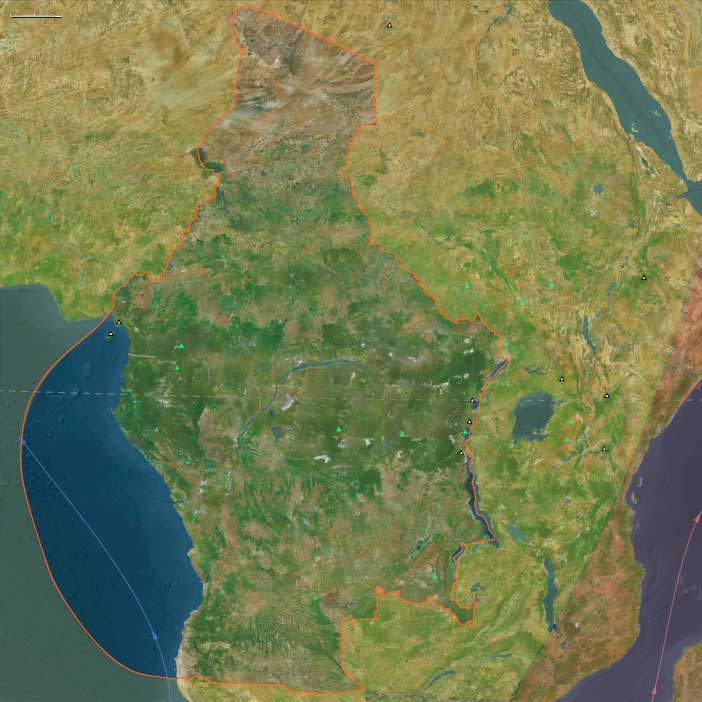
Middle Africa (49,293 – 28,578 BCE) Upper Pleistocene I — Rainforest Refugia, Savanna Corridors, and Lake Chad Shores
Geographic and Environmental Context
The broad equatorial–central belt of Africa including:
-
Chad and Lake Chad Basin,
-
the Central African Republic (Ubangi–Sangha region),
-
Cameroon (highlands, Adamawa Plateau, coastal plains),
-
Equatorial Guinea (islands and coast),
-
São Tomé e Príncipe,
-
Gabon,
-
the Republic of the Congo (Brazzaville),
-
the Democratic Republic of the Congo (Congo Basin, Kasai, Katanga, Ituri),
-
Angola.
Anchors: Lake Chad, Chari–Logone delta, Adamawa Plateau, Sangha–Ubangi junction, Cameroon Highlands, São Tomé e Príncipe volcanic isles, Congo River mainstem, Kasai–Katanga copperbelt, Ituri rainforest, Angolan escarpment.
-
At LGM, Congo rainforest contracted into isolated refugia along rivers and highlands.
-
Savannas and open woodland stretched through the Adamawa Plateau–Lake Chad zone.
-
Lake Chad fluctuated at reduced size but still present.
Climate & Environmental Shifts
-
Colder, drier; rainfall reduced across equator.
-
Congo Basin partly replaced by savanna corridors, enabling movement of fauna and people.
Subsistence & Settlement
-
Foragers moved between forest refugia (Ituri, Sangha–Ubangi) and savannas.
-
Fishing in Chari–Logone–Lake Chad and Congo tributaries.
-
Hunting antelope, forest hogs, primates, and savanna game.
Technology & Material Culture
-
Flake industries of quartz, chert; bone points for fishing.
-
Ostrich eggshell beads (from savanna links) show symbolic networks.
Movement & Interaction Corridors
-
Lake Chad–Sahara corridor tied to North Africa.
-
Congo River trunk routes integrated equatorial refugia.
Cultural & Symbolic Expressions
-
Ochre and beads used as personal ornaments.
-
Rock shelters in Cameroon highlands served as ritual spaces.
Environmental Adaptation & Resilience
-
Mobility between forest–savanna ecotones buffered against aridity.
Transition
By 28,578 BCE, Middle Africans were foragers straddling forest and savanna, pioneers of rainforest survival strategies.
Cultural features associated with modern humans, such as careful burial of the dead, the production of art in the form of elaborate cave decoration, and the decoration of objects of everyday use, date from this period.
Between 100,000 and 38,000 BCE, African cultures have adapted to desert, savanna, and forest environments, with distinctive toolkits for each.
Hunting, fishing, and gathering remain the basic way of life, but Africans employ a wider range of strategies in exploiting different environments.
Middle Africa (28,577 – 7,822 BCE) Upper Pleistocene II — Deglaciation, Lake Mega-Phases, and Expanding Forests
Geographic and Environmental Context
The broad equatorial–central belt of Africa including:
-
Chad and Lake Chad Basin,
-
the Central African Republic (Ubangi–Sangha region),
-
Cameroon (highlands, Adamawa Plateau, coastal plains),
-
Equatorial Guinea (islands and coast),
-
São Tomé e Príncipe,
-
Gabon,
-
the Republic of the Congo (Brazzaville),
-
the Democratic Republic of the Congo (Congo Basin, Kasai, Katanga, Ituri),
-
Angola.
Anchors: Lake Chad, Chari–Logone delta, Adamawa Plateau, Sangha–Ubangi junction, Cameroon Highlands, São Tomé e Príncipe volcanic isles, Congo River mainstem, Kasai–Katanga copperbelt, Ituri rainforest, Angolan escarpment.
-
Deglaciation brought wetter pulses; Congo rainforest expanded.
-
Lake Chad swelled into mega-lake phases.
-
São Tomé & Príncipe remained uninhabited volcanic isles.
Climate & Environmental Shifts
-
Bølling–Allerød (14.7–12.9 ka): humid spike, forest corridors reconnect.
-
Younger Dryas (12.9–11.7 ka): drought returns, forests shrink.
-
Early Holocene: rainfall surges, rivers flood.
Subsistence & Settlement
-
Foragers exploited aquatic mega-lakes: fish, hippo, crocodile, mollusks.
-
Rainforest game and wild yams, fruits.
-
Semi-sedentary camps at lake/river junctions.
Technology & Material Culture
-
Barbed harpoons (Ubangi, Semliki region); microliths.
-
Wooden dugouts inferred.
Movement & Interaction Corridors
-
Lake Chad overflow connected Niger–Nile–Congo headwaters.
-
Congo River broadened canoe passage.
Cultural & Symbolic Expressions
-
Shell middens as ritual deposits.
-
Rock art emerges in Chad/Cameroon depicting fauna.
Environmental Adaptation & Resilience
-
Aquatic foraging buffered climate shifts.
Transition
By 7,822 BCE, peoples of Middle Africa mastered lake–riverine adaptations in fluctuating climates.
Middle Africa (7,821 – 6,094 BCE) Early Holocene — Fishing Villages and Rainforest Abundance
Geographic and Environmental Context
The broad equatorial–central belt of Africa including:
-
Chad and Lake Chad Basin,
-
the Central African Republic (Ubangi–Sangha region),
-
Cameroon (highlands, Adamawa Plateau, coastal plains),
-
Equatorial Guinea (islands and coast),
-
São Tomé e Príncipe,
-
Gabon,
-
the Republic of the Congo (Brazzaville),
-
the Democratic Republic of the Congo (Congo Basin, Kasai, Katanga, Ituri),
-
Angola.
Anchors: Lake Chad, Chari–Logone delta, Adamawa Plateau, Sangha–Ubangi junction, Cameroon Highlands, São Tomé e Príncipe volcanic isles, Congo River mainstem, Kasai–Katanga copperbelt, Ituri rainforest, Angolan escarpment.
-
Congo Basin forests lush; Lake Chad large; Cameroon Highlands productive.
Climate & Environmental Shifts
-
Holocene optimum: warm, wet, stable.
-
Rainforests reached maximum extent.
Subsistence & Settlement
-
Semi-sedentary fishing villages on rivers and lakes.
-
Intensive gathering of yams, oil palm, nuts, fruits.
-
Hunting of antelope, duiker, forest pig, primates.
Technology & Material Culture
-
Ground stone tools, polished axes for clearing.
-
Bark cloth, fiber nets, fish traps.
-
Early pottery appears in Chad/Cameroon ~9th millennium BCE.
Movement & Interaction Corridors
-
Congo River as arterial highway.
-
Adamawa Plateau as savanna–forest bridge.
Cultural & Symbolic Expressions
-
Ancestral burials along river terraces.
-
Rock art in Cameroon shows hunting and ritual.
Environmental Adaptation & Resilience
-
Riverine + forest resources created reliable surplus.
Transition
By 6,094 BCE, Middle Africa sustained semi-sedentary fisher–foragers with pottery.
During the seventh millennium BCE, the northern half of Chad is part of a broad expanse of land, stretching from the Indus River in the east to the Atlantic Ocean in the west, in which ecological conditions favor early human settlement.
Rock art of the ''Round Head" style, found in the Ennedi region, has been dated to before the seventh millennium BCE and, because of the tools with which the rocks were carved and the scenes they depict, may represent the oldest evidence in the Sahara of Neolithic industries.
Many of the pottery-making and Neolithic activities in Ennedi date back further than any of those of the Nile Valley to the east.
In the prehistoric period, Chad was much wetter than it is today, as evidenced by large game animals depicted in rock paintings in the Tibesti and Borkou regions.
Recent linguistic research suggests that all of Africa's languages south of the Sahara Desert (except Khoisan) originated in prehistoric time in a narrow band between Lake Chad and the Nile Valley.
The origins of Chad's peoples, however, remain unclear.
Several of the proven archaeological sites have been only partially studied, and other sites of great potential have yet to be mapped.