A map of a river valley between…
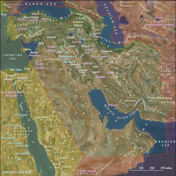
2349 BCE to 2206 BCE
A map of a river valley between two hills is shown on a 7.6 centimeter by 6.8 centimeter clay tablet found in 1930 at Ga-Sur, near contemporary Kirkuk.
Most scholars date the tablet to the twenty-fifth to twenty-fourth century BCE.
Cuneiform inscriptions label the features on the map, including a plot of land described as three hundred and fifty-four iku (twelve hectares) that was owned by a person called Azala.
Locations
Groups
Topics
Subjects
Regions
The Near and Middle East
View →Subregions