Micronesia (1396–1539 CE) Navigational Networks, Monumental Islands,…
1396 CE to 1539 CE
Micronesia (1396–1539 CE)
Navigational Networks, Monumental Islands, and the Star Compass World
Geography & Environmental Context
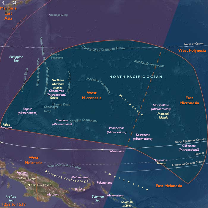
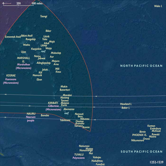
Micronesia in this age stretched across a thousand leagues of sea, encompassing East Micronesia—the Marshall Islands, Caroline Islands (including Yap, Chuuk, Pohnpei, and Kosrae), and eastern Kiribati—and West Micronesia, including Palau, Yap, and the Mariana Islands.
Low coral atolls, volcanic high islands, and uplifted limestone ridges formed a constellation of lands bound by the Pacific’s great currents and the trade winds. Eastward lay the vast lagoons of the Marshalls and Carolines; westward, Palau’s barrier reefs and the Marianas’ volcanic chain marked the meeting of Asia and Oceania.
Climate & Environmental Shifts
The onset of the Little Ice Age brought subtle cooling and erratic rainfall.
-
Atolls experienced severe droughts that desiccated freshwater lenses, punctuated by years of cyclones and floods.
-
Volcanic islands such as Pohnpei, Kosrae, and the Marianas moderated these extremes with rivers, springs, and fertile soils, sustaining denser populations.
-
ENSO (El Niño–Southern Oscillation) cycles oscillated between drought and deluge, forcing flexible agricultural and navigational adaptations.
Subsistence & Settlement
Across Micronesia, communities mastered life amid scarcity and abundance:
-
High islands supported irrigated taro and yam gardens, breadfruit groves, and banana terraces.
-
Atolls relied on coconut and pandanus orchards, pulaka pits, and lagoon fisheries, integrating arboriculture and aquaculture.
-
Settlements ringed lagoons or river valleys; stilt houses and canoe sheds lined coasts.
-
Domesticated pigs and chickens contributed to ritual feasting.
-
Populations were densest on Pohnpei, Kosrae, Yap, and the Marianas, where hierarchical chiefdoms arose, while atolls remained integrated through voyaging and tribute.
Technology & Material Culture
Micronesian innovation centered on mastery of the sea:
-
Canoe technology: Double-hulled and outrigger canoes ranged hundreds of kilometers, guided by etak star compasses, wave patterns, and bird flight.
-
Navigation: Stick charts in the Marshalls abstracted swells and island chains into learning tools for apprentices of the palu (navigators).
-
Architecture: Monumental stoneworks defined high islands—most famously Nan Madol on Pohnpei, a canal city of prismatic basalt that symbolized centralized authority.
-
Symbolic wealth: In Yap, rai stones—massive carved disks quarried in Palau and ferried home by canoe—embodied prestige and the fusion of navigation, economy, and spirituality.
-
Art & craft: Shell ornaments, woven mats, barkcloth, and carved ceremonial houses (bai) carried both utilitarian and sacred meaning.
Movement & Interaction Corridors
Micronesia was a world woven by voyaging.
-
Eastward circuits: Navigators connected the Marshalls, eastern Carolines, and Kiribati through predictable seasonal routes, maintaining food redistribution and ritual alliance.
-
Central networks: Tribute flowed between atolls and volcanic centers like Pohnpei and Kosrae, where chiefs regulated exchange and labor.
-
Western corridors: Yap dominated an extensive sawei system—tributary relationships spanning hundreds of kilometers eastward. Palau served as the source of rai stone money and as a key bridge to island Southeast Asia.
-
Marianas chain: Unified by inter-island voyaging and shared architecture, from Guam to Saipan and Tinian, sustaining the Chamorro cultural sphere.
Cultural & Symbolic Expressions
Micronesian worldviews fused navigation, ancestry, and hierarchy.
-
Sacred kingship: On Pohnpei and Kosrae, rulers claimed descent from divine ancestors, embodying authority through monumental centers like Nan Madol.
-
Ritual exchange: Feasting and gift-giving of food, mats, and ornaments reinforced social bonds and ecological redistribution.
-
Navigation as religion: Knowledge of stars, currents, and reefs was guarded and transmitted through chant and initiation.
-
Monumental symbolism: In the Marianas, latte stone pillars supported elite dwellings and anchored ancestral presence; in Palau, carved bai houses displayed mythic histories.
-
Oral traditions: Dances, songs, and genealogies encoded both navigation and cosmic law, linking each island to the broader order of sea and sky.
Environmental Adaptation & Resilience
Resilience underpinned every aspect of Micronesian life:
-
Crop diversification: Breadfruit, coconut, and taro systems balanced against climatic variability.
-
Redistribution & alliance: Tribute networks transferred surplus food to drought-stricken atolls.
-
Conservation ethics: Lagoon and reef tenure governed fishing seasons and taboo zones.
-
Arboriculture: Deep-rooted tree crops stabilized soils and freshwater lenses.
-
Voyaging relief: Canoe expeditions moved provisions, labor, and kin between islands, ensuring survival through cooperation.
Transition (to 1539 CE)
By 1539 CE, Micronesia was a mature maritime civilization—its volcanic and coral worlds interlocked through navigation, exchange, and sacred kingship.
Nan Madol’s basalt canals, Yap’s stone currency, Palau’s carved bai, and Marianas’ latte pillars all spoke to a shared ethos of mastery over land and sea.
Europe had yet to intrude—Magellan’s fleet would sight the Marianas only in 1521—but Micronesians had already mapped their own cosmos in stars, stones, and stories.
Their oceanic networks, adaptive systems, and enduring cosmologies stood as one of humanity’s greatest achievements in the art of living within the sea itself.
Topics
Subjects
Regions