Modibo Adama, a commander of Sheikh Usman…
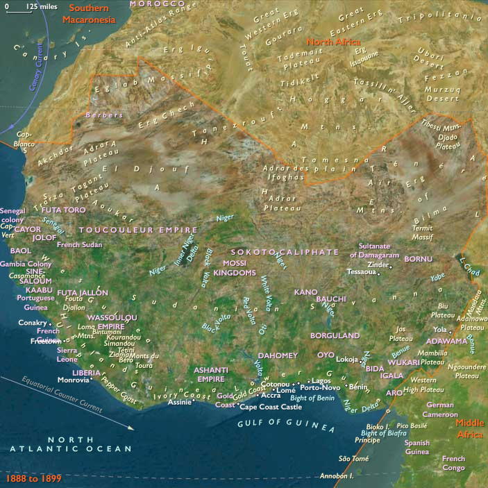
1888 CE to 1899 CE
Settled peoples who fled the Fulani had caused a major redistribution of population.
The Adamawa emirate lies south of Lake Chad, and east of Hausaland, within latitudes 6° and 11° North, and longitudes 10° and 14° East.
The external limits are hard to fix in exact terms, because it is difficult to distinguish between people who the Fulani have subjected to their rule, and those whom they simply raid for slaves, without establishing any form of administrative links
According to some estimates, by the late nineteenth century, slaves constitute about fifty percent of the population of the Fulɓe-ruled Adamawa Emirate, where they are referred to as jeyaɓe (singular jeyado).
Based on the region subjected to Fulani rule, the emirate stretches from areas south of the Adamawa plateau near Tibati, in the South, to the Diamare, in the north, from the slopes of the Bamenda-Adamawa-Mandara Highlands in the west, to Baya, Laka, Mundang and Musgum country in the east.
Early British administrators reporting from Yola put the surface area of Adamawa at between 35,000 and 40,000 square miles or between 90,650 and 103,600 square kilometers.
Locations
Groups
Topics
Commodities
Regions

West Africa
View →Subregions