Middle America (4,365 – 2,638 BCE): Late …
Years: 4365BCE - 2638BCE
Middle America (4,365 – 2,638 BCE): Late Neolithic / Chalcolithic — Capes, Corridors, and Canoe Worlds
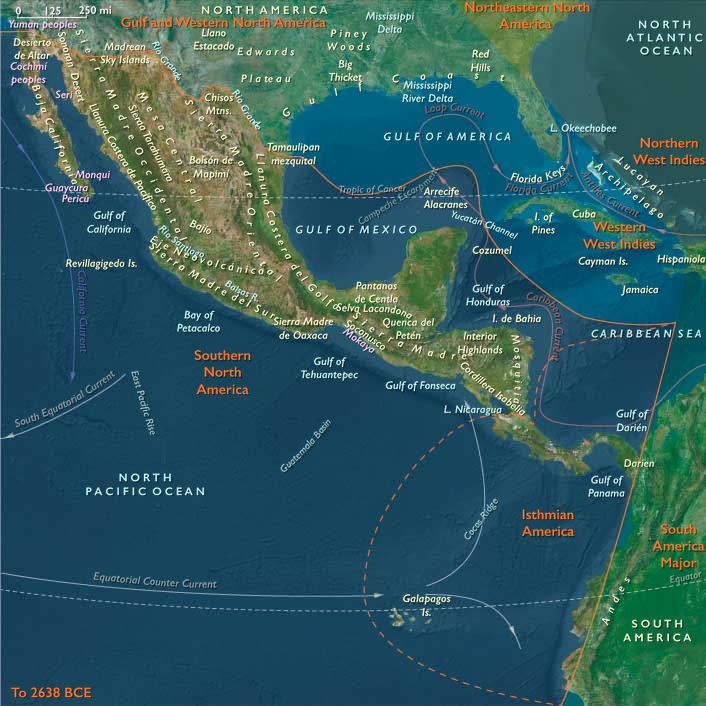
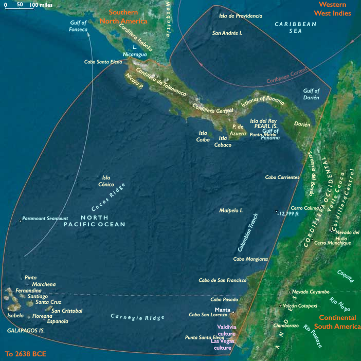
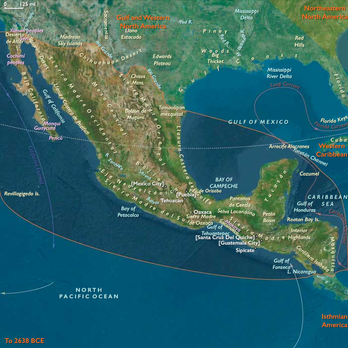
Geographic & Environmental Context
Middle America cohered as a two-ocean hinge linking the tropical Gulf–Caribbean to the upwelling-rich eastern Pacific. River terraces, volcanic piedmonts, and dry tropical capes graded into mangrove lagoons and coral shelves; interior basins stepped upward to cloud-forest ridges and back down to Pacific embayments. Along the inter-isthmian narrows, short portages and tidal creeks stitched watersheds together, while to the south the Manta–Santa Elena capes faced Nicoya–Azuero across predictable wind and swell windows. Offshore, the San Andrés banks sustained seasonal fisheries; the Galápagos remained unpeopled yet figured in the maritime imagination as bird, turtle, and driftwood outliers. This was a single environmental engine—garden rivers + reef lagoons + capes and passes—that made movement as fundamental as place.
Climate & Environmental Shifts
The epoch was broadly warm and seasonally reliable, with a monsoon-like alternation of wet and dry. Cyclone clusters were episodic on the Caribbean side; ENSO-like pulses periodically re-tuned Pacific fisheries and nearshore productivity. River meanders refreshed floodplain soils, mangroves trapped sediment behind barrier spits, and fog-laden dry seasons along exposed capes favored arboriculture and drought-tolerant plots. Predictable winds and currents created repeatable voyaging windows, the meteorological grammar of later canoe economies.
Subsistence & Settlement
A portfolio subsistence matured across coastal and near-interior belts. Shoreline villages paired gardens (early maize, gourds, squashes; regional roots and tree crops) with reef–lagoon fisheries, shellfish, and sea turtles. Estuary levees hosted hamlets with canoe sheds, drying racks, and smokehouses; river-hamlet strings climbed into foothills to tap palms, fibers, and lithic sources. On the Pacific capes and peninsulas, courtyard hamlets organized field-and-fish schedules; within the Azuero–Nicoya–Manta triangle, provisioning sites supplied water, salt, fuel, and cured fish for inter-cape voyages. Farther east, Darién waterways nurtured garden-forager mosaics that brokered goods between seas. The Galápagos remained unoccupied but were seasonally surveyed as ecological beacons.
Technology & Material Culture
Toolkits blended groundstone adzes, shell and bone points, and increasingly diverse pottery (cooking jars, necked storage, griddles where cassava processing emerged). Barkcloth and plant-fiber cordage, net floats, and basketry underwrote fishing and storage. Canoes standardized toward longer, lighter hulls suitable for coast-hugging and short open-water hops; in places, outrigger and lashed-plank refinements improved stability in cross-sea. Shell ornaments, drilled teeth, and selected stones signaled house and lineage identity; fine polishing and incising grew alongside exchange.
Movement & Interaction Corridors
Middle America functioned as a braided corridor system:
-
Coast-to-coast inter-isthmian links (portages, tidal creeks) moved dried fish, salt, resins, fibers, and river stones between the two oceans.
-
North–south cape circuits ran Manta ⇄ Santa Elena ⇄ Nicoya ⇄ Azuero, timing departures to seasonal winds and countercurrents.
-
Caribbean littoral lanes connected bank fisheries and mangrove saltworks to river valleys and island shelves (including San Andrés).
These routes overlapped to form redundant exchange webs—if one sea ran rough, the other sea or an inland trunk carried the traffic.
Belief & Symbolism
Capes, bars, and river mouths acted as ritual thresholds. Ancestor veneration clustered at shell middens and prominent headlands; canoe-burial markers and cairns signposted tenure over landing places and fishing stations. Feasting at provisioning nodes reaffirmed passage rights and alliance. House altars curated shells, polished stones, and figurines—tokens tying dwellings to winds, currents, and kin.
Adaptation & Resilience
Communities hedged risk through garden–reef–mangrove–river layering. Drought meant pivoting to shellfish and lagoon fish; storm years leaned on stored roots, smoked meats, and inter-village reciprocity. Settlement fabrics were modular and mobile—hamlets could bud off to a new levee or sand-spit while keeping ritual ties to ancestral places. Exchange obligations redistributed protein and starch across bad seasons; canoe repair and net-mending anchored the dry-season work calendar.
Long-Term Significance
By 2,638 BCE, Middle America had crystallized as an interoceanic gateway: coastal horticulture, standardized canoeing, and reliable portage links forged a managerial landscape without cities. The habits formed here—schedule-keeping by winds and currents, redundancy across food webs, and ritual governance of landing rights—prepared the narrows for the metallurgical and goldworking chiefdoms, long-haul circuits, and ceremonial seascapes that rise in subsequent ages.
Groups
Commodoties
Subjects
Regions
Subregions
Related Events
Showing 10 events out of 68950 total
Years: 4365BCE - 2638BCE
Groups
Commodoties
Subjects
Regions
Subregions