West Europe (7,821 – 6,094 BCE): Early…
7821 BCE to 6094 BCE
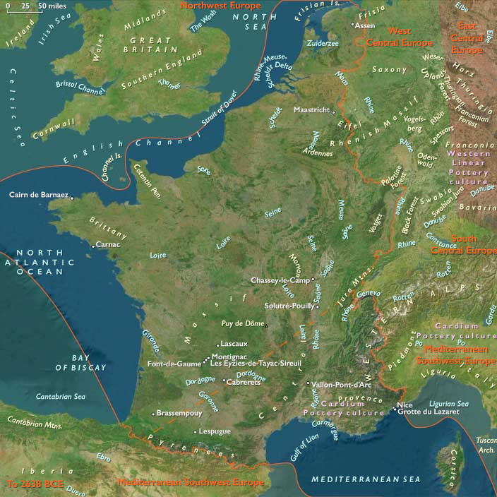
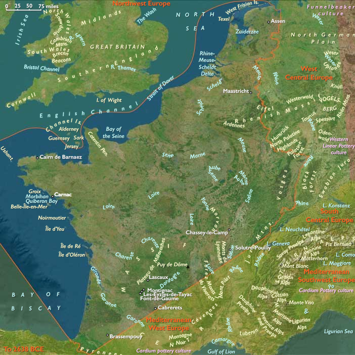
West Europe (7,821 – 6,094 BCE): Early Holocene — Lagoons, Rias, and River Corridors in Concert
Geographic & Environmental Context
West Europe in this epoch braided two coherent shores into one water-bound world:
-
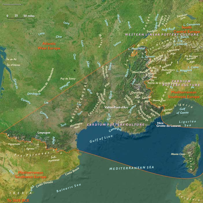
Mediterranean West Europe—the Rhône–Camargue, Languedoc lagoons, Provençal massifs, the Roussillon–Pyrenean forelands, the southern Jura passes, and Corsica—a chain of stabilized estuaries and back-barrier basins under warm, predictable skies.
-
Atlantic West Europe—the Channel and Atlantic façades of France (Brittany–Normandy–Pays de la Loire–Poitou–Aquitaine) and the Low Countries—a rim of rias, sandy bays, and prograding deltas (Seine–Somme, Loire, Gironde, Scheldt–Meuse–Rhine).
Postglacial transgression had largely slowed by this span: lagoons, salt-marshes, and tidal flats reached near-modern outlines, while oak–hazel forests thickened from the Provençal and Jura slopes to the Armorican and Flemish low hills. Rivers—Rhône, Saône, Loire, Seine, Somme, Meuse, Scheldt, Rhine distributaries—functioned as inland spines, knitting forest valleys to the sea.
Climate & Environmental Shifts
The Holocene Thermal Maximum brought warm, moist, and seasonally reliable conditions.
Stable discharges in the Rhône and Atlantic rivers maintained broad wetlands; coastal sediment budgets favored lagoon infilling and marsh expansion along the Gulf of Lion and in the Channel–North Sea embayments. Forest cover advanced yet left mosaic grasslands and reedbeds in uplands, floodplains, and dune slacks—prime ecotones for game, nuts, and fisheries.
Subsistence & Settlement
Across both façades, communities converged on semi-sedentary, water-anchored lifeways:
-
Mediterranean shore–valley belt: Shell-rich lagoon villages exploited mullet, eels, and waterfowl with weirs and traps; inland, hazelnut and acorn harvests paired with red deer/boar hunting in Provençal and Jura forests. Corsica combined narrow coastal foraging with upland hunts of endemic caprids and small deer. Long-lived shell-midden hamlets accumulated around Languedoc basins and the Camargue margins.
-
Atlantic–Channel rim: Estuary and ria settlements in Brittany, Normandy, and the Lower Loire mixed intertidal shellfish, salmon/sea-trout runs, and seal/turtle episodics with deer/boar and extensive nut-gathering. Dune-ridge and islet sites (Armorican and Channel archipelagos) became persistent seasonal nodes; marsh villages diversified into wild fowling and reedcraft.
Everywhere, households returned annually to the same levees, dune bars, rock-shelters, and islets, building semi-sedentary clusters without abandoning seasonal mobility into karst uplands or oak ridges.
Technology & Material Culture
Toolkits were shared across seas and rivers:
-
Microlithic triangles and trapezes armed composite arrows; ground-stone adzes supported canoe/house carpentry.
-
Nets, stake-weirs, basket traps, and dugout canoes underwrote lagoon and estuary mass-capture; fish gaffs and harpoons targeted larger runs.
-
Ornaments of shell and bone, drilled teeth, and ochre use persisted in domestic and mortuary contexts.
-
Earliest pottery touched the northern and eastern fringes late in the span (via Danubian/Thracian contacts), first for boiling, fermenting, and storage, while most groups still relied on heated stones and organic containers.
Movement & Interaction Corridors
Water was the infrastructure:
-
The Rhône–Saône–Jura axis connected Mediterranean lagoons to the Danubian world, carrying prestige lithics, pigments, and—late—ceramic know-how into the interior.
-
Coastal cabotage stitched Languedoc–Provence–Liguria eastward and Gulf of Lion → Catalan–Aquitaine westward; along the Atlantic, short-hop runs linked Brittany–Channel Islands–Normandy–Pays de Caux and the Loire–Gironde ria system.
-
Loire, Seine, Somme, Scheldt–Meuse–Rhine corridors moved shell ornaments, high-quality flints, and seasonally cured fish and nuts between lowlands and forest interiors.
These braided lanes created redundancy—if a shell bank failed or a salmon run thinned, another river reach or lagoon cluster supplied calories and salt.
Cultural & Symbolic Expressions
Waterfront places became ritual topographies:
-
Shell middens doubled as ancestral monuments; formal cemeteries appeared on dune spurs and levee knolls with ornaments and ochre.
-
Hearth complexes and shrine stones anchored kin rights to inlets, fish weirs, and nut groves; rock art persisted in Jura and Pyrenean forelands.
-
Seasonal feasts at fish/turtle peaks reaffirmed alliances among neighboring coves and valleys, binding settlement clusters into cooperative networks.
Environmental Adaptation & Resilience
Households engineered stability through portfolio subsistence and storage:
-
Drying/smoking fish and meat, nut roasting, and fat rendering created portable reserves.
-
Multiple-ecotone scheduling (lagoon–marsh–forest–upland) smoothed inter-annual variability.
-
Canoe mobility and weir tenure distributed pressure across fisheries; ritualized access rules limited conflict and over-take.
Long-Term Significance
By 6,094 BCE, West Europe was a paired-façade heartland of the Mesolithic: lagoon villages along the Mediterranean and ria–estuary communities on the Atlantic–Channel rim, both knit by rivers that funneled goods and ideas inland.
The region’s enduring pattern—semi-sedentary water economies, storage, canoe logistics, and shrine-marked tenure—formed the cultural substrate upon which Neolithic farming intrusions from the Rhône–Saône and Danubian corridors would soon graft.
Here, the sea was larder and road, and the river memory and measure—a balanced coastal-continental system poised for transformation.
Commodities
Subjects
Regions