The Near and Middle East (4,365 – …
Years: 4365BCE - 2638BCE
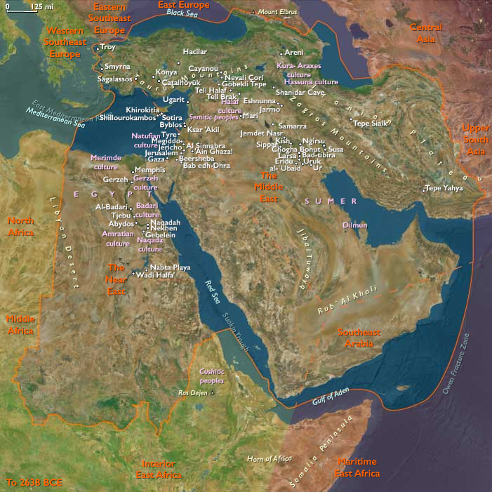
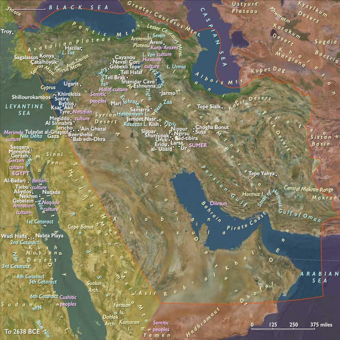
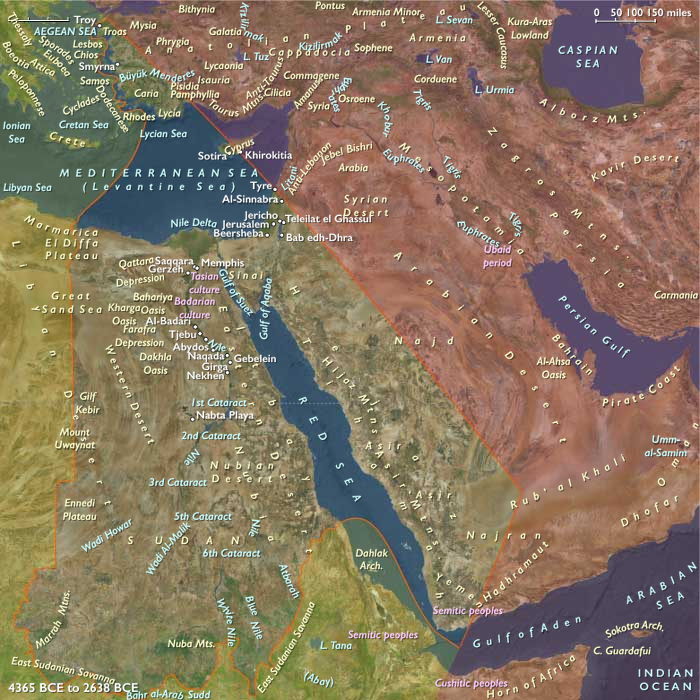
The Near and Middle East (4,365 – 2,638 BCE): Late Neolithic / Chalcolithic — Canal Worlds, Copper Horizons, and Incense Frontiers
Geographic & Environmental Context
During the Late Holocene, the Near and Middle East formed a vast corridor linking Africa, Asia, and the emerging Mediterranean world.
Its landscapes ranged from the canal-fed alluvium of Mesopotamia to the mountain arcs of the Zagros and Caucasus, from the Red Sea terraces of Arabia to the Aegean coasts of Anatolia and the floodplain gardens of the Nile’s eastern reach.
This was an environment of extraordinary ecological diversity:
-
alluvial lowlands (Khuzestan, the Tigris–Euphrates, and the Nile),
-
arid steppe and wadi systems (Syria, Jordan, and northern Arabia),
-
monsoon-fed highlands (Yemen and Dhofar), and
-
maritime corridors along the Aegean and the Gulf.
By the mid-fourth millennium BCE, these distinct zones were already bound together by trade and shared technologies, forming a continental network of canals, oases, and copper routes—the crucible of the world’s first urban civilizations.
Climate & Environmental Shifts
Climatic conditions remained broadly warm but trended toward greater aridity and hydrological instability.
Monsoon withdrawal across Arabia and the Levant reduced rainfall, while alluvial rivers such as the Tigris, Euphrates, and Nile experienced episodic floods and channel shifts.
Marshes waxed and waned with avulsion cycles, while terrace cultivation expanded along mountain slopes and wadis to compensate for declining lowland fertility.
Despite these fluctuations, the region’s hydraulic ingenuity ensured continuity: canals, levees, and terrace systems multiplied, transforming seasonal variability into predictable abundance.
Subsistence & Settlement
Agriculture reached mature complexity across the region.
-
In Mesopotamia, irrigated fields supported wheat, barley, flax, and date palms; villages clustered along levees evolved into proto-towns.
-
In the Zagros and Iranian uplands, mixed farming combined with mobile herding of sheep, goats, and cattle; oasis gardens and storage compounds appeared in Khuzestan and Fars.
-
Along the Nile, canalized floodplains sustained orchard mosaics and grain surplus; in the Hejaz and Yemen, terraces and wells anchored small agro-oases.
-
Across the Aegean–Anatolian littoral, caprine herding and olive and grape cultivation began to shape the coastal economy.
Societies thus mastered both irrigation and pastoral mobility, using each to stabilize the other—a pattern of interdependence that would endure through Bronze Age state formation.
Technology & Material Culture
This epoch marked the metallurgical awakening of the Near and Middle East.
Copper working spread from Anatolia and Iran into the Arabian Gulf and Levantine coasts, while painted ceramics, stamp seals, and lapidary crafts revealed both artistry and administration.
Marshland boatbuilding, sewn-plank hulls along the Gulf, and early sail technology along the Red Sea and Aegean coasts extended trade into a true interregional web.
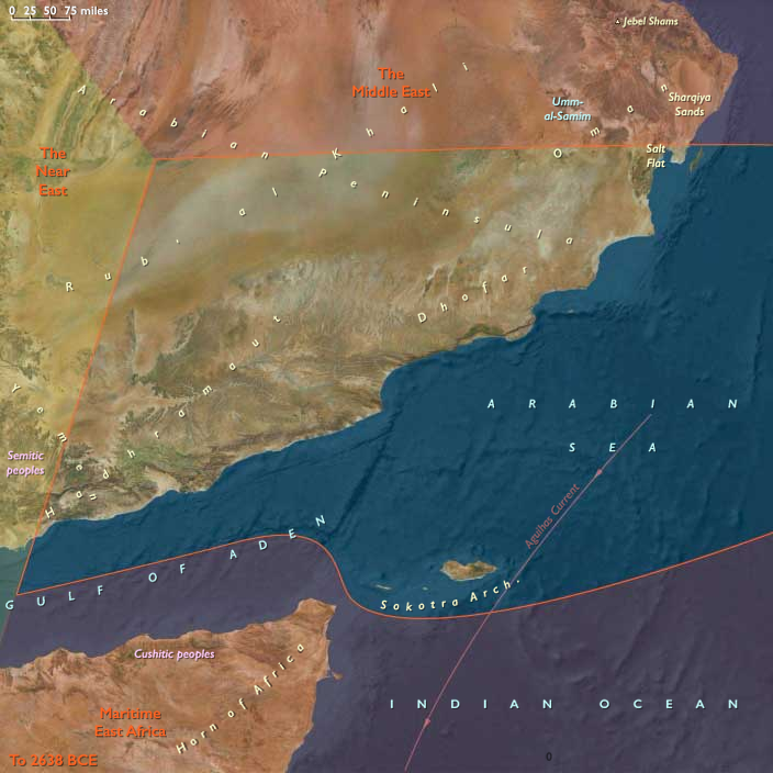
In Arabia’s southern highlands, incense resins joined copper and bitumen as high-value exchange commodities, linking Dhofar to the Gulf and the Levant.
Longhouse compounds, fortified hamlets, and temple-precursor spaces emerged—architectures of both storage and ceremony—reflecting growing social organization.
Movement & Exchange Corridors
The region functioned as a vast network of corridors:
-
The Tigris–Euphrates–Gulf axis linked canal towns to maritime trade.
-
The Zagros and Iranian plateau carried obsidian, copper, and lapis through caravan routes into Central Asia.
-
The Levant–Sinai–Nile interface mediated exchanges between Mesopotamia and Egypt.
-
Maritime routes extended from Bahrain and Oman through Socotra to Yemen and the Red Sea, connecting with the Aegean and eastern Mediterranean circuits.
These overlapping networks produced the earliest transcontinental economy—a fabric of goods, techniques, and ritual forms that spanned from the Caucasus to the Indian Ocean.
Belief & Symbolism
Religious and symbolic life reflected the region’s deep relationship with water, fertility, and ancestry.
Canal openings were marked by offerings; terrace and spring shrines celebrated renewal; incense was burned as both ritual and commodity.
Ancestor veneration remained central: tombs in wadis and cairns on highlands mirrored the monumental shrines rising in lowland settlements.
Across the cultural spectrum—from the Nile and the Euphrates to the incense plateaus of Dhofar—the sacred landscape united earth, water, and sky in a single cosmological order, prefiguring later temple religions of the Bronze Age.
Adaptation & Resilience
Environmental resilience was achieved through redundancy and diversification.
Canal networks mitigated river shifts; terrace agriculture stabilized slopes; transhumant herding bridged ecological zones; and incense and copper trade buffered economic shocks.
Communities responded flexibly to drought, alternating between floodplain farming and highland pasturing, ensuring food security through cross-ecological alliances.
The combination of hydraulic engineering, caravan mobility, and coastal exchange turned climate stress into opportunity—innovation born from aridity.
Long-Term Significance
By 2,638 BCE, the Near and Middle East had evolved into a connected sphere of technological and cultural experimentation.
Metallurgy, irrigation, and maritime navigation had fused into a single transregional system linking Africa, Asia, and the Mediterranean.
This integration set the stage for the rise of early Bronze Age states—from Uruk and Susa to Ebla, Byblos, and Dilmun—and for the incense, copper, and grain economies that would sustain them.
Here, in these canal worlds and incense highlands, urban civilization found its first durable template: hydraulic mastery, ritual centrality, and a networked geography that joined desert and delta, mountain and sea, into one interdependent whole.
Groups
- Ubaid culture
- Sumer
- Uruk, city-state of
- Uruk period
- Kura-Araxes culture
- Proto-Elamite period
- Dilmun (Bahrain?)
Topics
- Older Peron Transgression during the Neolithic Subpluvial
- Younger Peron Transgression during the Neolithic Subpluvial
- 5.9 kiloyear event during the Neolithic Subpluvial
- Early Bronze Age I (Near and Middle East)
- Piora Oscillation ending the Neolithic Subpluvial
- Early Bronze Age II (Near and Middle East)
Commodoties
Subjects
- Commerce
- Architecture
- Painting and Drawing
- Environment
- Decorative arts
- Faith
- Government
- Custom and Law
- Technology
- Metallurgy
Regions
Subregions
Years: 4365BCE - 2638BCE
Groups
- Ubaid culture
- Sumer
- Uruk, city-state of
- Uruk period
- Kura-Araxes culture
- Proto-Elamite period
- Dilmun (Bahrain?)
Topics
- Older Peron Transgression during the Neolithic Subpluvial
- Younger Peron Transgression during the Neolithic Subpluvial
- 5.9 kiloyear event during the Neolithic Subpluvial
- Early Bronze Age I (Near and Middle East)
- Piora Oscillation ending the Neolithic Subpluvial
- Early Bronze Age II (Near and Middle East)
Commodoties
Subjects
- Commerce
- Architecture
- Painting and Drawing
- Environment
- Decorative arts
- Faith
- Government
- Custom and Law
- Technology
- Metallurgy
Regions
Subregions