West Africa (49,293 – 28,578 BCE): Sahelian…
49293 BCE to 28578 BCE
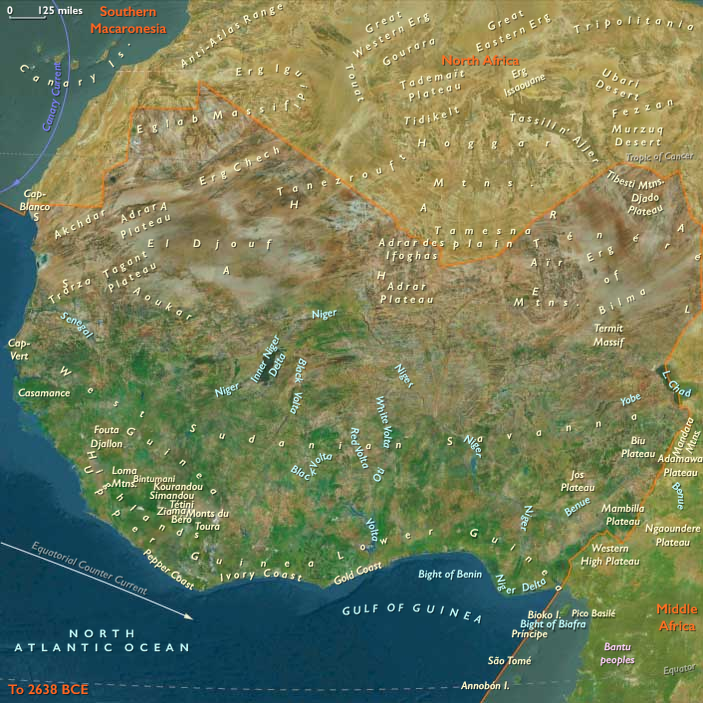
West Africa (49,293 – 28,578 BCE): Sahelian Frontiers and Coastal Corridors
Geographic and Environmental Context
West Africa spans the Atlantic coast from modern Senegal southward to Sierra Leone and inland through the Sahel–savanna belt of Mali, Burkina Faso, and northern Ghana.
-
During this interval, global sea levels were ~60–90 m lower, pushing the shoreline far west and exposing broad coastal plains and submerged river valleys (palaeo-Senegal, Gambia).
-
Inland, a Sahelian steppe–savanna mosaic prevailed north of a denser Guinean woodland strip along the wetter southern margins.
Climate and Environmental Shifts
-
Dansgaard–Oeschger warming pulses and intervening Heinrich cooling events drove large swings in rainfall.
-
During wetter interstadials, the monsoon belt pushed north, expanding grasslands and wooded savanna into what is now hyper-arid Sahel; rivers carried larger flows.
-
Cool–dry phases contracted woodlands, reduced lake extents, and fragmented river corridors, concentrating resources in riparian zones and high-rainfall coastal belts.
Subsistence and Settlement
-
Coastal zones: shellfish, fish, and turtle foraging complemented hunting of antelope, suids, and small game in adjacent coastal woodlands.
-
Inland river corridors: seasonal camps focused on fishing, waterfowl trapping, and pursuit of large grazers like kob and hartebeest.
-
In dry pulses, mobility increased, linking permanent-water refuges across the Sahel margin.
-
Plant gathering emphasized tubers, wild legumes, and seasonal fruits in wetter phases.
Technology and Material Culture
-
Predominantly Middle Stone Age-derived industries with gradual microlithisation in some regions.
-
Quartzite, chert, and quartz microlithic points, backed blades, and scrapers served in both projectile and cutting functions.
-
Bone tools (points, gorges) for fishing likely present but rarely preserved.
-
Personal ornaments from shell and ochre use show symbolic and possibly social-network functions.
Movement and Interaction Corridors
-
Coastal corridor linked West Africa to the Gulf of Guinea littoral, supporting genetic and cultural exchange.
-
Sahel–Niger Bend route tied inland savannas to West-Central African forest fringes.
-
Seasonal movements mirrored shifting monsoon boundaries, with wet-phase expansions into grassland hunting territories.
Cultural and Symbolic Expressions
-
Ochre fragments at some sites indicate continued use in body decoration or hide processing.
-
Aggregation at river mouths and larger waterholes during wet years may have reinforced alliances and shared knowledge.
Environmental Adaptation and Resilience
-
Flexible switching between coastal–inland foraging systems buffered against climatic volatility.
-
Knowledge of ephemeral water sources and seasonal fruiting cycles was critical in dry phases.
-
Broad-spectrum diets mitigated the risk of over-reliance on any one resource.
Transition Toward the Last Glacial Maximum
By 28,578 BCE, West Africa’s human groups had navigated a period of repeated climatic whiplash, maintaining population continuity through mobility, ecotone exploitation, and long-range social ties — strategies that would serve them well as conditions trended toward the harsher aridity of the Last Glacial Maximum.
Images

West Africa in the Upper Paleolithic
Subjects
Regions

West Africa
View →Subregions