Habsburg Monarchy, or Empire
State | Defunct
1526 CE to 1583 CE
The Habsburg family had originated with the Habsburg Castle in modern Switzerland and after 1278 came to rule in Austria (the Habsburg Hereditary Lands).
The Habsburg family grew to European prominence with the marriage and adoption treaty by Emperor Maximilian I at the First Congress of Vienna in 1515 and the subsequent death of adopted Louis II of Hungary and Bohemia in 1526.
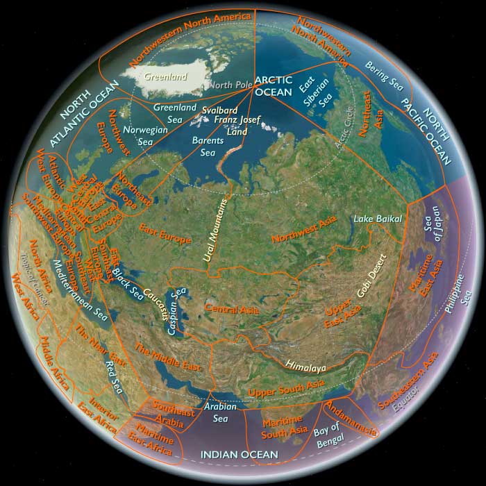
Archduke Ferdinand of Austria, the younger brother of the Holy Roman Emperor Charles V, is elected the next King of Bohemia and Hungary following the death of Louis II of Hungary and Bohemia, in the Battle of Mohács against the Turks.The Imperial capital is Vienna, except from 1583 to 1611,when it is moved to Prague.
Worlds
The Great Crossroads
View →Related Events
Showing 10 events out of 284 total
The succession of Holy Roman Emperors from the Habsburg line gives the House of Austria great prestige in Germany and Europe, but the family's real power base is the lands in its possession, that is, the Habsburg Empire.
This is because the Holy Roman Empire is a loosely organized feudal state in which the power of the emperor is counterbalanced by the rights and privileges of the empire's other princes, lords, and institutions, both secular and ecclesiastical.
Habsburg power is significantly enhanced in 1453, when Emperor Frederick III confirms a set of rights and privileges, dubiously claimed by the Habsburgs, that parallel those of the elector-princes, in whose ranks the family does not yet sit.
In addition, the lands the Habsburgs possess in 1453 are made inheritable through both the male and the female line.
Because feudal holdings usually revert to the emperor to dispose of as he wishes when the holder of the fief dies, the right of inheritable succession measurably strengthens the Habsburgs.
The lands they hold in 1453 become known collectively as the Hereditary Lands, and—with the exception of territories possessed by the archbishops of Salzburg and Brixen—encompass most of modern Austria and portions of Germany, France, Italy, Croatia, and Slovenia.
Southeast Europe (1396–1539 CE)
Ottoman Ascendancy, Balkan Frontiers, and the Fault Line of Christendom
Geography & Environmental Context
Southeast Europe in this era was a land of rivers, mountains, and fortified cities dividing Christian and Islamic worlds.
Eastern Southeast Europe stretched from Turkey-in-Europe and Thrace through Bulgaria, Moldova, and Romania to the Danube Delta—a landscape of river valleys, forest plains, and mountain ramparts feeding into the Bosporus and the Black Sea.
Western Southeast Europe encompassed Greece, Albania, Montenegro, North Macedonia, Kosovo, Bosnia, Croatia, and Slovenia, where the Dinaric Alps, Pindus, and Adriatic coasts met the mountain hinterlands of the Balkans.
This region formed the great hinge between Central Europe and the eastern Mediterranean, a crossroads of empires and faiths.
Climate & Environmental Shifts
The Little Ice Age cooled the region, tightening agricultural margins:
-
Danube Basin: Floods alternated with droughts, reshaping floodplain farming.
-
Carpathian & Balkan uplands: Heavy snow prolonged transhumance cycles; spring torrents enriched meadows.
-
Thrace & Aegean coasts: Frosts damaged olives and vines; Mediterranean crops retreated upslope.
-
Adriatic & Ionian Seas: Stormier seasons and colder currents complicated navigation and coastal trade.
Subsistence & Settlement
-
Plains & river valleys: Wheat, barley, rye, and millet formed staples; vineyards in Bulgaria and Thrace produced wine for local and export trade.
-
Uplands: Sheep, goats, and cattle moved along seasonal routes between the Carpathians, Balkans, and Dinaric Alps.
-
Coasts & islands: Olive oil, figs, salt, and fisheries supported maritime towns from Dubrovnik to Thessaloniki.
-
Mining zones: Bosnia and Serbia exported silver and lead via Dalmatian ports.
-
Urban nodes: Constantinople/Istanbul, Sofia, Iași, Belgrade, and Dubrovnik were vital centers of administration, craft, and exchange.
Technology & Material Culture
-
Agriculture: Iron-tipped plows and watermills improved productivity; Ottoman timar tenure reorganized rural estates.
-
Military: Gunpowder artillery transformed sieges; the Ottomans perfected field logistics and fortress artillery; local principalities deployed cavalry and wagon defenses.
-
Architecture: Frescoed Orthodox monasteries such as Voroneț and Humor adorned Moldavia; Ottoman mosques, baths, and bridges reshaped Balkan towns; Venetian Gothic façades persisted on the Adriatic.
-
Crafts: Balkan goldsmithing, woodcarving, and textile production continued under mixed Ottoman and local patronage.
Movement & Interaction Corridors
-
The Danube Corridor: Lifeline for armies, grain, and trade; fortresses like Belgrade and Vidin guarded crossings.
-
Via Egnatia & Balkan passes: Connected Adriatic ports with Thrace and Constantinople, sustaining overland caravans.
-
Black Sea–steppe routes: Linked Moldavia, Dobruja, and the Crimea, feeding Ottoman supply lines.
-
Adriatic and Aegean sea lanes: Carried Venetian, Ragusan, and Ottoman fleets, merchants, and pilgrims between Italy, Greece, and Anatolia.
-
Mountain and forest roads: Enabled transhumance and the smuggling of goods and people across imperial frontiers.
Cultural & Symbolic Expressions
-
Orthodox Christianity: Monasteries in Moldavia, Wallachia, Serbia, and Athos preserved liturgy, manuscript illumination, and identity under Ottoman rule.
-
Islamic urban culture: Mosques, caravanserais, and vakıf foundations spread through conquered towns, introducing Ottoman civic life.
-
Catholic & Humanist enclaves: Dalmatian cities like Zadar, Split, and Dubrovnik maintained Latin schools and libraries; émigré scholars from Constantinople brought Greek manuscripts to Italy, fueling the Renaissance.
-
Folk traditions: Heroic songs of Hunyadi, Skanderbeg, and Stephen the Great celebrated resistance; South Slavic and Albanian epics sustained oral memory.
-
Civic artistry: Icon painting, manuscript copying, and folk embroidery bridged church and household devotion.
Environmental Adaptation & Resilience
-
Agrarian diversity: Mixed grain, vine, and pastoral systems buffered risk; maize was still unknown but cereals diversified diets.
-
Transhumant mobility: Pastoralists followed snowmelt, shifting herds between alpine meadows and Danubian plains.
-
Forest refuge: Villages rebuilt after raids amid forest cover; woodlands supplied construction and fuel.
-
Maritime exchange: Salt, fish, and ship timber stabilized economies when inland fields failed.
-
Ottoman provisioning networks: Redirected Balkan surpluses toward Istanbul and garrisons, maintaining trade under imperial integration.
Technology & Power Shifts (Conflict Dynamics)
-
Ottoman victories:
-
Nicopolis (1396) and Varna (1444) shattered crusader resistance.
-
Constantinople fell in 1453, transforming it into Istanbul.
-
Belgrade (1521) and Mohács (1526) opened Hungary to Ottoman partition.
-
-
Danubian principalities: Wallachia and Moldavia maintained tributary autonomy; leaders like Mircea the Elderand Stephen the Great resisted Ottoman and Tatar incursions.
-
Crimean Tatars: Allied with the Ottomans, raided Moldavia, Poland, and Ukraine, feeding the Black Sea slave trade.
-
Western frontiers: Venice clashed with Ottoman fleets; Dubrovnik navigated neutrality and profit as intermediary; Skanderbeg’s Albanian revolt (1443–1468) became emblematic of mountain resistance.
-
Naval dominance: The Battle of Preveza (1538) secured Ottoman mastery of the Ionian and Aegean seas.
Transition (to 1539 CE)
By 1539, Southeast Europe had become the principal marchland of empire.
The Ottoman crescent stretched from the Danube to the Aegean and Adriatic, with Istanbul at its center.
Bulgaria, Thrace, Greece, and Bosnia were integrated into Ottoman administration; Wallachia and Moldavia paid tribute; Transylvania balanced between Habsburg and Ottoman influence.
The Adriatic remained contested—Venice held coastal enclaves, while Dubrovnik thrived as a neutral broker.
Amid conquest, Balkan peoples preserved faith, language, and tradition through monastery, market, and mountain refuge.
The age closed with the Battle of Preveza (1538) and Ottoman control of the eastern Mediterranean, confirming Southeast Europe as the heart of the empire’s European frontier—a landscape of faith, resistance, and imperial transformation.
Eastern Southeast Europe (1396–1539 CE): Ottoman Ascendancy, Danubian Principalities, and Balkan Crossroads
Geographic & Environmental Context
The subregion of Eastern Southeast Europe includes Turkey-in-Europe, Thrace-in-Greece, Bulgaria (except the southwest), Moldova, Romania, northeastern Serbia, northeastern Croatia, and extreme northeastern Bosnia and Herzegovina. Anchors included the Danube from the Iron Gates to its delta, the Wallachian and Moldavian plains, the Transylvanian and Carpathian margins, the Balkan and Rhodope ranges, and the Thracian plain leading to Constantinople/Istanbul. This was a meeting ground of steppe and forest, mountain fortresses and river valleys, bound by the Danube corridor and the Bosporus straits.
Climate & Environmental Shifts
The Little Ice Age cooled winters and shortened growing seasons.
-
Danube basin: spring floods inundated floodplains; summer droughts alternated with wet years, affecting grain surpluses.
-
Carpathian foothills & Balkan uplands: heavy snowpack fed torrents; pastoralists shifted grazing with snowmelt.
-
Thrace & Marmara lowlands: Mediterranean crops of vines and olives endured but suffered frost in severe winters.
Subsistence & Settlement
-
Rural farming: Wheat, barley, millet, and rye across Wallachia, Moldavia, and Thrace; vineyards in Bulgaria and Thrace; maize only arrived later.
-
Pastoralism: Sheep, cattle, and horses grazed on plains and upland meadows; transhumance between Carpathians and lowlands.
-
Towns & trade nodes: Constantinople/Istanbul, Sofia, Târgu Jiu, Bucharest (emerging), Iași, and Brașov; fortified citadels guarded Danube crossings.
-
Fishing & forests: Danube, Prut, and Dniester supplied sturgeon and carp; forests yielded honey, wax, and timber.
Technology & Material Culture
-
Agriculture: Wooden plows, iron-tipped tools, watermills; peasant strips and manorial estates persisted under Ottoman timar and local boyar systems.
-
Military: Cavalry and fortresses dominated warfare; Ottomans refined siege artillery; Moldavian and Wallachian hosts combined light cavalry with war wagons.
-
Crafts & architecture: Orthodox monasteries in Moldavia and Wallachia (Voroneț, Humor) painted with vivid frescoes; Ottoman mosques and baths began reshaping Balkan towns.
Movement & Interaction Corridors
-
Danube corridor: Lifeline for grain, salt, and armies; Brașov and Belgrade were major crossings.
-
Black Sea–steppe routes: Moldavia and Dobruja linked to Genoese colonies (until Ottoman conquest in 1475) and later Ottoman trade.
-
Balkan passes: Shipka and Iron Gates moved caravans between plains and coastal zones.
-
Ottoman expansion: After Battle of Nicopolis (1396) and Varna (1444), Ottomans pressed north; 1453 capture of Constantinople secured the Bosporus; Belgrade resisted until 1521.
Cultural & Symbolic Expressions
-
Orthodoxy: Wallachia, Moldavia, and Bulgaria maintained Orthodox liturgy, monasteries, and saints’ cults as centers of identity under Ottoman suzerainty.
-
Ottoman Islam: Spread in towns via mosques, markets, and administrative complexes; janissary garrisons became cultural nodes.
-
Humanism: Latin and Greek scholars fled Constantinople (1453), carrying manuscripts to Italy; Balkan literacy endured in monasteries.
-
Epic & folklore: Songs of resistance (Hunyadi, Skanderbeg) circulated; Moldavian chronicles preserved local memory.
Environmental Adaptation & Resilience
-
Farmers: Diversified between cereals, vineyards, and pastoralism; stored grain in earth cellars.
-
Pastoralists: Practiced flexible transhumance, moving flocks between Carpathian pastures and Danubian lowlands.
-
Villages: Rebuilt after raids with timber palisades; forests offered refuge.
-
Markets: Redistributed surpluses; Ottoman provisioning drew resources toward Istanbul and military roads.
Technology & Power Shifts (Conflict Dynamics)
-
Ottoman victories: Nicopolis (1396), Varna (1444), Kosovo (1448), Constantinople (1453), Belgrade (1521), Mohács (1526).
-
Danubian principalities: Wallachia and Moldavia maintained tributary autonomy, resisting at times (Mircea the Elder, Stephen the Great of Moldavia defeated Ottomans at Vaslui, 1475).
-
Hungary & Habsburgs: Held the northern frontier until Mohács (1526), after which Ottomans partitioned Hungary and pressed into the Carpathian basin.
-
Crimean Tatars: Allied to Ottomans, raided Moldavia, Poland, and Ukraine through Black Sea steppes.
Transition
By 1539 CE, Eastern Southeast Europe had become an Ottoman marchland. Constantinople was the Ottoman capital, Bulgaria and Thrace integrated into the timar system, and Belgrade secured. Wallachia and Moldavia remained tributary but strategically vital; Transylvania, now semi-independent, stood between Ottoman and Habsburg spheres. The Danube and Carpathian arc had become Europe’s central fault line between Christendom and the expanding Ottoman world.
They apparently enjoyed broad autonomy in the seventh century, after escaping Avar domination.
The Franks overran the Slovenes in the late eighth century; during the rule of the Frankish king Charlemagne, German nobles began enserfing the Slovenes, and German missionaries baptized them in the Latin rite.
Emperor Otto I had incorporated most of the Slovenian lands into the duchy of Carantania in 952; later rulers had split the duchy into Carinthia, Carniola, and Styria.
In 1278 the Slovenian lands had fallen to the Austrian Habsburgs, who will control them until 1918.
Turkish marauders plague Carinthia, Carniola, and Styria in the sixteenth and seventeenth centuries.
The Slovenes abandon lands vulnerable to attack and raise bulwarks around churches to protect themselves.
The Turkish conquest of the Balkans and Hungary also disrupts the Slovenian economy; to compensate, the nobles stiffen feudal obligations and crush peasant revolts between 1478 and 1573.
Atlantic Southwest Europe (1396–1539 CE): Estuaries, Shipyards, and the First Oceanic Empires
Geographic & Environmental Context
The subregion of Atlantic Southwest Europe includes continental Portugal and Spain’s Atlantic façade from the Gulf of Cádiz to the Bay of Biscay—the Tagus, Sado, Mondego, Douro, and Minho estuaries; Portugal’s Alentejo and Algarve coasts; Spain’s Guadalquivir–Cádiz seaboard; and the Cantabrian–Galician rías (A Coruña, Vigo, Gijón, Santander) and Basque capes (Bilbao–San Sebastián). These shorelines and river corridors bound maritime towns to grain-and-vine interiors and iron-rich uplands.
Climate & Environmental Shifts
The Little Ice Age brought cooler winters, stormier seas, and variable rains:
-
Iberian west & south coasts: more frequent Atlantic gales and bar shifts at estuary mouths (Douro, Tagus, Guadalquivir), alternately silting and scouring channels.
-
Northwest (Galicia–Asturias–Cantabria): heavy rainfall and rough seas; rich upwelling sustained fisheries.
-
Interior hinterlands: periodic droughts hit Alentejo and Andalusian cereal zones; frosts checked vines and olives in bad years; good years yielded ample wheat, wine, and oil.
Subsistence & Settlement
-
Rural belts: Wheat, rye, barley, olives, and vines; cork oak montado in Alentejo; gardens and orchards along river terraces.
-
Fisheries: Sardine and tunny on the Portuguese and Andalusian shelves; cod and whale began to matter for Basque fleets in the early 16th century. Saltworks (Aveiro, Setúbal, Cádiz) underwrote fish preservation and trade.
-
Ports & river towns: Lisbon (Tagus) and Porto (Douro); Seville and Cádiz (Guadalquivir–Cádiz); A Coruña–Vigo (rías), Santander, Bilbao and San Sebastián on the Bay of Biscay; Viana do Castelo, Figueira da Foz, Setúbal along Portugal’s coast. Urban workshops produced sails, rope, barrels, and victuals for ocean-going fleets.
Technology & Material Culture
-
Shipbuilding & navigation: The caravel (lateen rig, shoal-draft) matured on Portugal’s south coast; rounder naos carried freight across oceans. Magnetic compass, sternpost rudder, astrolabe, cross-staff, portolan charts, and toleta de marteloio tables improved blue-water navigation.
-
Maritime institutions: In Portugal, the Order of Christ’s revenues (successor to the Templars) and the crown’s Casa da Guiné and later Casa da Índia in Lisbon centralized Atlantic/Indian trade. Basque iron and timber supported Biscayan yards.
-
Urban & courtly arts: Manueline architecture (rope, coral, armillary motifs) crowned Lisbon/Belém; Mudéjar–Plateresque blended in Andalusia; guild crafts (textiles, leather, ceramics) supplied ships and cities.
Movement & Interaction Corridors
-
Estuary arteries: The Tagus, Douro, and Guadalquivir funneled grain, wine, oil, salt fish, and hides from interior plains to oceanic convoys; return flows brought spices, gold, and slaves by the early 1500s.
-
Atlantic lanes: Portugal’s Volta do Mar looped down the African coast and home via mid-ocean westerlies; Andalusian–Cantabrian coasting linked Biscay iron and salt fish to southern shipyards and markets.
-
Pilgrimage & fairs: Santiago de Compostela drew pilgrims through Galician ports; Lisbon and Seville fairs knit merchants from Italy, Flanders, and the Maghreb.
-
Imperial routes (first phase): After 1498, spice fleets sailed India–Lisbon; after 1492, Castilian fleets used the Guadalquivir–Seville corridor to the Caribbean.
Cultural & Symbolic Expressions
-
Religious life: Cathedrals and confraternities structured urban devotion; seafarers’ brotherhoods honored Our Lady of Good Voyage; shrines dotted headlands and capes (e.g., Cape St. Vincent).
-
Court and chronicle: Portuguese chronicles (Gomes Eanes de Zurara) celebrated exploration; Iberian courts patronized cartography and cosmography.
-
Communal identities: Fisher guilds, ship carpenters, ropewalkers, coopers, and salt-pan communities developed strong customs and saints’ days; Basque whalers forged distinctive sea rituals.
Environmental Adaptation & Resilience
-
Risk-spreading portfolios: Mixed farming (cereal–vine–olive), stock-raising, and salt-fish curing buffered bad harvests; riverine mills and terraces stabilized yields.
-
Harbor works: Jetties and dredging (Lisbon, Porto, Seville) fought bar siltation; salt granaries and fish warehouses bridged lean seasons.
-
Maritime provisioning: Biscayan and Portuguese fleets salted fish and whale meat; victualing yards stockpiled biscuit, wine, oil, and salted pork for oceanic voyages.
Technology & Power Shifts (Conflict Dynamics)
-
Iberian realignments: The Conquest of Ceuta (1415) opened Portugal’s North African gateway and Atlantic thrust; the War of the Castilian Succession (1475–1479)—including the Battle of Toro (1476)—ended with the Treaty of Alcáçovas (1479), fixing early Atlantic spheres between Castile and Portugal. The Treaty of Tordesillas (1494) divided extra-European worlds meridionally.
-
Oceanic breakout: Vasco da Gama’s voyage (1497–1499) linked the Tagus to India; Pedro Álvares Cabral (1500) reached Brazil; Portugal’s Estado da Índia took shape after the Battle of Diu (1509) and the Capture of Malacca (1511), routing Eastern spices to Lisbon.
-
Castile’s Atlantic: From 1492, Columbus’s voyages (out of Palos/Cádiz) opened Caribbean routes; Seville’s Casa de la Contratación (from 1503) regulated fleets.
-
Privateering & defense: Biscay–Galician coasts armed against English, Breton, and Norman raiders; corsair warfare flickered in the Bay of Biscay and off the Algarve.
Transition
By 1539 CE, Atlantic Southwest Europe had transformed from a cluster of estuarine towns into the launchpad of two oceanic empires. Lisbon and Seville–Cádiz rose as global entrepôts; Biscayan and Galician ports provisioned fleets and pioneered whaling and Atlantic cod. Inland cereals, vines, and olives still fed the system, but caravel and nao had redrawn horizons—binding Iberian estuaries to Africa, Asia, and the Americas, and setting the stage for a sixteenth century of maritime hegemony and imperial rivalry.
Greedy nobles and an ill-planned crusade spark a widespread peasant revolt in Hungary and Transylvania in 1514.
Well-armed peasants under György Dózsa sack estates across the country.
Despite strength of numbers, however, the peasants are disorganized and suffer a decisive defeat at Timisoara.
Dózsa and the other rebel leaders are tortured and executed.
After the revolt, the Hungarian nobles enact laws that condemn the serfs to eternal bondage and increase their work obligations.
With the serfs and nobles deeply alienated from each other and jealous magnates challenging the king's power, Hungary is vulnerable to outside aggression.
The Ottomans storm Belgrade in 1521, rout a feeble Hungarian army at Mohacs in 1526, and will conquer Buda in 1541.
They install a pasha to rule over central Hungary; Transylvania becomes an autonomous principality under Ottoman suzerainty; and the Habsburgs assume control over fragments of northern and western Hungary.
King Francis I of France had been defeated at the Battle of Pavia on February 24, 1525 by the troops of the Habsburg Holy Roman Emperor, Charles V. After several months in prison, Francis had been forced to sign the Treaty of Madrid.
In a watershed moment in European diplomacy, Francis had come to an understanding with the Ottoman Empire, which has led to a formal Franco-Ottoman alliance.
The objective for Francis I is clearly to find an ally against the powerful Habsburg Emperor, in the person of Ottoman Sultan Suleiman.
The Ottoman-French strategic, and sometimes tactical, alliance will last for about three centuries.
It does, however, cause quite a scandal in the Christian world.
To relieve the Habsburg pressure on France, Francis has asked Suleiman to make war on the Holy Roman Empire, and the road from Turkey to the Holy Roman Empire leads across Hungary.
The request of the French king coincides nicely with the ambitions of Suleiman in Europe and gives him an incentive to attack Hungary in 1526.
The Ottomans see the growing alliance between Hungary and Bohemia and the Habsbugs as a threat to their power in the Balkans and have worked to break this alliance.
After Suleiman I came to power in 1520, the High Porte had made the Hungarians at least one and possibly two offers of peace.
It is unclear why King Louis refused the offer.
It is possible that Louis is well aware of Hungary's situation (especially after the Battle of Chaldiran and Polish-Ottoman peace from 1525) and he believes that war is a better option than peace.
Even in peacetime the Ottomans raid Hungarian lands and conquer small territories (with border castles), but a final battle still offers a glimmer of hope.
To such ends, an Ottoman army had set out from Istanbul on April 16, 1526, led by Suleiman the Magnificent personally.
In the Hungarian kingdom, riven by social and national divisions stimulated by the Reformation, a general call to arms is proclaimed, but the most important forces—those from Transylvania and Croatia—are late in obeying it.
Louis hurriedly assembles a force of some sixteen thousand men and advances from Buda to meet the Turks.
The Hungarian nobles, who still do not realize the dimensions of the approaching danger, do not heed their King's call to arms.
Louis II orders them to encamp on July 2 but no one reports on this day—not even the King.
Only when Louis himself furnishes an example with his appearance in the camp do things start to move.
The Hungarian war council—without waiting for their reinforcements only a few days march away—makes a serious tactical error by choosing the battlefield near Mohács, an open but uneven plain with some swampy marshes.
The Hungarian army is divided into three main units: the Transylvanian army under John Zápolya, charged with guarding the passes in the Transylvanian Alps, with between eight thousand and thirteen thousand men; the main army, led by Louis himself (beside numerous Spanish, German, Czech and Serbian mercenaries); and another smaller force, commanded by the Croatian count Christoph Frankopan, numbering around five thousand men.
Due to geography, the Ottoman army's ultimate goal could not be determined until it was crossing the Balkan Mountains.
Unfortunately for the Hungarians, by the time the Ottoman army had crossed, the Transylvanian and Croatian army was further from Buda than the Ottomans were.
Contemporary historical records, though sparse, indicate that Louis preferred a plan of retreat, in effect ceding the country to Ottoman advances, rather than directly engaging the Ottoman army in open battle.
The Hungarian forces choose the battlefield, an open but uneven plain with some swampy marshes near Mohács leading down to the Danube.
The Ottomans had been allowed to advance almost unopposed.
While Louis waited in Buda, they had besieged several towns and crossed the Sava and Drava Rivers.
Louis has assembled around twenty-five thousand to thirty thousand soldiers (with Croatian and Polish contingents and about eight hundred to one thousand soldiers of the Papal States) while the Ottoman army was long thought to have numbered around fifty thousand.
However, military history books from the twenty-first century will calculate the number of the Ottoman Army around one hundred thousand men.
In addition, the Ottoman forces have up to one hundred and sixty cannon.
Most of the Ottoman Balkan forces registered before this battle are labeled as Bosnians or Croats, as a designation of the territory in which they had been they were recruited.
The Hungarian army is arrayed to take advantage of the terrain and hopes to engage the Ottoman army piecemeal.
The only advantage the Magyars have is that their troops are well-rested, while the Turks have just completed a strenuous march in scorching summer heat.
Rather than attacking their fatigued enemy, however, the Hungarians merely watch as they struggle through the marshy terrain.
It would be "unchivalrous" to attack the enemy when they are not yet ready for battle.
Hungary has built up an expensive but obsolete army, structured similarly to that of King Francis I at the Battle of Pavia mostly reliant on old fashioned heavily armored knights on armored horses (gendarme knights).
The Hungarian line consists of two lines, the first with a center of mercenary infantry and artillery and the majority of the cavalry on either flank.
The second line is a mix of levy infantry and cavalry.
The Ottoman army is a more modern force built around the elite, musket-armed Janissaries, and artillery.
The rest of the army consists of feudal Timari cavalry and conscripted levies from Rumelia and the Balkans.
Like the uncertainty over the number of actual combatants, there is debate over the length of the battle.
Its starting time is generally placed between 1:00 PM and 2:00 PM, but the endpoint is difficult to ascertain.
As the first of Suleiman's troops, the Rumelian army, advance onto the battlefield, they are attacked and routed by Hungarian troops led by Pál Tomori.
This attack by the Hungarian right is successful in causing considerable chaos among the irregular Ottoman troops, but even as the Hungarian attack presses forward, the Ottomans rally with the arrival of Ottoman regulars deployed from the reserves.
While the Hungarian right advances far enough at one time to place Suleiman in danger from Hungarian arrows that strike his cuirass, the superiority of the Ottoman regulars and the timely charge of the Janissaries, the elite troops of the Ottomans, probably overwhelms the attackers, particularly on the Hungarian left.
The Hungarians take serious casualties from the skillfully handled Turkish artillery and musket volleys.
The Hungarians cannot hold their positions, and those who do not flee are surrounded and killed or captured.
The result us a disaster, with the Hungarians advancing into withering fire and flank attacks.
The king leaves the battlefield sometime around twilight but is thrown from his horse in a river at Csele and dies, weighed down by his heavy armor.
Some one thousand other Hungarian nobles and leaders are killed also.
It is generally accepted that more than fourteen thousand Hungarian soldiers were killed in the initial battle.
The Ottoman army does not retreat from the field and enter camp after the battle; instead, they remain on the field all night without food, water, or shelter.
Given that the Ottoman historians all note that it was raining, it seems likely that had the battle been short and ended early in the afternoon, by 5:00 PM at the latest, when the Sultan would have ordered his army to camp or at least to return to their baggage.
The few reliable sources indicate that Louis left the field at twilight and made his escape under cover of darkness; since the sun would not have set until 6:27 PM on August 29, 1526, this would imply that the battle lasted significantly longer than two to three hours (perhaps as long as four or five).