Hittites (Middle) Kingdom of the
State | Defunct
1500 BCE to 1430 BCE
During the fifteenth century BCE, Hittite power falls into obscurity, reemerging with the reign of Tudhaliya I from ca.
1400 BCE.
Capital
Worlds
The Great Crossroads
View →Related Events
Showing 10 events out of 45 total
-
The Near and Middle East (2637 – 910 BCE): Bronze and Early Iron — Empires, Incense, and the First Great Corridors
Regional Overview
During the Bronze and Early Iron Ages, the Near and Middle East stood at the center of Afro-Eurasian innovation.
From the Tigris–Euphrates to the Nile, from the Caucasus uplands to the Arabian Sea, irrigation, metallurgy, and overland and maritime trade linked highlands, deserts, and fertile deltas into a single interdependent world.
By the close of this epoch, the region had evolved into a mosaic of palace-states, caravan polities, and incense ports that prefigured the classical empires of the first millennium BCE.
Geography and Environment
The region spanned three great ecological belts:
-
the alluvial lowlands of Mesopotamia and Egypt,
-
the mountain and plateau arcs of Iran, Armenia, and Anatolia, and
-
the arid steppe and coastal deserts of Arabia and the Levant.
Rivers such as the Tigris, Euphrates, Nile, and Jordan supplied irrigation, while the Zagros and Caucasus offered pastures and metals.
The Red Sea, Persian Gulf, and eastern Mediterranean served as maritime corridors binding these lands into one economic sphere.
Climate and Environmental Shifts
Late-Holocene arid pulses intensified after 2000 BCE.
Mesopotamian salinization and river avulsion forced canal redirection and crop rotation, while the Caucasus and Zagros pastures remained comparatively stable.
Along the Red Sea and Arabian coasts, fog oases and mountain terraces mitigated drought.
This interplay of aridity and adaptation produced the region’s hallmark—hydraulic ingenuity.
Societies and Political Developments
In the Mesopotamian and Iranian highlands, Elamite, Susian, and Zagros polities balanced urban irrigation systems with pastoral hinterlands.
Metal-rich Transcaucasia (Trialeti, Kura–Araxes legacies) supplied arsenical bronzes and stimulated north-south trade.
By the late second millennium BCE, the foundations of Assyria, Urartu, and Syro-Anatolian kingdoms were emerging.
To the south and east, Southeast Arabia developed terraced oases in Hadhramaut and Dhofar, expanding goat-camel herding and pioneering the frankincense and myrrh trades.
Socotra’s resins and dried fish entered long-range exchange networks that reached the Gulf and the Red Sea.
In the Near East proper, the Nile and Aegean worlds intertwined.
Egypt’s New Kingdom power extended into the Levant, while Aegean mariners and Anatolian city-states (Minoan–Mycenaean, later Aeolian and Ionian) connected the Mediterranean coasts.
Tyre, within this subregion, grew into a Phoenician entrepôt, while western Arabia’s oases and Yemeni highlands cultivated incense gardens and terraced cereals—the first outlines of the later incense road.
Economy and Technology
Across the region, Bronze-Age craft economies reached maturity.
-
Bronze metallurgy dominated tools, weapons, and luxury goods; iron-smelting appeared near the end of the period in Anatolia and Iran.
-
Wheeled transport and pack-camels widened caravan trade.
-
Canal agriculture, terrace farming, and oasis irrigation supported dense populations.
-
Sewn-plank dhows and sail-rigged ships carried pearls, dates, metals, and incense along the Gulf and Red Sea.
The interplay of highland ores, lowland crops, and coastal markets created a vertically integrated economic web unmatched elsewhere in the ancient world.
Belief and Symbolism
Ritual and kingship centered on divine mediation of fertility and order.
Highland peoples carved rock reliefs and tended fire altars; Mesopotamian and Levantine cities built temple precinctsaligned with stars and rivers.
In Egypt, solar and funerary cults radiated outward; in Aegean Anatolia, maritime sanctuaries honored capes and storms; in Arabia, ancestor tombs and incense offerings sacralized the desert routes.
The region’s mythic imagination—of gods ruling sky, sun, and flood—underpinned later Zoroastrian, Hebrew, and Hellenic traditions.
Movement and Interaction Corridors
Trade and migration moved through a network of interlocking routes:
-
Overland Zagros–Tigris and Caucasus–Ararat–Urmia corridors moved metals and livestock.
-
The Royal Road precursors tied Susiana to Anatolia.
-
The Gulf and Red Sea coasts hosted pearl fishers, incense ports, and ferry routes linking Arabia, Egypt, and the Levant.
-
Nile–Aegean maritime lanes ferried copper, tin, and luxury goods.
Together these paths created the first durable framework of continental-scale commerce.
Environmental Adaptation and Resilience
Societies balanced extremes through ecological complementarity:
mountain pastures fed lowland markets; oases and terraces offset desert risk; multi-crop rotations and canal maintenance curbed salinity.
Pastoral mobility and diversified trade insulated economies from drought and political upheaval.
By coupling agriculture, herding, and commerce, the region sustained continuity through climatic and dynastic flux.
Regional Synthesis and Long-Term Significance
By 910 BCE, the Near and Middle East had matured into a highly interconnected world system.
Its urban irrigation states, steppe-oasis alliances, and maritime incense routes linked Africa, Asia, and Europe.
The technological and cultural legacies of this era—bronze metallurgy, writing, monumental architecture, and long-distance exchange—formed the enduring template for the imperial and religious civilizations that would dominate the first millennium BCE and beyond.
Middle East (2,637 – 910 BCE) Bronze and Early Iron — Highland–Oasis Symbiosis, Steppe Links
Climate & Environment
-
Aridity pulses increased; alluvial avulsion and salinization risks rose; Caucasus/Zagros pastures remained reliable.
Societies & Settlement
-
Elamite–Susiana sphere influenced Khuzestan; Zagros polities (Lullubi, Gutian forebears) persisted; northern Syrian/Cilician towns grew; Transcaucasian metal zones (Trialeti, Kura–Araxes legacies) supplied copper/arsenical bronzes.
-
Nomadic/pastoral networks (steppe links via Caspian–Caucasus) interacted with oases.
Technology
-
Bronze weaponry/tools; early iron appears by the end; wheeled transport; canalized agriculture scaling.
Corridors
-
Zagros–Tigris caravan lines; Caucasus–Ararat–Lake Urmia nodes; Gulf coasting (pearls, dates) with the Arabian littoral.
Symbolism
-
Highland rock reliefs; fire altars; ancestor cults; temple precincts in oases.
Adaptation
-
Highland–oasis complementarity (pasture vs. irrigation); distributed canal networks and multi-crop rotations resisted salinization.
Transition
By 910 BCE, the matrix exists for the Neo-Assyrian, Urartian, and Syro-Anatolian polities that will dominate early Iron Age corridors intersecting our region.
Near East (2,637 – 910 BCE) Bronze and Early Iron — Delta Kingdoms, Aegean City-Coasts, Arabian Caravan Seeds
Geographic and Environmental Context
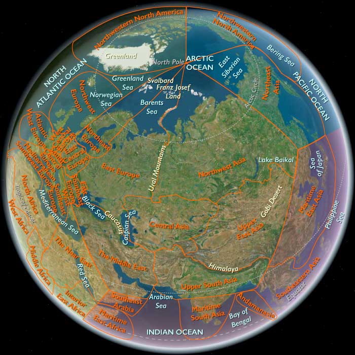
The Near East includes Egypt, Sudan, Israel, most of Jordan, western Saudi Arabia, western Yemen, southwestern Cyprus, and western Turkey (Aeolis, Ionia, Doris, Lydia, Caria, Lycia, Troas) plus Tyre (extreme SW Lebanon).-
Anchors: the Nile Valley and Delta; Sinai–Negev–Arabah; the southern Levant (with Tyre as the sole Levantine node in this subregion); Hejaz–Asir–Tihāma on the Red Sea; Yemen’s western uplands/coast; southwestern Cyprus; western Anatolian littoral (Smyrna–Ephesus–Miletus–Halicarnassus–Xanthos; Troad).
Climate & Environment
-
Nile floods oscillated; Aegean coastal plains fertile; Arabian west slope aridity increased, highland terraces scaled slowly.
Societies & Settlement
-
Lower/Upper Egypt (full Pharaonic cores just south but contiguous influence); Aegean Anatolia (Minoan/Mycenaean interactions; later Aeolian/Ionian/Dorian successors).
-
Levantine Tyre (within this subregion) arose as Phoenician node; Arabian west oases supported caravan precursors; Yemen west highlands nurtured terrace farming and incense beginnings.
Technology
-
Bronze widespread; early iron in Anatolia/Levant; sail-powered shipping matured; terracing and cisterns in Hejaz–Yemen highlands.
Corridors
-
Nile–Delta–Aegean maritime bridge; Tyre connected to Cyprus/Anatolia; Red Sea coastal cabotage began; Incense path seeds in Yemen–Hejaz.
Symbolism
-
Egyptian temple cosmology radiated north; Aegean cults at capes; Tyrian Melqart/Asherah; Arabian highland local cults.
Adaptation
-
Floodplain–coastal–terrace redundancy stabilized economies; incense gardens hedged aridity.
Indo-European-speaking tribes invade India beginning in approximately 1600 BCE; other tribes settle in Iran and in Europe.
One of these groups, the Hittites, allies itself with the Kassites, a people of unknown origins.
Together, they conquer and destroy Babylon.
The Hittites and Hurrians continue to vie for dominance in Syria and Anatolia.
Farmers in northern Mesopotamia improve the plowshare around 1600 BCE by inventing a share and sole that digs deeper furrows.
The warring Hurrian tribes and city states are believed to have become united under one dynasty after the collapse of Babylon following its sack by the Hittite king Mursili I and the Kassite invasion.
The Hittite conquest of Aleppo (Yamhad), the weak middle Assyrian kings, and the internal strife of the Hittites had created a power vacuum in upper Mesopotamia, leading to the formation of the kingdom of Mitanni.
The city of Ebla is destroyed again in the turbulent period of 1575–1525 BCE, by a Hittite king (Mursili I or Hattusili I).
The fragmentary Hurro-Hittite Song of Release is the only attestation.
Mursili I, possibly a grandson of Hattusili, marches on Aleppo and conquers it in about 1600 BCE, then defeats Mitanni around 1595 BCE.
The Hurrians of Mitanni retake Cilicia and establish the subkingdom of Kizzuwatna, …