Russian Empire
State | Defunct
1721 CE to 1917 CE
The Russian Empire (also known as Russia) is an empire that exists from 1721 until it is overthrown by the short-lived February Revolution in 1917.
One of the largest empires in world history, stretching over three continents, the Russian Empire is surpassed in landmass only by the British and Mongol empires.
The rise of the Russian Empire happens in association with the decline of neighboring rival powers: the Swedish Empire, the Polish–Lithuanian Commonwealth, Persia and the Ottoman Empire
It plays a major role in 1812–1814 in defeating Napoleon's ambitions to control Europe and expanded to the west and south.
The House of Romanov rules the Russian Empire from 1721 until 1762, and its German-descended cadet branch, the House of Holstein-Gottorp-Romanov, ruled from 1762.
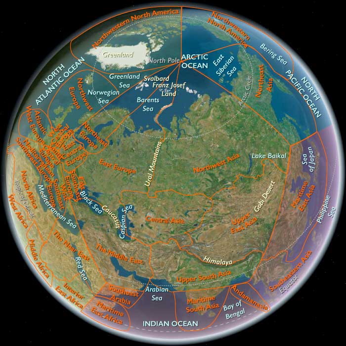
At the beginning of the nineteenth century, the Russian Empire extends from the Arctic Ocean in the north to the Black Sea in the south, from the Baltic Sea on the west to the Pacific Ocean, and (until 1867) into Alaska in North America on the east.
With 125.6 million subjects registered by the 1897 census, it has the third-largest population in the world at the time, after Qing China and India
Like all empires, it includes a large disparity in terms of economics, ethnicity, and religion.
There are numerous dissident elements, who launch numerous rebellions and assassination attempts; they are closely watched by the secret police, with thousands exiled to Siberia.
Economically, the empire has a predominately agricultural base, with low productivity on large estates worked by serfs (until they were freed in 1861).
The economy slowly industrializes with the help of foreign investments in railways and factories.
The land had been ruled by a nobility (the boyars) from the tenth through the seventeenth centuries, and subsequently by an emperor.
Tsar Ivan III (1462–1505) had laid the groundwork for the empire that later emerges.
He had tripled the territory of his state, ended the dominance of the Golden Horde, renovated the Moscow Kremlin, and laid the foundations of the Russian state.
Tsar Peter the Great (1682–1725) fights numerous wars and expands an already huge empire into a major European power.
He moves the capital from Moscow to the new model city of St. Petersburg, and leads a cultural revolution that replaces some of the traditionalist and medieval social and political mores with a modern, scientific, Europe-oriented, and rationalist system.
Catherine the Great (reigned 1762–1796) presides over a Golden age.
She expands the state by conquest, colonization and diplomacy, continuing Peter the Great's policy of modernization along West European lines.
Tsar Alexander II (1855–1881) promotes numerous reforms, most dramatically the emancipation of all twenty-three million serfs in 1861.
His policy in Eastern Europe involves protecting the Orthodox Christians under the rule of the Ottoman Empire.
That connection by 1914 led to Russia's entry into the First World War on the side of France, Britain, and Serbia, against the German, Austrian and Ottoman empires.
The Russian Empire functions as an absolute monarchy until the Revolution of 1905, then becomes a de jure constitutional monarchy.
The empire collapses during the February Revolution of 1917, largely as a result of massive failures in its participation in the First World War.
Worlds
The Great Crossroads
View →Related Events
Showing 10 events out of 2263 total
The route of the Oregon Trail, one of the main overland migration routes on the North American continent, had begun to be scouted out as early as 1823 by fur traders and explorers.
The trail has begun to be regularly used by fur traders, missionaries, and military expeditions in the 1830s
At the same time, small groups of individuals and the occasional family have attempted to follow the trail, and some have succeeded in arriving at Fort Vancouver in Washington.
On May 1, 1839, a group of men from Peoria, Illinois, sets out with the intention to colonize the Oregon Country on behalf of the United States of America and drive out the British fur trading companies operating there.
The men of the Peoria Party, who are among the first pioneers to blaze the Oregon Trail, are led by Thomas J. Farnham and call themselves the Oregon Dragoons.
They carry a large flag emblazoned with their motto "OREGON OR THE GRAVE.”
Although the group will split up on the trail, several of their members will reach the Oregon Country to become among the prominent early pioneers of this region.
Northeastern Eurasia (1684–1827 CE)
Imperial Frontiers, Salmon Rivers, and the Making of a Northern Sea–Steppe System
Geography & Environmental Context
From the Baltic–Black Sea corridor across the forest–steppe of East Europe to the taiga, tundra, and Pacific rims of Siberia and Northeast Asia, this macro-region bridged three oceanic worlds: the Arctic, the North Atlantic–Baltic, and the North Pacific. Anchors ranged from the Dnieper–Don–Volga and Neva to the Ob–Yenisei–Lena–Kolyma river highways; from the Pontic steppe and Polesia wetlands to the Amur–Ussuri lowlands, Sakhalin, Okhotsk coast, Chukotka, Wrangel, and Hokkaidō. Permafrosted interiors, salmon-rich rivers, and storm-beaten coasts met fertile chernozem belts—a continent-spanning frontier of grain, furs, timber, fish, and salt.
Climate & Environmental Shifts
The Little Ice Age lingered with severe winters (notably 1708–1709) and short growing seasons. Baltic freeze-ups delayed shipping; Tambora (1816–1817) and earlier cool pulses triggered dearth from Finland to Ukraine. In Siberia, rivers were ice roads most of the year, and taiga fires alternated with deep frosts; along the Sea of Okhotsk and Chukchi coasts, gales and sea ice shortened sailing windows even as ice-edge fisheries boomed. Hokkaidō endured snowy winters yet sustained abundant salmon and herring runs.
Subsistence & Settlement
-
East Europe (Belarus–Ukraine–European Russia): Peasant communes rotated rye, oats, barley, wheat, flax, and hemp; chernozem frontiers (Novorossiya) turned to estate grain and sheep; Odessa (1794) rose as a Black Sea grain port. Cossack borderlands mixed fishing, apiaries, horse breeding, and mobile farming.
-
Northwest Asia (W/C Siberia): Indigenous Khanty, Mansi, Nenets, Evenki and others combined fishing, hunting (sable), and reindeer herding; Russian ostrogs (Tobolsk–Tomsk–Krasnoyarsk–Irkutsk) spread plough agriculture along river terraces; promyshlenniki pursued fur frontiers.
-
Northeast Asia (Amur–Okhotsk–Chukotka–Hokkaidō): Daur, Nanai, Nivkh, Udege, Evenki, Chukchi, Siberian Yupik, and Ainu economies centered on salmon, sturgeon, marine mammals, reindeer, and garden grains/beans; Russian wintering posts dotted the Lena–Kolyma–Anadyr; Matsumae traders controlled Hokkaidō’s SW littoral.
Technology & Material Culture
-
Agro-forestry & mills: Estate granaries, wind/watermills, and flax/hemp scutching in East Europe; drainage and rotations raised yields.
-
River–snow logistics: Birch-bark canoes, skis, sledges, and portages linked basins; in the south, barges moved bulk grain to Baltic and Black Sea outlets.
-
Maritime gear: Copper-sheathed hulls, chronometers, and sturdy Okhotsk craft; Ainu and Amur communities maintained weirs, net fisheries, and smokehouses.
-
Trade kits: Iron pots, beads, textiles, tobacco, vodka, firearms into indigenous markets; outflow of furs, hides, fish oils, potash, tar, timber, and grain.
-
Sacred and civic builds: Orthodox churches and wooden chapels along Siberian rivers; Ukrainian Baroque façades; ancestor shrines, masks, and bear-sending paraphernalia among Amur and Ainu communities.
Movement & Interaction Corridors
-
Baltic & Black Sea “windows”: St. Petersburg (1703) opened a northern outlet (timber, hemp, tar, flax); successive Russo-Ottoman wars unlocked a Black Sea export front (Kherson–Mykolaiv–Odessa).
-
Trans-Siberian rivers: Ob–Irtysh–Yenisei–Lena functioned as summer barge routes/winter roads; overland portages and the Omsk–Semipalatinsk steppe link tied Siberia to Central Asia.
-
Amur–Okhotsk–Pacific: The Treaty of Nerchinsk (1689) fixed a Qing–Russian line; Okhotsk became Russia’s Pacific lifeline; Bering’s voyages (1728, 1741) projected to Alaska.
-
Hokkaidō littoral: Canoe routes knit Ainu villages; Matsumae intermediaries funneled rice, sake, and lacquerware north in exchange for fish, furs, and crafts.
Cultural & Symbolic Expressions
-
Orthodox & imperial: Icons, pilgrimages, parish schools, and baroque/neoclassical cityscapes in Kyiv–St. Petersburg–Moscow; Cossack dumy and kobzar song preserved frontier memory.
-
Indigenous cosmologies: Shamanic drums, bear rituals, river and mountain shrines structured relations with animal masters and waters; Ainu iomante remained a central rite.
-
Border syncretisms: Crosses beside carved idols; firearms, silk robes, and lacquer bowls reinterpreted as prestige ritual items; Jesuit/Orthodox/mission outposts mingled with men’s houses and clan lodges.
Environmental Adaptation & Resilience
-
Risk portfolios: Salmon weirs, stone/wooden fish traps, oil rendering, and cached stores carried Arctic and taiga households through long winters; reindeer routes adjusted to snow cover.
-
Commune & kin relief: Mir/obshchina land repartition and labor exchange in East Europe; parish charity, confraternities, and brotherhoods mitigated dearth.
-
Frontier agronomy: Shelterbelts and spring sowings on steppe; rye/oats on floodplains; mixed household economies (spinning, weaving, seasonal wage-work) buffered shocks.
Political & Military Shocks
-
East European re-maps: Partitions of the Polish–Lithuanian Commonwealth (1772, 1793, 1795); Crimean annexation (1783); Russo-Ottoman wars (1768–1774; 1787–1792; 1806–1812) opened the Northern Black Sea corridor; 1812 invasion forged a continental war economy.
-
Siberian incorporation: Fort lines, yasak fur tribute, and missionary courts consolidated imperial rule; Kiakhta (1727) regulated China–Russia caravan exchange.
-
Amur frontier & Pacific turn: Qing patrols contained Russian access after Nerchinsk; Okhotsk staged Pacific expeditions; coastal violence and disease shadowed contact zones.
-
Hokkaidō: Matsumae monopoly tightened over Ainu trade, sowing tensions that presaged 19th-century conflict.
Transition
Between 1684 and 1827, Northeastern Eurasia shifted from mosaic frontiers to an integrated river-and-sea system of empires. East Europe became a grain-export engine tied to the Baltic and a newly forged Black Sea corridor; Siberia turned into a transcontinental fur and transit realm; Northeast Asia emerged as Russia’s Pacific hinge, bounded by Qing defenses and Matsumae controls yet newly linked to Alaska by Bering’s routes.
Amid wars, partitions, and missions, indigenous lifeways—reindeer herding, salmon fisheries, shamanic rites—endured and adapted. By 1827, the region stood enmeshed in global trade and imperial logistics, its salmon rivers and steppe grain, tar forests and Okhotsk ships, together powering a northern world poised for the accelerations and ruptures of the nineteenth century.
Northeast Asia (1684–1827 CE): Imperial Frontiers, Salmon Rivers, and Expanding Maritime Worlds
Geography & Environmental Context
Northeast Asia encompasses the Lena–Indigirka–Kolyma river basins and the New Siberian Islands; the Chukchi Peninsula, Wrangel Island, and Anadyr basin; the Sea of Okhotsk rim from Magadan to Okhotsk; the Uda–Amur–Ussuri lowlands (including extreme northeastern Heilongjiang); the Sikhote–Alin and Primorye uplands; Sakhalin and the lower Amur mouth; and Hokkaidō (all but the southwestern corner). These lands stretch from permafrosted tundra and taiga to salmon-filled rivers, storm-beaten Arctic coasts, and the oak–birch forests of Hokkaidō. Their contrasts created a vast frontier between Arctic barrens, Amur floodplains, and the resource-rich Okhotsk and Japan Seas.
Climate & Environmental Shifts
The Little Ice Age remained in force, with long winters and shortened growing seasons. Permafrost deepened across the Lena and Kolyma basins, constraining cultivation but preserving winter travel routes over frozen rivers. The Sea of Okhotsk froze extensively, limiting navigation to brief summer months, while its ice-edge fisheries remained highly productive. Hokkaidō endured cold, snowy winters but maintained rich salmon and herring runs. Volcanic eruptions in Kamchatka occasionally cast ash over the subregion, while harsh storms along the Okhotsk and Chukchi coasts tested seafaring communities.
Subsistence & Settlement
-
High Arctic and Chukchi Peninsula: Chukchi herders expanded large-scale reindeer pastoralism, while coastal communities pursued whale and walrus hunting. Siberian Yupik and Yukaghir relied on fishing and seal hunting, moving seasonally between tundra and shore.
-
Taiga and River Basins (Lena–Indigirka–Kolyma): Evenki and Even followed seasonal hunting and fishing rounds, combining fur trapping with mobile herding. Russian settlers established wintering posts and small farming colonies along rivers.
-
Amur–Ussuri–Sakhalin: Daur, Nanai, Nivkh, and Udege cultivated millet and beans, alongside intensive salmon and sturgeon fishing. Villages lined riverbanks, with smokehouses and storehouses prominent features.
-
Hokkaidō: Ainu relied on salmon runs, deer and bear hunting, and limited agriculture, while Japanese settlers under the Matsumae domain controlled trade posts on the southwestern fringe.
Settlements multiplied with Russian forts and villages along the Lena and Okhotsk coasts, while Qing garrisons appeared in the Amur to police frontiers after the Treaty of Nerchinsk (1689).
Technology & Material Culture
Traditional toolkits remained vital—bows, harpoons, fish weirs, sledges, and birch-bark canoes—but new materials entered rapidly. Russian firearms, iron traps, and metal tools spread along fur routes. The yakut horse and cattle breeds supported Russian colonists, while imported crops like rye and barley were planted near river posts. Ainu artisans continued to carve ritual sticks (ikupasuy) and wooden inau, while Matsumae trade introduced lacquerware, sake, and rice. Along the Amur, iron cauldrons, ceramics, and silks filtered in through both Russian and Qing channels.
Movement & Interaction Corridors
-
Frozen rivers (Lena, Aldan, Indigirka, Kolyma, Anadyr) functioned as winter highways, enabling Russian Cossack expansion and indigenous trade.
-
Amur corridor: A contested artery where Daur, Nanai, and Qing forces intersected. After 1689, the Treaty of Nerchinsk fixed a negotiated border, limiting Russian access.
-
Sea of Okhotsk coast: Became Russia’s maritime lifeline, with Okhotsk town (founded 1649, expanded in the 18th century) serving as the staging point for Pacific expeditions.
-
Hokkaidō littoral: Canoe routes linked Ainu villages; Matsumae intermediaries funneled trade to Honshu.
-
Global links: Vitus Bering’s expeditions (1728, 1741) pushed Russian presence into the Pacific; fur traders later reached Alaska, with Northeast Asia as their base.
Cultural & Symbolic Expressions
Shamanism remained vital among Evenki, Chukchi, and Yukaghir, with trance rituals, drums, and spirit journeys mediating between human and natural realms. Ainu bear-sending ceremonies (iomante) continued as the centerpiece of ritual life, blending ecological reverence with social cohesion. Russian Orthodoxy arrived with missions, erecting chapels at Yakutsk, Okhotsk, and in scattered forts. In the Amur basin, ancestor shrines, wooden masks, and ritual feasts bound communities to rivers and forests. Cross-cultural encounters layered new symbols: icons and crosses, lacquer bowls, firearms reinterpreted as prestige items, and silk robes entering indigenous ritual circuits.
Environmental Adaptation & Resilience
Adaptations reflected deep ecological knowledge:
-
Reindeer pastoralists adjusted migration routes as pasture zones shifted with snow cover.
-
Salmon management in Amur and Hokkaidō was reinforced with taboos and regulated weir use.
-
Stone and wooden fish traps in Okhotsk rivers provided secure seasonal harvests.
-
Cache systems—smoked fish, dried venison, rendered oils—sustained households through long winters.
-
Kinship-based exchange systems, tribute obligations (yasak), and cross-cultural alliances distributed surpluses and buffered shortages.
Transition
Between 1684 and 1827, Northeast Asia transformed from a largely indigenous frontier into an imperial crossroads. Russian forts, settlers, and traders advanced along rivers and the Okhotsk coast, seeking furs and Pacific access. The Qing consolidated Amur defenses after Nerchinsk, enforcing borders with patrols and alliances. The Matsumae domain tightened control over Ainu trade, sowing tensions that would later erupt into conflict. At the same time, Vitus Bering’s voyages linked Northeast Asia to the Americas, beginning a Pacific system of trade and empire. Indigenous lifeways remained resilient, but their landscapes were now arenas where empires tested boundaries and reshaped the seascape of northern Eurasia.
Northern North America (1684–1827 CE); Empires Contested, Nations Born, Frontiers Pushed
Geography & Environmental Context
Northern North America includes the modern United States and Canada, excluding the West Indies. It is divided into three subregions:
-
Northeastern North America: east of 110°W, from New England and the Maritimes through the Great Lakes and Hudson Bay to Virginia, the Carolinas, most of Georgia, and the Mississippi Valley above Little Egypt.
-
Northwestern North America: west of 110°W, from Alaska and the Yukon to the Pacific Northwest and northern California north of the Gulf line.
-
Gulf and Western North America: the wedge south of the Montana diagonal, encompassing the plantation South, the Mississippi Valley below Illinois’ Little Egypt, the Plains, the Southwest, and California south of the Oregon border.
Together, these lands embraced a mosaic of boreal forest, prairie, Appalachian highlands, arid plains, subtropical deltas, and Pacific fjords. Each subregion developed distinct lifeways, but all were drawn into the same imperial rivalries and revolutionary transformations.
Climate & Environmental Shifts
The Little Ice Age persisted into the 18th century, bringing harsh winters to the northeast, erratic salmon and root harvests in the northwest, and drought cycles to the Southwest. Hurricanes battered the Gulf coast, while floods shaped the Mississippi delta. Resource pressures mounted: beaver populations declined from overtrapping, forests receded around port towns and plantations, and horse herds spread across the Plains.
Subsistence & Settlement
-
Indigenous nations maintained diverse economies: maize horticulture in the northeast and southeast, bison hunting on the Plains, salmon fisheries along Pacific rivers, and seal and whale hunting in the Arctic.
-
Colonial settlements took different forms: French Canada and Louisiana, Spanish missions in the Southwest and California, British seaboard colonies, and Russian posts in Alaska.
-
The United States, born of revolution, expanded westward into Kentucky, Tennessee, and the Ohio Valley, while Loyalists and Acadians reshaped Canada’s demography.
Technology & Material Culture
Indigenous technologies — birchbark canoes, snowshoes, horse gear, cedar plankhouses, irrigation systems — persisted alongside European imports: muskets, iron tools, plows, mills, sailing ships, and missions. Hybrid cultures emerged, such as Métis in the fur trade, African-descended Gullah in the Carolinas, and Spanish-Indian ranching lifeways in the Southwest.
Movement & Interaction Corridors
-
Rivers: the St. Lawrence, Great Lakes, Mississippi, and Columbia were arteries of commerce and war.
-
Maritime networks: Atlantic ports linked to Europe, the Caribbean, and Africa; Gulf and Pacific ports tied into global markets.
-
Overland corridors: mission trails, fur brigades, and horse trade networks tied regions together.
-
Migration: enslaved Africans carried to the South, European immigrants to the seaboard and interior, Loyalist refugees to Canada, and Indigenous nations displaced westward.
Cultural & Symbolic Expressions
Indigenous diplomacy — wampum belts, council fires, potlatch ceremonies, and Green Corn rituals — remained central. European religions spread: Catholicism in French and Spanish zones, Protestantism in the British colonies, syncretic traditions among African and Native peoples. Symbols of sovereignty proliferated: forts, flags, treaties, missions, and plantations marked territorial claims.
Environmental Adaptation & Resilience
Indigenous nations diversified subsistence, shifting to fur trapping, mounted bison hunting, or blending ritual with Catholic observance. Colonists adapted to hurricanes, droughts, and floods with new architecture, irrigation, and crop rotations. Food storage, trade alliances, and hybrid practices allowed resilience in a volatile climate.
Political & Military Shocks
-
Imperial wars: Nine Years’ War, Queen Anne’s War, and the Seven Years’ War reshaped borders and alliances.
-
Revolutions: The American Revolution created the United States; the Haitian Revolution reverberated through the Gulf; Indigenous uprisings, from Tecumseh’s confederacy to Pueblo resistance, challenged colonial regimes.
-
Territorial transfers: Louisiana Purchase (1803), Florida cession (1821), Russian America consolidations in Alaska.
-
War of 1812: Britain and the U.S. contested Great Lakes and Gulf coasts, leaving Native confederacies weakened.
Transition
Between 1684 and 1827, Northern North America was transformed from a patchwork of Indigenous nations and rival empires into a continental stage of settler republics, expanding frontiers, and Indigenous dispossession. The fur trade, cod fisheries, plantations, and salmon runs tied its subregions into global markets, while revolution and war redrew its maps. By 1827, the United States was pushing across Appalachia, Canada remained in Britain’s orbit, Russian America and Spanish missions dotted the Pacific, and Native nations, though battered, continued to anchor economies and cultures from the Arctic to the Gulf.
Northwestern North America (1684–1827 CE): Salmon Worlds, Cedar Civilizations, and Empires on the Horizon
Geography & Environmental Context
Northwestern North America includes all territory west of 110°W, except the lands belonging to Gulf and Western North America. This encompasses Alaska, the Yukon, British Columbia, Alberta west of 110°W, the Pacific Northwest of the United States including Washington, northern Idaho, the northwestern portions of Montana, Oregon north of the Gulf line, and northern California north of the Gulf line.
Anchors include the Alaska Peninsula and Aleutian chain, the Gulf of Alaska, Puget Sound, the Fraser and Columbia River systems, the coastal cordilleras, and the Inside Passage. The region combined storm-lashed fjords and temperate rainforests on the Pacific coast with salmon-bearing rivers, interior plateaus, and Arctic tundra sweeping toward the Bering Strait.
Climate & Environmental Shifts
The Little Ice Age remained in force. Glaciers advanced in Alaska and the St. Elias Mountains, while heavy snowpacks lingered in the interior plateaus. Coastal storms battered bays, and ocean cycles created variability in salmon runs, though fisheries remained robust. Interior valleys endured shorter growing seasons, with drought occasionally stressing root crops such as camas and wapato. Abundant wildlife and preserved foods buffered communities against these fluctuations.
Subsistence & Settlement
-
Coastal nations (Tlingit, Haida, Tsimshian, Kwakwaka’wakw, Coast Salish, Nuu-chah-nulth) lived in permanent plankhouse villages, supported by salmon, halibut, herring, shellfish, sea mammals, and berries. Potlatch ceremonies reinforced rank, redistribution, and community identity.
-
Aleut (Unangan) on the Aleutians specialized in sea otters, seals, and fish, inhabiting semi-subterranean barabaras that withstood gales.
-
Interior groups (Carrier, Sekani, Nez Perce, Shoshone) followed seasonal rounds, hunting caribou, elk, and bison, while fishing and root gathering.
-
Columbia River peoples organized large fisheries with weirs and platforms, hosting great trade fairs at Celilo Falls that drew thousands each year.
Technology & Material Culture
-
Cedar culture: monumental plankhouses, dugout canoes, totem poles, bentwood boxes, and masks demonstrated both engineering and artistry.
-
Tools: stone, bone, and antler remained common; copper and occasional iron entered via long-distance exchange (notably from Asia through the Aleutians).
-
Sea-mammal hunting gear: Aleutian baidarkas (kayaks), umiaks, and sophisticated harpoons allowed mastery of dangerous waters.
-
Artistry: masks, regalia, and poles embodied cosmology, lineage, and animal spirits, integrating material culture with social order.
Movement & Interaction Corridors
-
The Inside Passage supported canoe travel and trade in oil, fish, copper, and shell ornaments.
-
The Columbia River corridor linked plateau and coast, with annual trade fairs redistributing salmon, obsidian, and goods from the plains.
-
The Aleutians and Bering Strait connected Alaska to Siberia through seasonal exchanges of iron, beads, and furs between Unangan, Siberian Yupik, and Chukchi communities.
-
Overland portages across mountain passes carried obsidian, hides, and dried fish to interior groups.
Cultural & Symbolic Expressions
-
Myths: Raven, Thunderbird, and other animal beings remained central to coastal cosmologies.
-
Potlatch ceremonies dramatized hierarchy, redistribution, and cosmic cycles.
-
Aleut rituals honored sea mammals as spiritual beings, blending with shamanic practice.
-
Interior traditions venerated mountains, rivers, and animal masters, with shamans mediating between human and spirit worlds.
Environmental Adaptation & Resilience
-
Preservation: dried salmon, berries, and rendered oils provided security during lean seasons.
-
Mobility: seasonal migrations optimized access to salmon runs, hunting grounds, and root fields.
-
Alliances: exchange partnerships ensured surpluses moved across ecological zones.
-
Architecture: plankhouses, insulated barabaras, and semi-subterranean lodges resisted storms and cold.
Political & Military Shocks
Through much of this age, Indigenous nations dominated the subregion. But imperial rivals arrived on the horizon:
-
Russian fur traders reached the Aleutians by the mid-18th century, founding posts at Unalaska and Kodiak, and exploiting sea otters intensively.
-
Spanish voyages charted the Pacific Northwest in the late 18th century, establishing short-lived footholds such as Nootka Sound.
-
British and American expeditions followed (Cook, Vancouver, Gray), mapping coasts and seeking trade.
-
By the early 19th century, Russian America consolidated in Alaska, while the Hudson’s Bay Company expanded down the Columbia River. Indigenous nations remained powerful, but new dependencies, fur-trade diseases, and colonial rivalries foreshadowed upheaval.
Transition
Between 1684 and 1827, Northwestern North America remained overwhelmingly Indigenous, sustained by salmon runs, cedar technology, and ceremonial life. Yet external pressures mounted. Russian exploitation of sea otters, Spanish and British coastal expeditions, and the first Hudson’s Bay posts signaled that this subregion would soon be contested ground of empires. By 1827, Northwestern North America still pulsed with Indigenous strength, but its peoples stood at the threshold of profound transformations brought by fur trade expansion, foreign settlement, and imperial rivalry.
Fur trading is one of the main economic activities in Northern America from the late sixteenth century to the mid-nineteenth century
At this time, demand for fur is surging in Europe as it is used to make cloth and fancy hats.
Data collected from England in the eighteenth century highlights that the years from 1746 to 1763 see an increase of twelve shillings per pelt.
It has been calculated that over twenty million beaver hats were exported from England alone from 1700 to 1770.
Both trading partners in North America, natives and Europeans, provide the other a comparative advantage in the fur trade industry.
The opportunity cost of hunting beavers in Europe is extremely high: by the seventeenth and eighteenth centuries, the Eurasian beaver is near extinction in England and France.
On the other hand, traders and trappers think the wildlife in the New World is essentially limitless.
Natives make use of the trade goods received, particularly knives, axes, and guns.
The fur trade will provides a stable source of income for many Native Americans until the mid-nineteenth century, when changing fashion trends in Europe and a decline in the beaver population in North America bring about a collapse in demand for fur.
As Native Americans are pressed into alliances by the Europeans for Queen Anne's War, the Seven Years' War, the Nine Years' War, and other standing competitions among the European powers: France, Great Britain and Spain, with whom they are dealing in North America, they feel drawn into the Europeans' endemic warfare.
The Pacific Northwest is one of the last significant non-polar regions in the world to be explored by Europeans.
Centuries of reconnaissance and conquest have brought the rest of North America within the claims of imperial powers.
A number of empires and commercial systems during the late eighteenth and early nineteenth centuries converge upon the Northwest Coast, by sea as well as by land across the continent.
The Russian and Spanish empires are extended into the region simultaneously, from opposite directions.
British interest in the maritime fur trade peaks between 1785 and 1794, then declines as the French Revolutionary Wars diminish Britain's available manpower and investment capital.
The country also concentrates its foreign trade activities in India.
Trade is not China's sole basis of contact with the West.
Since the thirteenth century, Roman Catholic missionaries have been attempting to establish their church in China.
Although by 1800 only a few hundred thousand Chinese have been converted, the missionaries—mostly Jesuits—contribute greatly to Chinese knowledge in such fields as cannon casting, calendar making, geography, mathematics, cartography, music, art, and architecture.
The Jesuits are especially adept at fitting Christianity into a Chinese framework and are condemned by a papal decision in 1704 for having tolerated the continuance of Confucian ancestor rites among Christian converts.
The papal decision quickly weakens the Christian movement, which it proscribead as heterodox and disloyal.
The Portuguese are the pioneers in China, as elsewhere in Asia, establishing a foothold at Macao (Aomen in pinyin), from which they monopolize foreign trade at the Chinese port of Guangzhou (Canton).
Soon the Spanish arrive, followed by the British and the French.
Trade between China and the West is carried on in the guise of tribute: foreigners are obliged to follow the elaborate, centuries-old ritual imposed on envoys from China's tributary states.
There is no conception at the imperial court that the Europeans will expect or deserve to be treated as cultural or political equals.
The sole exception is Russia, the most powerful inland neighbor.
The Manchus are sensitive to the need for security along the northern land frontier and therefore are prepared to be realistic in dealing with Russia.
The Treaty of Nerchinsk (1689) with the Russians, drafted to bring to an end a series of border incidents and to establish a border between Siberia and Manchuria (northeast China) along the Heilong Jiang (Amur River), is China's first bilateral agreement with a European power.
In 1727 the Treaty of Kyakhta delimits the remainder of the eastern portion of the Sino-Russian border.
Western diplomatic efforts to expand trade on equal terms are rebuffed, the official Chinese assumption being that the empire is not in need of foreign—and thus inferior—products.
Despite this attitude, trade flourishes, even though after 1760 all foreign trade is confined to Guangzhou, where the foreign traders have to limit their dealings to a dozen officially licensed Chinese merchant firms.