Said bin Sultan, Sultan of Muscat and Oman
Sultan of Muscat and Oman
1791 CE to 1856 CE
(Sayyid) Said bin Sultan Al-Said (Arabic: Sa‘id bin Sulṭān) (June 5, 1791 – October 19, 1856) is Sultan of Muscat and Oman from November 20, 1804 to June 4, 1856.
He becomes joint ruler of the country along with his brother Salim on the death of their father, Sultan bin Ahmad, in 1804.
Said deprives his brother of joint rule on September 14, 1806.
World
The Great Crossroads
View →Related Events
Showing 10 events out of 43 total
The Near and Middle East (1684 – 1827 CE)
Empires in Decline, Pilgrimage Routes in Turmoil, and the Return of Reforming Powers
Geography & Environmental Context
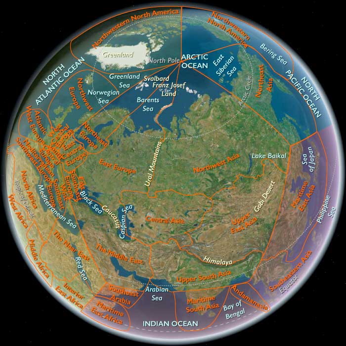
The Near and Middle East spanned the eastern Mediterranean, the Arabian Peninsula, Mesopotamia, Persia, and the Caucasus—a crossroads from the Nile to the Hindu Kush. Its three interlocking subregions—the Near East(Egypt, Hejaz, Yemen, Levant, Sudan, southwestern Turkey, and Cyprus), the Middle East (Iraq, Iran, Syria, Armenia, Georgia, Azerbaijan, eastern Arabia, and most of Anatolia), and Southeast Arabia (southern Oman, eastern Yemen, and Socotra)—together formed a vast zone of deserts, deltas, plateaus, and pilgrimage corridors. Major anchors included the Nile, Tigris–Euphrates, and Zagros–Caucasus uplands; the Red Sea, Persian Gulf, and Arabian Seacoasts; and the high valleys of Yemen and Oman that bridged Africa and Asia.
Climate & Environmental Shifts
The late Little Ice Age imposed alternating drought and flood.
-
Mesopotamia and Iran endured erratic rains and destructive river floods.
-
Egypt oscillated between low- and high-Nile years; plague and famine shadowed poor floods.
-
Hejaz and Yemen suffered water scarcity punctuated by torrential storms.
-
Caucasus winters grew harsher; earthquakes at Tabriz (1721), Shiraz (1824), and along the Levantine Riftreshaped towns.
-
Dhofar and Hadhramawt relied on fickle khareef monsoons, while Socotra was struck by periodic cyclones.
Despite volatility, canal maintenance, terrace farming, and nomadic mobility preserved regional resilience.
Subsistence & Settlement
-
Mesopotamia & Iran: Irrigated grains, dates, and silk; qanats and canals remained vital to subsistence and taxation.
-
Caucasus & Anatolia: Pastoralism and mountain farming—wine, fruit, and grain—supported caravan towns like Tiflis, Yerevan, and Aleppo.
-
Levant & Egypt: Terrace agriculture (olives, vines, citrus) complemented Nile wheat, barley, and sugar.
-
Arabian littoral: Date groves, pearling, and fishing from Basra to Muscat linked desert to sea.
-
Yemen & Oman: Terraced grains, coffee, and frankincense; mixed herding in uplands.
-
Sudan: Millet and sorghum in river belts tied to Egypt’s provisioning system after Muḥammad ʿAlī’s conquest (1820–1821).
Urban centers—Cairo, Baghdad, Isfahan, Damascus, Tehran, Muscat, Sanaʿa, and Tiflis—functioned as nodes of governance, trade, and craft.
Technology & Material Culture
-
Agrarian infrastructure: Qanats, canals, and dikes remained the hydraulic spine; terrace systems in Yemen and Palestine embodied millennia of continuity.
-
Crafts & manufactures: Persian silks and carpets; Aleppine cottons; Damascene soap; Cairene brassware; Georgian and Armenian metallurgy.
-
Architecture: Ottoman domes, Safavid and Qajar mosques, Armenian churches, and Yemeni tower-houses defined skylines.
-
Maritime innovation: Omani dhows and Red Sea sambuks maintained oceanic trade; firearms and artillery modernized gradually through Ottoman and Persian reforms.
-
Printing & learning: The French expedition to Egypt (1798–1801) introduced presses and surveying; by the 1820s Muḥammad ʿAlī’s workshops were producing cotton gins, arms, and canal plans.
Movement & Interaction Corridors
-
Caravan arteries: Aleppo–Mosul–Baghdad; Isfahan–Tabriz–Yerevan–Baku; Basra–Shiraz–Hormuz–Muscat.
-
Pilgrimage routes: Cairo and Damascus caravans converged on Mecca until disrupted by Wahhabi–Saʿūdī control (1803–1812); Egyptian forces restored Ottoman sovereignty (1811–1818).
-
Maritime spheres: Omani fleets projected power across the Indian Ocean to Zanzibar; Hadhrami merchants spread to Gujarat, Southeast Asia, and the Swahili coast.
-
Caspian & Black Sea fronts: Russian expansion brought forts and commerce, drawing Persia into treaties (Gulistan 1813, Turkmenchay 1828).
-
Nile & Sudan corridors: River convoys moved grain and troops; Khartoum and Sennar became extensions of Cairo’s fiscal reach.
Cultural & Symbolic Expressions
-
Ottoman provinces: Sunni institutions, Sufi lodges, and urban guilds organized civic life; Coptic, Armenian, Greek, and Jewish communities sustained schools and trade.
-
Persia: Shiʿism remained the ideological core from Safavid through Qajar eras; Isfahan and Tehran mosques, gardens, and miniatures embodied Persian identity.
-
Caucasus: Islamic and Christian traditions coexisted; oral epics preserved frontier memory.
-
Arabian coasts: Poetry, pearling songs, and mosque schools reflected maritime Islam.
-
Hejaz & Yemen: Pilgrimage festivals, Sufi orders, and coffee rituals intertwined devotion and commerce.
-
Egypt: Al-Azhar scholars debated governance; after 1798, the Arabic press and translation offices of Muḥammad ʿAlī inaugurated modern intellectual life.
Environmental Adaptation & Resilience
-
Nomadic transhumance adjusted to drought belts from Arabia to Iran.
-
Oasis and terrace restoration maintained food security.
-
Maritime adaptation: Oman’s sea routes and Gulf pearling offset inland disruption.
-
Pilgrim provisioning: Waqf-funded cisterns, markets, and bakeries sustained caravans.
-
Irrigation renewal: In Egypt, canal repair and proto-barrage planning sought to stabilize Nile floods and expand cotton cultivation.
Political & Military Shocks
-
Safavid collapse (1722): Afghan incursions toppled Isfahan; Ottoman and Russian invasions followed.
-
Nader Shah (1736–1747): Restored Persian power, campaigned in India and the Caucasus.
-
Qajar consolidation (1794–1827): Centralized Iran but ceded territory to Russia.
-
Ottoman strain: Frontier wars with Russia; Wahhabi revolt in Arabia; provincial autonomy in Syria and Egypt.
-
Muḥammad ʿAlī’s rise (1805): Eliminated Mamluks (1811), reformed army and monopolies, annexed Sudan (1820–1821).
-
Omani revival: The Al Bu Saʿid dynasty (from 1749) rebuilt fleets, expelled Portuguese remnants, and dominated Gulf trade.
-
European encroachment: Consuls, treaties, and naval patrols—French in the Levant, British in the Gulf and Red Sea—tightened economic dependence though not yet direct rule.
Transition
Between 1684 and 1827 CE, the Near and Middle East transformed from a network of venerable Islamic empires into a patchwork of reforming provinces and maritime powers under growing Eurasian pressure. The Safavids vanished, the Qajars struggled with Russia, and the Ottomans faced internal revolt and European diplomacy. Oman extended Arab reach to East Africa, while Muḥammad ʿAlī’s Egypt pioneered modern bureaucratic reform.
By 1827, caravan and monsoon still ordered daily life, yet behind their continuity loomed the industrial powers of Europe—ready to recast these crossroads into the geopolitical heart of the nineteenth-century world.
The Middle East (1684–1827 CE): Ottoman Decline, Safavid Collapse, and the Rise of New Powers
Geography & Environmental Context
The Middle East includes Iraq, Iran, Syria, Armenia, Georgia, Azerbaijan, Qatar, Bahrain, the United Arab Emirates, most of Turkey (except the European part and southwest Anatolia), eastern Jordan, all but southernmost Lebanon, eastern Saudi Arabia, and northern Oman. Anchors include the Tigris–Euphrates basin (Mesopotamia), the Zagros and Caucasus ranges, the Iranian Plateau, the Caspian littoral, the Syrian Desert, and the Persian Gulf and Caspian Sea coasts. This geography spans irrigated river valleys, steppe corridors, semi-arid plateaus, and mountain enclaves linking Anatolia, Persia, and Arabia.
Climate & Environmental Shifts
The period fell within the late Little Ice Age, producing cooler winters in Anatolia, Armenia, and the Caucasus, alongside recurrent droughts in Mesopotamia and Iran. Floods along the Tigris and Euphrates periodically devastated farmlands, while earthquakes struck Tabriz (1721) and Shiraz (1824). Pastoral nomads in Arabia, Iran, and the Caucasus moved widely to buffer drought, while irrigation in Mesopotamia and northern Iran faltered under war and neglect but revived when political stability returned.
Subsistence & Settlement
-
Mesopotamia: Date groves, rice paddies, and cereal fields along the Tigris–Euphrates remained staples; tribal confederations dominated countryside around Ottoman Baghdad.
-
Iranian Plateau: Dryland farming (wheat, barley) and oasis gardening (fruit, melons) sustained populations; silk in Gilan and rice in Mazandaran anchored Caspian subsistence.
-
Caucasus (Armenia, Georgia, Azerbaijan): Pastoralism, viticulture, and orchards flourished in upland valleys; caravan towns like Tiflis and Yerevan mediated exchange.
-
Anatolia & Syria: Grain, olives, and vines in uplands; Aleppo and Damascus remained provisioning and craft centers despite periodic crises.
-
Persian Gulf & Oman: Fishing, date cultivation, and pearling dominated, with maritime trade sustaining settlements from Basra to Muscat.
Technology & Material Culture
Agriculture relied on qanats, canals, and animal-powered irrigation. Fortresses and caravanserais dotted plateau routes; mosques, madrasas, and Armenian and Georgian churches anchored towns. Persian silk textiles, Azerbaijani carpets, and Aleppine cottons were prized. Gunpowder weapons, artillery, and fortress improvements spread, though unevenly. Maritime craft ranged from Ottoman galleys to Omani dhows controlling Indian Ocean lanes.
Movement & Interaction Corridors
-
Caravan routes: Linked Aleppo to Mosul and Baghdad; Isfahan to Tabriz, Yerevan, and Baku; Basra to the Gulf; Shiraz and Yazd to Hormuz/Muscat.
-
Persian Gulf: Omani seafaring extended across the Arabian Sea; Basra exported dates and grain; pearl fisheries tied Bahrain and Qatar to Indian and European markets.
-
Caspian trade: Connected Gilan’s silk and Astrakhan’s markets; Russian expansion brought new garrisons and merchants.
-
Imperial contest zones: Anatolia and the Caucasus saw repeated wars; Iraq oscillated between Ottoman and Persian control.
Cultural & Symbolic Expressions
-
Ottoman provinces: Islam anchored society through mosques, Sufi lodges, and guilds; Armenian and Syriac Christians maintained schools and churches; Jewish communities thrived in Aleppo and Baghdad.
-
Safavid Iran: Shi‘ism remained state religion; Isfahan’s mosques and gardens expressed grandeur, though after the Safavid collapse, Qajar art and architecture reshaped Persian identity.
-
Caucasus: Christian Orthodoxy (Georgian, Armenian) coexisted with Islam; mountain oral epics and shrine pilgrimages preserved memory.
-
Arabian littoral: Tribal poetry, pearl-diver songs, and Omani mosque schools expressed maritime identity.
Environmental Adaptation & Resilience
-
Nomadic strategies: Tribal migrations across steppe and desert balanced drought and grazing.
-
Oasis and qanat systems: Managed water for cereals and orchards; local repair after war was critical.
-
Silk, carpet, and date economies: Offered export resilience when crops failed.
-
Maritime trade: Oman and Gulf ports buffered against inland disruption by maintaining Indian Ocean routes.
Transition
Between 1684 and 1827, the Middle East was a contested imperial borderland. The Safavid dynasty collapsed (1722); Afghans, Ottomans, and Russians fought over Iran and the Caucasus. Nader Shah briefly restored Persian power (1736–1747), raiding into India and the Caucasus. The Qajar dynasty (from 1794) consolidated Iran but conceded land to Russia in treaties (Gulistan 1813, Turkmenchay 1828). The Ottoman Empire faced Russian expansion in the Black Sea and Caucasus and Wahhabi revolts in Arabia. Oman emerged as a naval power, dominating the Gulf and East Africa. By 1827, the region was still a mosaic of caravans, mosques, and fortified towns, but the balance of power had tilted toward European and Russian pressures—foreshadowing the 19th-century age of colonial rivalry and reform.
Ahmad ibn Said had succeeded in uniting Oman under an Ibadi imamate, but the religious nature of his family's authority does not last long.
His son, Said ibn Ahmad Al Said, had been elected to the imamate after him, but no other family member has won the official approval of the religious establishment.
As a result, the Al Said call themselves sultans, a secular title having none of the religious associations of imam.
They further distance themselves from Ibadi traditions by moving their capital from Ar Rustaq, a traditional Ibadi center in the interior, to the trading center of Muscat.
As a result of the move, the dichotomy between coast and interior that had traditionally split Oman is reinstituted.
East Africa (1684–1827 CE)
Omani Seas, Highland Courts, and the Caravan Turn
Geography & Environmental Context
East Africa in this age braided the Indian Ocean littoral—Somalia, eastern Ethiopia/Kenya/Tanzania, northern Mozambique, Comoros, Zanzibar–Pemba, Madagascar, Mauritius, Seychelles—with the interior highlands and lake plateaus—Eritrea/Ethiopia, South Sudan, Uganda, Rwanda, Burundi, inland Kenya/Tanzania, northern Malawi, northwestern Mozambique, Zambia, northern Zimbabwe. Anchors ranged from Swahili port cities(Mogadishu, Mombasa, Kilwa, Sofala, Zanzibar) and island crossroads (Comoros, Mascarenes) to Gondar and the Ethiopian escarpments, the Great Rift lakes (Victoria, Tanganyika, Kivu, Turkana), the inter-lacustrine plateaus, and the savanna woodlands of inland Tanzania and Zambia.
Climate & Environmental Shifts
The waning Little Ice Age brought alternating droughts and floods. Pastoral belts in the Horn suffered grazing crises; cyclones periodically battered Comoros, Mauritius, Seychelles; southern Madagascar swung between famine and recovery while the highlands expanded irrigated rice. Rift-lake levels fluctuated, altering fisheries and lakeshore fields; coastal farmers diversified to cushion rainfall volatility.
Subsistence & Settlement
-
Littoral & islands: Swahili towns remained Islamic mercantile hubs; diets widened with cassava and maize. Zanzibar–Pemba cultivated rice, coconuts, and, in the early 1800s, rapidly expanding clove plantations under Omani rule; Comoros balanced gardens, rice, and fishing; Mauritius/Seychelles developed sugar and copra plantations with enslaved labor.
-
Madagascar: Merina highland consolidation (late 18th–early 19th c.) intensified rice terracing, tribute, and firearms-backed expansion; Sakalava coastal polities sustained cattle, raiding, and slave exports.
-
Highlands & plateaus: Ethiopian/Eritrean terraces produced teff, barley, wheat; church forests and ox-plough agriculture anchored villages. Great Lakes polities (Buganda, Bunyoro, Rwanda, Burundi) rested on banana gardens, sorghum/millet, beans, and cattle, with dense settlement and court redistribution.
-
Savannas & pastoral belts: Sorghum/millet/maize mosaics spread; fishing and hunting remained key; South Sudan–Turkana–Karamoja transhumance tracked pastures and wells.
Technology & Material Culture
-
Oceanic kit: Dhows with lateen sails stitched ports to Arabia/India; coral-stone mosques, carved doors, and merchant houses framed Swahili towns.
-
Highland engineering: Stone terraces, canals, ox traction, and manuscript ateliers at Gondar; royal compounds and muraled churches.
-
Court regalia & crafts: Drums, ivory trumpets, barkcloth and raffia weaving, lake canoes; island sugar mills, Seychellois coconut presses.
-
Arms & imports: Firearms and powder into coastal and Malagasy polities; in the interior, guns followed caravan lines, supplementing spears and shields.
Movement & Interaction Corridors
-
Omani ascendancy: Oman expelled Portugal from Mombasa (1698) and built a coastwise regime centered on Zanzibar, re-routing Indian Ocean commerce.
-
Caravan turn: Ivory and slave caravans from the Tanzania–Mozambique interior converged on Kilwa, Bagamoyo, Zanzibar, Mozambique Island; inland copper and cattle moved along the Zambezi/central Zambian routes.
-
Madagascar–Mascarenes link: Merina and Sakalava exported captives and cattle to the Mascarenes; textiles, beads, and firearms returned.
-
Horn & Red Sea spurs: Ethiopian caravans carried salt, honey, grain to coastal markets when warfare allowed.
-
Lake corridors: Canoe routes on Victoria and Tanganyika fed court capitals and fisheries.
Cultural & Symbolic Expressions
-
Coast & islands: Islamic learning (mosques, madrasas, Arabic-script poetry) flourished under Omanipatronage; plantation societies in the Mascarenes blended French Catholicism, African traditions, and creole forms.
-
Highlands: The Gondarine era left castles and muraled churches; Christian feast calendars, monasteries, and pilgrimage routes ordered time.
-
Great Lakes courts: Regnal drums, sacred groves, and oral epics legitimated kingship; clientship(ubuhake/ubugabire) bound households to lords; rainmaking rituals linked rule to fertility.
-
Pastoral rites: Cattle rituals, age-grades, and clan shrines regulated law and memory.
Environmental Adaptation & Resilience
-
Crop portfolios: Cassava/maize/banana diversification stabilized coastal and savanna diets; highland rice terraces buffered famine.
-
Mobility & storage: Transhumance and widened grazing circuits; dried fish, grain pits, and caravan grain purchases bridged lean years.
-
Rebuilding after storms: Island societies replanted coconuts/rice and repaired harbors; plantation colonies depended on forced labor and imports to absorb shocks.
-
Institutional cushions: Church granaries, court redistribution, waqf and guild charity mitigated crises.
Political & Military Shocks
-
Coastal realignment: Portuguese forts waned as Omani fleets and cannon secured the main ports; Zanzibaremerged as the political–commercial capital.
-
Interior militarization: Merina centralization (c. 1787–1810 →) expanded with firearms; Sakalava raiding persisted. Great Lakes—Buganda pushed lakeward with canoe fleets; Rwanda intensified hill-country tribute; Bunyoro contested supremacy.
-
Slave & ivory booms: Demand from Zanzibar/Mascarenes widened raiding zones in Tanzania, Mozambique, Madagascar; caravan chiefs and coastal patrons gained leverage.
Transition
Between 1684 and 1827, East Africa pivoted from a Portuguese littoral to an Omani oceanic order, while interior kingdoms—from Gondar to Buganda and the Merina highlands—refined statecraft under climatic strain and a growing gun–caravan economy. By the 1820s, Zanzibar orchestrated coastwise trade; Merina hegemony reshaped Madagascar; Great Lakes courts consolidated; and plantation regimes in the Mascarenes took root. The stage was set for the nineteenth-century surge in slave and ivory exports, deeper Indian Ocean entanglement, and, soon after, more direct European intervention.
Maritime East Africa (1684–1827 CE): Omani Ascendancy, Malagasy Kingdoms, and Island Crossroads
Geographic & Environmental Context
The subregion of Maritime East Africa includes Somalia, eastern Ethiopia, eastern Kenya, eastern Tanzania and its islands, northern Mozambique, the Comoros, Madagascar, Mauritius, and Seychelles. Anchors included the Swahili port cities (Mombasa, Zanzibar, Kilwa, Sofala, Mogadishu), the offshore islands of Zanzibar, Pemba, and the Comoros, the highlands and rice terraces of Madagascar, and the outlying islands of Mauritius and Seychelles.During this period, Portuguese coastal dominance receded and Omani Arabs asserted control, reshaping trade and political authority across the Indian Ocean rim.
Climate & Environmental Shifts
The waning Little Ice Age produced cycles of drought and flood. Pastoral Horn communities faced grazing crises; coastal farmers diversified subsistence with cassava, maize, and bananas. Madagascar experienced alternating famine and abundance: drought struck southern regions, while the highlands expanded irrigated rice. Cyclones occasionally battered the Comoros, Mauritius, and Seychelles.
Subsistence & Settlement
-
Swahili towns: Retained Islamic, mercantile character; hinterland caravans carried ivory, slaves, and gold. Cassava and maize, by now entrenched, expanded diets.
-
Zanzibar and Pemba: Grew coconuts, rice, and cloves (clove plantations expanded in the early 19th century under Omani rule). Fishing and trade supported islanders.
-
Comoros: Balanced subsistence gardens, rice paddies, fishing, and inter-island commerce; communities rebuilt repeatedly after cyclones.
-
Madagascar: Merina kingdom in the central highlands expanded under Andrianampoinimerina (r. c. 1787–1810), consolidating rice terraces, tribute systems, and iron-armed armies. The Sakalava maintained coastal cattle-based polities, raiding for slaves.
-
Mauritius and Seychelles: Colonized by the French in the 18th century; developed sugar plantations using enslaved labor.
Technology & Material Culture
Swahili towns featured coral-stone mosques, minarets, and merchant houses with carved doors. Dhows with lateen sails carried regional cargoes. Firearms, imported via Omani and European trade, armed coastal and Malagasy polities. On Madagascar, rice irrigation systems, cattle corrals, and fortified hilltop villages symbolized power. French colonists built sugar mills on Mauritius; Seychellois settlers planted coconuts and food gardens.
Movement & Interaction Corridors
-
Omani ascendancy: By the late 17th century, Oman expelled Portugal from Mombasa (1698) and gradually claimed authority over Swahili ports, consolidating Zanzibar as a capital of Indian Ocean commerce.
-
Ivory and slave caravans: Moved inland from Tanzania and Mozambique toward coastal entrepôts, feeding growing Omani and French demand.
-
Madagascar: Exported slaves and cattle to the Mascarenes and Swahili coast; imported textiles, firearms, and beads.
-
Comoros: Functioned as provisioning islands for dhows, slavers, and European ships rounding the Cape.
-
Mauritius and Seychelles: Integrated into the French colonial empire as plantation colonies, with enslaved Africans imported from Mozambique and Madagascar.
Cultural & Symbolic Expressions
Islam remained central to Swahili towns: mosques, madrasas, and Arabic-script poetry thrived. Omani authority patronized Islamic judges and scholars. On Madagascar, ancestor veneration, tomb construction, and cattle rituals anchored Merina and Sakalava legitimacy; Merina rulers combined ritual kingship with bureaucratic tribute. The Comoros developed Islamic scholarship blended with local ritual. In the Mascarenes, French Catholicism, African traditions, and creole cultures fused in plantation societies.
Environmental Adaptation & Resilience
Coastal and island farmers diversified crops—cassava, maize, bananas—buffering drought. Highland Merina expanded rice terraces to secure food supplies. Sakalava herders maintained cattle herds across shifting pastures. Island societies rebuilt after cyclones, replanting coconuts and rice paddies. Plantation colonies relied on enslaved labor for resilience, but suffered when storms or droughts disrupted supply lines.
Technology & Power Shifts (Conflict Dynamics)
Portuguese forts weakened as Oman asserted dominance; cannon and ships secured Zanzibar and Mombasa. Omani sultans organized tribute and port governance, tying the coast to Muscat. Slave and ivory raiding expanded inland, destabilizing societies in Tanzania, Mozambique, and Madagascar. The Merina kingdom grew into a centralized power, conquering neighbors with firearms and reorganizing tribute. In the Mascarenes, French planters entrenched slavery; enslaved resistance and marronage persisted.
Transition
By 1827 CE, Maritime East Africa had entered a new era. Omani Zanzibar dominated the Swahili coast, dispatching dhows across the Indian Ocean. Madagascar saw the rise of the powerful Merina kingdom, while coastal Sakalava still controlled raiding zones. The Comoros remained small but strategic. Mauritius and Seychelles functioned as French plantation colonies, later to be contested by Britain. The balance of power had shifted: Portuguese authority had receded, Omani Arabs and Malagasy monarchs had risen, and European plantation regimes had taken root—setting the stage for the 19th-century surge in slave and ivory exports.
Oman also strengthens its hold on the Muslim cities of East Africa.
These cities had been established by Omani traders in the tenth and eleventh centuries, but their connection to Oman had grown somewhat tenuous.
At the beginning of the nineteenth century, however, the Al Said reassert Omani authority in the area.
Said bin Sultan (1806-56) encourages Omanis to settle in Zanzibar, an island off the African coast that had retained strong connections with Oman, and, from Zanzibar, he sends expeditions to take over several cities on the mainland.
The Middle East: 1804–1815 CE
Expansion and Confrontation of the Saudi-Wahhabi State
Under the leadership of Saud ibn Abdul Aziz ibn Muhammad ibn Saud, the Saudi-Wahhabi state continues its territorial and ideological expansion. In 1805, Saudi forces successfully complete their conquest of the Hijaz, firmly controlling the holy cities of Mecca and Medina, significantly elevating their prestige across the Muslim world. The enforcement of strict Wahhabi practices provokes widespread resistance and hostility, especially among traditional Ottoman authorities. This tension ultimately escalates into a direct confrontation, with the Ottomans urging Muhammad Ali Pasha, the ambitious governor of Egypt, to launch a campaign aimed at reclaiming Hijaz from Wahhabi control.
Muhammad Ali's forces begin their decisive military campaign against the Saudis in 1811, marking the start of the Ottoman-Saudi War, which is intended to restore Ottoman prestige and authority across the Arabian Peninsula.
Qajar Dynasty: External Pressures and Internal Challenges
In Persia, Fath-Ali Shah Qajar (1797–1834) faces mounting pressures from both external rivals and internal dissent. Continuous conflict with Russia results in substantial territorial losses after the Treaty of Gulistan in 1813, where Persia cedes significant territories in the Caucasus, including Georgia, to Russian control. Georgia had been gradually annexed by Russia starting in 1801, with eastern regions incorporated in 1801 and western areas in 1804. These losses deeply affect Persian morale and economic strength. Domestically, Fath-Ali Shah strives to maintain central authority amid tribal dissent and regional uprisings, significantly challenging his governance and necessitating careful political maneuvering.
British Influence and Maritime Rivalries in Oman
Following Sultan bin Ahmad al-Busaidi's death in 1804, Oman experiences significant political fragmentation and family disputes over succession. His successor, Said bin Sultan al-Busaidi, initially co-rules with his brother Salim but becomes sole ruler after assassinating their usurper cousin, Badr, in 1806. Said bin Sultan consolidates his authority in Muscat, drawing intensified British interest in Oman's strategic maritime routes. This foreign involvement strengthens Oman's international trade but also brings increased tensions and maritime rivalries, particularly against the aggressive Qawasim pirates of Ra's al-Khaimah and ash-Shariqah, leading to multiple British punitive expeditions. In 1798, Oman had already entered a treaty with the British East India Company to counter threats from the Wahhabi-Saudi alliance.
Escalating Tribal Conflicts and Economic Shifts in the Persian Gulf
In Qatar and the broader Gulf region, tribal conflicts escalate, reshaping political alignments and local economies. The Al Khalifa solidify their control over Bahrain, significantly boosting their economic prospects at the expense of their former base in Az Zubarah, which continues its decline. Meanwhile, Rahman ibn Jabir Al Jalahma and the Al Jalahma tribe intensify maritime raids from Al Khuwayr, severely disrupting regional trade and earning Sheikh Jabir notoriety as a leading pirate.
The Al Thani clan consolidates its influence in Qatar, further adopting Wahhabi ideals to resist rival factions, especially the non-Wahhabi Al Khalifa. The Al Thani’s Wahhabi affiliations influence their political strategies and alliances.
The establishment of Abu Dhabi by the Al bu Falah continues to strengthen as a strategic center, aligning closely with Oman against mutual adversaries like the Qawasim pirates. Abu Dhabi grows in prominence as a commercial hub and a crucial center for regional maritime security.
Ottoman Decline and Rise of Muhammad Ali in Egypt
The weakening Ottoman Empire sees significant territorial and political erosion. The ambitious Albanian governor of Egypt, Muhammad Ali Pasha, becomes increasingly autonomous, responding assertively to the Ottoman call to curb Wahhabi expansion in the Arabian Peninsula. His assertive policies significantly reshape Egyptian autonomy and Ottoman relations.
Legacy of the Era
The period from 1804 to 1815 witnesses significant geopolitical shifts, marked by intensified Saudi-Ottoman confrontations, Persian territorial losses, and increased British maritime intervention. These developments solidify regional power dynamics, notably through the growing autonomy of Muhammad Ali in Egypt, the sustained influence of British maritime policies, and increased tribal fragmentation and rivalry in the Persian Gulf, setting enduring precedents for future regional interactions and conflicts.
Insecurity and rivalry characterize tribal relations in Qatar, with no dominant local ruler.
Settled tribes build walled towns, towers, and small forts to keep raiding Bedouin at bay.
Continuing bloody conflict in the Persian Gulf region involves the Al Khalifa, the Al Jalahma, and the Iranians as well as the Omanis under Sultan Said ibn Sultan, the nascent Wahhabis of Arabia, and the Ottomans.
The period also sees the rise of British power in the region as a result of their growing interests in India.
Said ibn Sultan, born in 1791, succeeds his father jointly with his brother Salim in 1804, but their cousin Badr immediately usurps the throne.
Said assassinates Badr in 1806 and becomes virtual sole ruler, though Salim, a nonentity, retains titular status.
Muscat and Oman grow to prominence in the early nineteenth century, ruling African Zanzibar and controlling the coasts of Persia and Pakistan.