
The plate could not be loaded.
Sundachina Collapse Brief Sundaland Rivers, Wallacean Crossings, and Early Symbolic Worlds Brief ‹ Southeast Asia Sundaland Rivers, Wallacean Crossings, and Early Symbolic Worlds Explore events
Late Pleistocene I
Sundaland Rivers, Wallacean Crossings, and Early Symbolic Worlds
Sundachina · Southeast Asia · The Far East
Read the brief
Geographic and Environmental Context
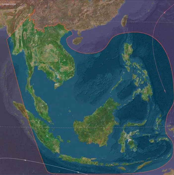
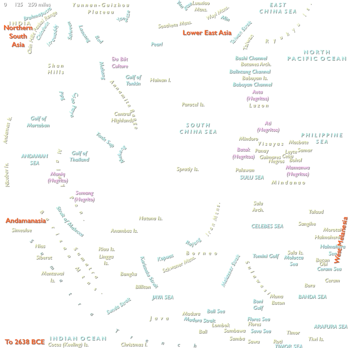
Sundachina includes southern and eastern Myanmar; Thailand, Cambodia, Laos, Vietnam; the Malay Peninsula; eastern and southern Sumatra, Java, Borneo, Sulawesi, the Philippines, and the surrounding island worlds of the Banda, Molucca, Ceram, Halmahera, and Sulu seas.
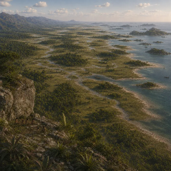
Lower sea level joined the Malay Peninsula, Sumatra, Java, and Borneo into the enormous continental landmass of Sundaland.
Great rivers crossed what are now the Java Sea and South China Sea shelves, linking mainland valleys, floodplains, wetlands, forests, and distant lowstand coasts into broad drainage systems.
East of Sundaland, Wallacea remained divided by deep-water channels. Even during low sea levels, reaching Sulawesi and farther eastern islands required sea crossings.
Sundachina was therefore divided between a vast continental shelf world in the west and an archipelagic maritime world in the east, with rivers and straits providing very different kinds of connectivity.
Climate and Environmental Shifts
Marine Isotope Stage 3 repeatedly altered Southeast Asian rainfall, monsoon strength, vegetation, river discharge, and coastal geography.
Sundaland was not a uniform grassland plain. Tropical forest persisted extensively, particularly in wetter refugia and along major river systems, while seasonal forest, savanna, wetlands, and more open vegetation expanded in some regions during colder or drier phases.
Large rivers and swamp systems provided enduring ecological structure through these changes. As monsoon strength varied, floodplains expanded or contracted, wetlands shifted, and forest boundaries moved across lowland landscapes.
In Wallacea and the Philippines, tropical forest remained widespread but varied with elevation, rainfall, seasonality, volcanism, and island size. High volcanic islands retained wetter uplands even when surrounding lowlands became drier.
The defining environmental pattern was therefore not uniform tropical continuity, but repeated reorganization across continental lowlands, river corridors, island interiors, and maritime margins.
Human Presence
Modern humans were established across parts of Sundachina and Wallacea during this eon.
The passage through Wallacea toward Sahul must have occurred before the beginning of the eon or very near its opening, since Australia was already inhabited by approximately 65,000 years ago.
Archaeological evidence places modern humans in Wallacea by at least the mid-40,000s. Occupation of these island environments required deliberate short- and medium-distance sea crossings and demonstrates that maritime movement was already part of human life in the western Pacific.
The population history was not one simple replacement sequence. Other archaic populations may have survived locally during portions of the interval, while modern-human groups themselves followed different technological and ecological trajectories.
Sundachina therefore combined long-inhabited continental landscapes with active maritime frontiers and complex population histories.
Subsistence and Settlement
Foragers exploited tropical forests, river valleys, caves, wetlands, savanna edges, coastal plains, reefs, and islands.
Food resources included deer, pigs, small mammals, reptiles, fish, shellfish, nuts, fruits, tubers, palms, and other tropical plants.
In Sundaland, major rivers connected inland forests, wetlands, and distant coastal plains. Floodplains and river margins concentrated freshwater, fish, plants, game, and movement routes.
In Wallacea, smaller and more restricted terrestrial faunas encouraged flexible use of coastal and marine resources alongside plant foods and island game.
Settlement remained mobile and locally adapted. Caves, river terraces, forest margins, coastlines, and island interiors were used according to resource availability, rainfall, and season rather than through one region-wide settlement system.
Technology and Material Culture
Stone technologies remained highly diverse.
Flake-based industries continued widely, while blade production and other more specialized forms occurred in particular regions and periods. Bone and shell tools appeared in some contexts but should not be generalized across Sundachina as a whole.
Organic technologies were probably fundamental to everyday life. Bamboo, wood, bark, fiber, resin, shell, and bone could provide cutting implements, containers, cordage, fishing equipment, carrying devices, digging tools, and components of watercraft.
The maritime crossings required to reach Wallacea and Sahul demonstrate boat or raft technology, navigation, cooperative planning, and practical knowledge of currents and winds even where the vessels themselves have not survived.
Technological diversity therefore reflected both ecological variation and the different histories of mainland, shelf, and island populations.
Movement and Connectivity
The great palaeorivers of Sundaland connected interior valleys with distant lowstand coasts.
Major mainland drainage systems linked uplands, floodplains, wetlands, and exposed shelf plains across distances that later became divided by sea. These river systems moved people, animals, raw materials, and ecological knowledge through the continental west.
Wallacean straits created a fundamentally different geography. Movement depended upon repeated sea crossings among islands separated by deep water, sometimes visible from one another and sometimes more distant.
The Philippine, Sulu, Moluccan, and Banda island worlds added additional maritime corridors, linking populations through chains of short and medium crossings.
Sundachina’s connectivity was therefore dual in character: terrestrial and riverine across Sundaland, maritime and archipelagic across Wallacea.
Cultural and Symbolic Expressions
Sundachina contains some of the world's most important evidence for early representational art.
Sulawesi preserves figurative and stencil traditions extending into this eon, demonstrating sophisticated symbolic expression far beyond Europe. Evidence places representational traditions at least around the mid-40,000-year range, while newer dating has pushed some imagery earlier still.
Pigment use, ornaments, shaped objects, and other forms of material display also occurred in varied contexts across the wider region.
These practices did not form one uniform symbolic system. Mainland populations, Sundaland communities, and Wallacean island societies developed locally distinct traditions within broader networks of movement and contact.
The surviving evidence therefore reveals symbolic diversity rather than a single shared cultural package.
Environmental Adaptation and Resilience
Human communities succeeded through exceptional ecological versatility.
In Sundaland, populations adapted to rainforest, seasonal woodland, savanna, river corridors, wetlands, and broad lowstand plains. In Wallacea, people combined island foraging, coastal collecting, marine exploitation, and deliberate sea travel.
Plant foods provided dependable resources across many tropical environments, while aquatic foods and smaller prey reduced dependence on large-game hunting.
River knowledge connected interior populations with distant coasts; maritime knowledge allowed island communities to move among geographically separated resource zones.
The region’s resilience rested on the ability to cross ecological boundaries—forest to river, mainland to coast, coast to island—while maintaining detailed knowledge of changing seasonal and climatic conditions.
Transition
By 28,558 BCE, Sundachina linked the continental worlds of mainland Southeast Asia and Sundaland with the maritime landscapes of Wallacea and the western Pacific.
Modern humans had crossed major biogeographic boundaries, occupied tropical forests and island environments, and developed maritime capacities that had already carried populations onward toward Sahul. At the same time, the region preserved strongly local technological, demographic, and symbolic traditions.
The immense lowlands of Sundaland still connected territories later separated by rising seas, while deep-water straits continued to divide the island worlds farther east.
At the close of Late Pleistocene I, Sundachina was therefore both a continental river world and a maritime frontier: one of the principal regions in which human ecological flexibility, seafaring, and symbolic expression became deeply established across the tropical Old World.