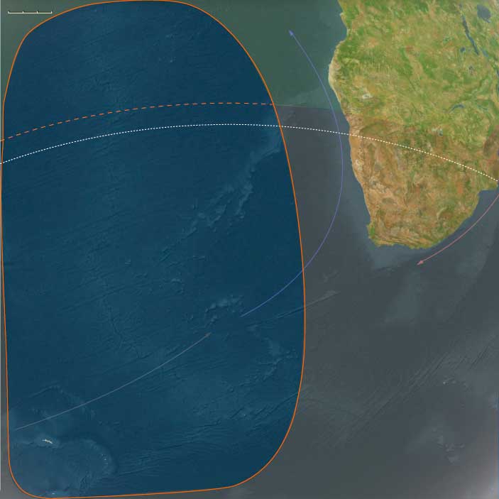
South Atlantic
Related Events
Showing 10 events out of 64 total
The Middle of the Earth, one of the twelve divisions of the globe, encompasses Africa down to its subcontinent, the lands and seas of the Mediterranean Basin and the Red Sea, the Canary Islands, and the Cape Verde Islands.
The northwestern boundary extends from south-central Germany along the Swiss border, encompassing all Swiss cities except Basel. It then separates southern France from northern France, continues through Spain, and divides Portugal at Setúbal, marking a north-south division within both countries. The boundary then extends into the Atlantic Ocean, where it distinguishes Madeira (a Portuguese territory) from the Canary Islands (ruled by Spain).
The northeastern boundary separates Alpine Austria from the rest of the country, then moves through the Balkans, roughly following the borders between:
- Hungary and Slovenia,
- Serbia and Croatia,
- Bosnia and Herzegovina, Montenegro, and Kosovo,
- Bulgaria and North Macedonia,
- Turkey-in-Europe and Greece.
From there, the line continues through western Turkey and Cyprus, dividing Syria and most of Lebanon from Israel and most of Jordan, and marking the separation between western and eastern Arabia.
The southeastern boundary follows the historic division between North and South Yemen, then extends through eastern Africa, delineating Mozambique from Zambia.
HistoryAtlas contains 18,610 entries for the Middle of The Earth from the Paleolithic period to 1899.Narrow results by searching for a word or phrase or select from one or more of a dozen filters.
The African South, encompassing the southern subcontinent of Africa, includes the Republic of South Africa, Lesotho, Eswatini (formerly Swaziland), Botswana, southern Mozambique, nearly all of Namibia except its far north, and the western portion of East Antarctica.
This region also extends into the South Atlantic and Southern Ocean, incorporating Coronation Island (visible above the tip of the Antarctic Peninsula), South Georgia, the South Sandwich Islands, and the remote Tristan da Cunha and Gough Islands in the mid-South Atlantic.
The desolate Kerguelen Islands, marking the convergence of Southern Africa, Australasia, and Afroasia, form its easternmost point.
The northern boundary runs just south of the Namibia-Angola border, tracing the Caprivi Strip before reaching the Mababe Depression, northwest of the Okavango Basin.
The northeastern border follows Botswana’s boundary with Zimbabwe, then continues between South Africa’s Drakensberg Range and Kruger National Park, before finally separating Eswatini from Mozambique.
HistoryAtlas contains 554 entries for the African South from the Paleolithic period to 1899.
Narrow results by searching for a word or phrase or select from one or more of a dozen filters.
South Atlantic (49,293 – 28,578 BCE): Upper Pleistocene I — Gyre Worlds, Glacial Winds, and the Dual Ocean of Life
Geographic and Environmental Context
The South Atlantic World in the late Ice Age consisted of two great subregions divided by climate and current:
-
Northern South Atlantic — the warm, subtropical to equatorial half of the basin, centered on the South Atlantic Gyre between Africa and Brazil.
It included St Helena and Ascension Island on the Mid-Atlantic Ridge, along with smaller seamounts and reefs scattered between the African and South American coasts.
The Brazilian ridge-islands of Fernando de Noronha, Trindade, and Martim Vaz, though oceanic in origin, belong properly to South America Major rather than this subregion. -
Southern South Atlantic — a cold, subantarctic crescent of Tristan da Cunha, Gough, Bouvet, South Georgia, the South Sandwich Islands, and the South Orkneys, swept by the Antarctic Circumpolar Current (ACC).
Together these domains—one bathed in tropical gyres, the other lashed by polar seas—formed a single oceanic system linking Africa, South America, and Antarctica through currents, winds, and migrating life.
Climate and Environmental Shifts
This epoch saw the intensification of the Last Glacial Maximum.
-
Sea Level: 60–90 m lower than today, broadening continental shelves but leaving the steep volcanic islands largely unchanged.
-
Atmosphere: Stronger trade winds spun the northern gyre; circumpolar westerlies sharpened into persistent gales in the south.
-
Temperature: The northern basin cooled modestly but remained tropical; the southern rim dropped far below freezing in winter, with seasonal sea ice pushing northward.
-
Ocean Circulation: The strengthened Benguela upwelling off southwest Africa and the cold-return limb of the ACC enriched planktonic productivity across both subregions.
The South Atlantic thus operated as a thermal bridge—drawing heat northward and nutrients southward.
Ecosystems and Biotic Communities
Northern South Atlantic
-
Islands: St Helena and Ascension were barren volcanic cones with thin soils, patchy grasses, and a few endemic shrubs.
-
Marine Life: Coral reefs persisted in warm pockets; tuna, billfish, and turtles patrolled gyre margins; seabirds nested on cliffs devoid of land predators.
-
Connections: Trade-wind drift and dust from the Sahara fertilized the sea surface, sustaining modest plankton blooms.
Southern South Atlantic
-
Islands: Volcanic or glaciated, from ice-bound Bouvet and South Georgia to the green, cloud-fed uplands of Tristan and Gough.
-
Fauna: Albatrosses, petrels, penguins, and seals crowded beaches and ridges; krill and fish filled the surrounding seas; whales migrated seasonally to feed.
-
Vegetation: Mosses, lichens, and cushion plants clung to ice-free patches; on Tristan and Gough, grasses and peat expanded in sheltered hollows.
Across both subregions, ecosystems were entirely pre-human but highly productive, their nutrient loops linking equator to ice edge.
Technology and Material Culture
Human societies elsewhere in the world—Africa, Europe, and Asia—were mastering blade technologies, tailored clothing, and cave art, yet none had crossed the Atlantic.
The South Atlantic remained wholly unvisited, its distances and storms forming an impassable frontier.
Had mariners somehow reached it, survival would have demanded cold-weather craft, insulated gear, and marine-mammal exploitation far beyond contemporary capacity.
Movement and Interaction Corridors
Without people, currents and wildlife defined movement:
-
The South Equatorial Current carried surface waters westward toward Brazil, returning via the Benguela Current up the African coast.
-
The ACC circled eastward around the subantarctic islands, binding the southern oceans into one ecosystem.
-
Migratory species—whales, seals, turtles, and seabirds—traced these routes, forming a living chain that connected polar and tropical worlds.
These same pathways would later shape human navigation and global trade, but in this age, they belonged wholly to the non-human biosphere.
Cultural and Symbolic Dimensions
The South Atlantic existed outside the human imagination.
Its islands, uncharted and unseen, bore only natural symbols—the cyclical return of whales and seabirds, the pulse of storms, and the sculpting of glaciers and lava.
Elsewhere, humans painted caves and buried their dead in ochre; here, the ocean itself was the artist, carving coastlines and layering guano into the first living soils.
Environmental Adaptation and Resilience
-
Northern gyre ecosystems adapted to cooler conditions with flexible plankton communities and resilient coral refugia.
-
Southern subantarctic systems tracked glacial rhythms: vegetation retreated under ice and recolonized rapidly when temperatures rose; animal colonies shifted breeding sites as sea ice expanded and contracted.
Despite climatic volatility, the basin’s food webs remained stable, proving that biological resilience thrives on movement and interconnection.
Transition Toward the Glacial Maximum
By 28,578 BCE, the South Atlantic stood in full glacial balance:
-
The Northern South Atlantic rotated as a warm, slow gyre feeding Africa and Brazil with moisture and marine life.
-
The Southern South Atlantic thundered with westerlies and icy spray, a crucible of upwelling and migration.
No humans yet sailed its waters, yet its two subregions already functioned as distinct worlds—one subtropical, one subantarctic—each more closely tied to distant hemispheric partners than to each other.
When seafarers finally ventured across it tens of millennia later, they would find not an empty sea, but a living engine that had been shaping climates, currents, and ecological continuity since long before human time began.
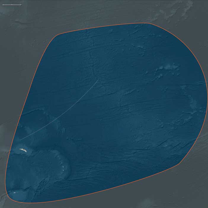
Southern South Atlantic (49,293–28,578 BCE): Subantarctic Shores in the Upper Paleolithic
Geographic & Environmental Context
The subregion of Southern South Atlantic includes the Tristan da Cunha archipelago, Bouvet Island, South Georgia and the South Sandwich Islands, and the South Orkney Islands (including Coronation Island). These islands were volcanic or glaciated outposts scattered across the stormy South Atlantic, lying between the subtropics and the Antarctic margin. Tristan da Cunha and Gough Island were volcanic highlands with fertile soils and rugged coasts; Bouvet was a small, ice-cloaked volcano adrift in the mid-ocean; South Georgia, the South Sandwich Islands, and the South Orkneys were larger, glacier-bound landmasses, with towering peaks, fjords, and ice shelves descending into icy seas. Offshore, the Antarctic Circumpolar Current (ACC) swept nutrients around the islands, binding them into global marine circuits.
Climate & Environmental Shifts
This age unfolded during the height of the Last Glacial period. Global sea levels stood 60–90 meters lower than today, broadening coastal shelves around Tristan and Gough but leaving steep islands largely unaltered. The climate was colder, windier, and stormier: glaciers expanded on South Georgia, the South Orkneys, and Bouvet, while snow and ice capped high volcanic summits. Sea ice advanced further north in winter, narrowing open-water habitats. Yet these glacial conditions also enriched the surrounding seas, intensifying upwellings and sustaining robust marine productivity.
Subsistence & Settlement
No humans reached these islands in this epoch. Their ecosystems were purely natural. Coastal cliffs and ice-free ridges supported seabird colonies—petrels, albatrosses, and penguins—while seals and sea lions hauled out on rocky shores. Offshore, rich krill swarms and fish populations supported whale migrations. Vegetation was sparse: mosses, lichens, and cushion plants clung to ice-free pockets on Tristan and Gough, while South Georgia and the Orkneys remained dominated by ice.
Technology & Material Culture
Globally, Upper Paleolithic humans advanced stone blade industries, bone tools, and symbolic art traditions (e.g., Lascaux, Blombos). But none of these reached the Southern South Atlantic. Human technologies had not yet penetrated such latitudes. The islands’ isolation meant they remained outside the reach of even the most expansive Paleolithic migrations.
Movement & Interaction Corridors
The ACC and strong westerlies defined movement here. Seabirds migrated vast distances, linking South Georgia and the Orkneys with Antarctica and South America. Whale migrations converged seasonally, feeding in krill-rich waters during summer before moving northward in winter. These corridors made the Southern South Atlantic a crucial biological crossroads, even without humans.
Cultural & Symbolic Expressions
No human symbolic traditions attached to these islands. In global terms, however, myths of southern lands were millennia away; the region existed only as ecological reality. Symbolically, continuity was inscribed only through natural cycles—penguin rookeries, whale migrations, and glacial rhythms.
Environmental Adaptation & Resilience
Ecosystems displayed resilience under extreme conditions. Seabirds and seals adapted breeding to brief summer ice retreats. Krill thrived under extended sea ice, feeding on under-ice algae and anchoring the marine food web. Pioneer plants colonized volcanic soils on Tristan and Gough, resisting frost and wind. Glaciers advanced and retreated with climate fluctuations, reshaping valleys and coasts.
Transition
By 28,578 BCE, the Southern South Atlantic was locked in glacial stability: glaciers pressed outward, seas teemed with marine life, and volcanic islands stood as ecological sentinels in the stormiest ocean on Earth. Humans remained absent, but the biological and climatic systems that would one day shape human encounters were already firmly in place.
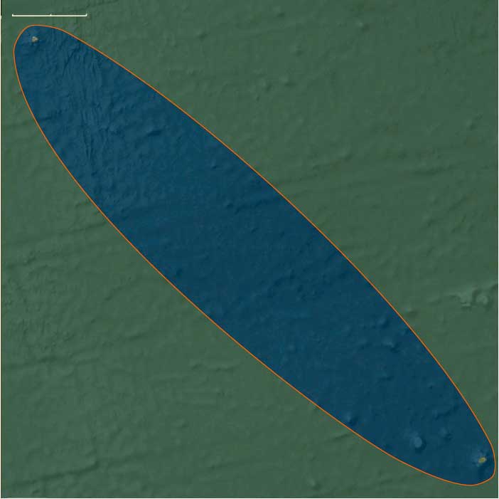
Northern South Atlantic (49,293–28,578 BCE): Volcanic Oases in a Cooler Ocean
Geographic & Environmental Context
The subregion of Northern South Atlantic includes Saint Helena and Ascension Island. These mid-ocean volcanoes rose steeply from abyssal plains: Ascension, a young shield with cinder cones and lava fields; Saint Helena, an older, deeply eroded massif ringed by cliffs. Narrow boulder/cobble strands, sea caves, and wave-cut benches framed their coasts; inland, stark basalt and trachyte ridges held patchy soils and crater basins.
Climate & Environmental Shifts
This was peak Last Glacial time. Sea level stood ~60–90 m lower, widening shore platforms and exposing additional benches. Cooler sea-surface temperatures and stronger southeast trade winds intensified upwelling along the eastern basin (Benguela limb) and invigorated the South Equatorial Current. Rainfall was limited; fog and orographic cloud banks wetted windward slopes episodically. Dust delivery from Africa waxed, seeding open-ocean productivity.
Subsistence & Settlement
No humans reached these islands. Ecologies were oceanic: immense seabird rookeries on ledges and cinder cones; green and hawksbill turtles foraged offshore and likely nested on low strands during interludes; intertidal zones teemed with grazers and filter feeders. Inland vegetation was sparse—ferns, lichens, and pioneering grasses colonized ash and scoria, with moisture-catching ravines sheltering a few shrub pockets.
Technology & Material Culture
Globally, Upper Paleolithic blade and bone technologies blossomed; none touched this oceanic pair. The only “materials” on island surfaces were volcanic rock, bird bone, shell, guano crusts, and wind-blown sand.
Movement & Interaction Corridors
The South Atlantic subtropical gyre (Brazil → South Equatorial → Guinea → Canary → North Brazil Currents) and trade-wind belts routed pelagic life. Seabirds commuted across basins; turtles navigated gyre margins; tunas, billfish, and sharks hunted frontal zones.
Cultural & Symbolic Expressions
None locally. If the islands “spoke,” it was through biogenic landmarks—white guano veneers on headlands and turtle crawls etched into storm-lowered beaches.
Environmental Adaptation & Resilience
Seabirds nested in dense, shifting colonies; pioneering plants stabilized ash with rhizo-mats; turtle nesting tracked strands that came and went with sea-level oscillation. Nutrient subsidies (guano → soils) catalyzed small green oases on otherwise austere rock.
Transition
By 28,578 BCE, glacial seas and trade winds still ruled. The islands stood as stark, lifeboat habitats in a cool, windier Atlantic, rich offshore, austere on land—entirely unknown to humans.
South Atlantic (28,577 – 6,094 BCE): Late Pleistocene → Early Holocene — Deglaciation, Gyre Highways, and Rising Island Ecosystems
Geographic & Oceanographic Frame
Spanning from the sub-Antarctic rim to the mid-latitude gyre, the South Atlantic comprised two linked but contrasting belts:
-
Southern South Atlantic (sub-Antarctic arc): the Tristan–Gough chain, ice-draped Bouvet, glacier-bound South Georgia and the South Sandwich arc, and the South Orkney Islands—volcanic and periglacial outposts embedded in the Antarctic Circumpolar Current (ACC) and swept by the westerlies.
-
Northern South Atlantic (gyre core and western ridge): the Ascension–St Helena segment of the Mid-Atlantic Ridge and Brazil’s offshore line of Fernando de Noronha, Rocas Atoll, São Pedro & São Paulo, and Trindade–Martim Vaz—arid, oceanic islands fringed (in places) by reefs and ring atolls, set within the South Equatorial Current and the subtropical gyre.
No permanent human presence touched either belt during this epoch; the region’s story is one of ice, wind, and water reorganizing life at planetary scale.
Climate Pulses & Sea-Level Change
The interval bridges the Last Glacial Maximum (LGM, ~26.5–19 ka) and the onset of the Holocene:
-
LGM: Global sea level stood ≈120 m lower, exposing broad coastal benches; sea ice spread far north; South Georgia and the South Orkneys lay under expanded ice caps reaching tidewater; Bouvet remained largely glaciated. Strengthened trades intensified Benguela upwelling off southwest Africa; cool, oligotrophic conditions dominated the gyre. Coral accretion at warm-water outposts (e.g., Rocas, Noronha) stalled.
-
Bølling–Allerød (~14.7–12.9 ka): Rapid warming and freshening seas shifted fronts poleward; ACC vigor persisted. Glaciers on South Georgia and the Orkneys began to retreat, unveiling new headlands and proglacial lakes. In the north, SSTs rose, trades relaxed, and reef frameworks re-animated in west-basin islands; seasonal productivity spikes intensified along gyre fronts and island wakes.
-
Younger Dryas (~12.9–11.7 ka): A brief cool relapse nudged productivity back toward wind-driven margins; reef growth slowed but persisted in sheltered lagoons; sub-Antarctic snowfall ticked up and outlet glaciers pulsed.
-
Early Holocene (post-11.7 ka): Sea level climbed by tens of meters toward modern stands, drowning LGM terraces and fixing contemporary shorelines. Sub-Antarctic climates stabilized—cold, windy, moist—with peat initiation in leeward basins on Kerguelen-like platforms mirrored at South Georgia and parts of the Orkneys. In the north, warm, stratified SSTs expanded reef habitat (notably at Rocas, the South Atlantic’s classic atoll) and widened turtle-nesting beaches on new sand cays.
Ecosystem Assembly & Expansion (No Human Presence)
With ice in retreat and coastlines reworked, life spread rapidly:
-
Sub-Antarctic belt: Tussock grasses, mosses, lichens, and cushion plants colonized freshly deglaciated slopes and moraines; peat began to accumulate in saturated hollows. Penguin (king, macaroni, gentoo) rookeries multiplied on new shingle terraces; albatross and petrel colonies rimmed cliffs; fur and elephant seals reoccupied emerging beaches. Offshore, the ACC’s krill-rich conveyor fueled surging baleen whale populations and dense pelagic food webs.
-
Gyre islands: On Ascension and St Helena, basaltic cones with scant freshwater supported sparse xeric flora; island-wake eddies (“island mass effect”) concentrated plankton and small pelagics, drawing boobies, terns, and tuna. Along Brazil’s offshore arc, Rocas’ ring-reef lagoons flourished as coral accretion resumed; Noronha and Trindade hosted mixed rocky reefs and pocket corals, while São Pedro & São Paulo sustained remarkable seabird and fish aggregations. Green and hawksbill turtles nested on expanding beaches; pelagic predatorscruised gyre fronts.
Movement & Interaction Corridors
Oceanic and atmospheric circulation knit the belts into one system:
-
The ACC and westerlies linked Tristan–Gough–Bouvet–South Georgia–Orkneys, transporting nutrients, ice, and biota around the hemisphere.
-
The South Equatorial Current and subtropical gyre connected Noronha–Rocas–Trindade–St Helena–Ascension, while Benguela upwelling along Africa’s margin and island wakes created predictable feeding hotspots.
-
Whale migrations bridged north–south belts seasonally; seabirds stitched the oceanic mosaic, moving marine nutrients ashore as guano and back to sea, reinforcing cross-realm productivity.
Symbolic & Cultural Dimensions
Human symbolic activity is absent; the islands lay beyond the range of late Pleistocene seafaring. The only “rituals” inscribed were ecological: annual penguin returns, seal pupping cycles, whale passage, and glacial advance–retreat—a natural chronicle of recurrence written in ice and surf.
Environmental Resilience & Feedbacks
Sub-Antarctic and gyre ecosystems displayed robust adjustment to large climate swings:
-
Relocation and recolonization: Penguins and seals shifted rookeries/haul-outs with retreating ice and changing surf exposure; pioneer plants rapidly stabilized new substrates.
-
Biogeochemical coupling: Guano-driven nutrient pumps enriched thin island soils and nearshore waters; krill dynamics tracked sea-ice phenology, buffering higher trophic levels.
-
Physical buffers: Peatlands and kelp forests moderated hydrologic and wave energy extremes; volcanic ash inputs periodically reset and fertilized soils.
Long-Term Significance
By 6,094 BCE, the South Atlantic’s dual identity was established: a thriving sub-Antarctic archipelago of peat-forming, bird-and-seal–rich islands to the south, and a string of oligotrophic mid-ocean oases to the north. Though unvisited by humans, these belts had reached a Holocene steady state—a biologically powerful, interconnected seascape that would later frame the first episodic human sightings and, much later, sustained voyages across the Atlantic’s southern reaches.
Southern South Atlantic (28,577–7,822 BCE): Deglaciation and Expanding Ecosystems
Geographic & Environmental Context
The subregion of Southern South Atlantic includes the Tristan da Cunha archipelago, Bouvet Island, South Georgia and the South Sandwich Islands, and the South Orkney Islands (including Coronation Island). During this epoch, these islands remained volcanic and glaciated outposts in the stormy South Atlantic. South Georgia and the South Orkneys were heavily ice-covered, with glaciers reaching the sea. Bouvet Island stood as a largely ice-bound volcano, while Tristan da Cunha and Gough presented rugged volcanic slopes with pockets of ice-free terrain. The surrounding Southern Ocean was dominated by the Antarctic Circumpolar Current (ACC), which circulated nutrients and linked ecosystems across vast distances.
Climate & Environmental Shifts
This epoch bridged the Last Glacial Maximum (c. 26,000–19,000 BCE) and the gradual warming that followed. At its peak, ice sheets extended farthest, pressing glaciers across South Georgia and the South Orkneys, and sea ice expanded far north into the Atlantic. After c. 19,000 BCE, deglaciation began: glaciers retreated, coastlines opened, and ice-free habitats expanded. Sea level rose by tens of meters, drowning coastal shelves and reshaping island shorelines. Temperatures warmed slightly, though the climate remained windy, variable, and cold.
Subsistence & Settlement
Humans had not yet arrived. Ecological communities, however, expanded in step with deglaciation. As ice retreated, tussock grasses, mosses, lichens, and cushion plants colonized newly exposed soils on Tristan, Gough, and parts of South Georgia. Seabird rookeries spread along rocky coasts. Penguin colonies and seal haul-outs multiplied as new beaches opened. Offshore, whale populations flourished in plankton-rich seas. Krill swarms thrived under sea-ice edges, anchoring the marine food chain.
Technology & Material Culture
Elsewhere in the world, human groups refined Upper Paleolithic technologies: microliths, bone harpoons, tailored clothing, and symbolic art. None reached the Southern South Atlantic, which remained far beyond human migration routes. The islands’ isolation meant their ecosystems evolved free of human presence.
Movement & Interaction Corridors
The ACC and westerlies were the great connectors. Migratory seabirds traversed hemispheres, linking Tristan and Gough to Africa, and South Georgia and the Orkneys to South America and Antarctica. Whale migrations intensified as deglaciation enriched feeding grounds, turning the Southern South Atlantic into a biological hub. Penguins and seals adapted to shifting sea-ice fronts, exploiting new coasts as glaciers retreated.
Cultural & Symbolic Expressions
No human symbolic activity was tied to these islands. Symbolism existed only in ecological continuity: seabird colonies returning each year, whale migrations marking seasons, and glacial rhythms writing their long cycles into the landscape.
Environmental Adaptation & Resilience
Species displayed resilience to dramatic changes. Penguins, seals, and seabirds relocated rookeries and haul-outs as glaciers pulled back. Pioneer vegetation colonized bare ground, anchoring soils against erosion. Krill adapted to shifting ice conditions, sustaining higher predators. The resilience of these systems underlined the adaptability of subantarctic ecosystems to major climatic shifts.
Transition
By 7,822 BCE, the Southern South Atlantic was in the midst of deglaciation. Ice had retreated from some coasts, vegetation was spreading, and marine ecosystems flourished under productive currents. Humans were still absent, but the ecological and climatic groundwork was being laid for the Holocene world that followed.
Northern South Atlantic (28557 – 7822 BCE): Gyre Heart, Volcanic Isles, and Oligotrophic Blue
Geographic and Oceanographic Frame
Northern South Atlantic here means the South Atlantic basin from the Equator to the mid-subtropics, centered on the South Equatorial Current and the subtropical gyre core. It includes the isolated volcanic and reef systems of Ascension and St Helena (on the Mid-Atlantic Ridge) and, on the western flank, Fernando de Noronha, Rocas Atoll, São Pedro & São Paulo, and Trindade–Martim Vaz off Brazil.
(Note: the Tristan–Gough group lies farther south in the Southern South Atlantic.)
Climate Pulses and Sea-Level Change
-
Last Glacial Maximum (c. 26,500 – 19,000 BCE): Global sea level ~120 m lower expanded rocky shore platforms around the islands; cooler SSTs and stronger trade winds intensified Benguela upwelling along southwest Africa and sharpened nutrient fronts. Coral accretion slowed on warm-water reefs (Noronha, Rocas), while pelagic productivity shifted toward upwelling margins and island wake effects.
-
Bølling–Allerød (c. 14,700 – 12,900 BCE): Rapid warming/moistening boosted SSTs; the SE trades relaxed slightly, gyre stratification increased, and reef growth rebounded in the west. Seasonal plankton blooms along current boundaries enriched food webs for fish, turtles, and seabirds.
-
Younger Dryas (c. 12,900 – 11,700 BCE): Modest cooling nudged productivity back toward wind-driven zones and island wake upwelling; reef growth slowed but persisted in sheltered lagoons.
-
Early Holocene (after c. 11,700 BCE): Rising seas drowned LGM terraces, establishing modern shorelines; warm, stable SSTs favored rapid reef expansion (especially at Rocas, the South Atlantic’s classic atoll) and broadened turtle nesting beaches on newly formed sand cays.
Islands, Reefs, and Ecologies
-
Mid-ocean volcanoes (Ascension, St Helena): Basaltic cones with young lava fields, cinder ridges, and scant fresh water; lee-side eddies created island mass effects that concentrated plankton and small pelagics. Harsh, arid climates on land; cliffs and ledges hosted immense booby, frigatebird, and tern rookeries.
-
Western ridge and seamount arc (Noronha, Rocas, São Pedro & São Paulo, Trindade–Martim Vaz): Mix of volcanic islands and reef platforms. Rocas—a low-lying ring of coral—supported lagoons rich in juveniles of reef fish and invertebrates. Noronha and Trindade had rocky shores and pocket reefs, with nutrient pulses from internal waves and current shear.
-
Pelagic highways: Humpback and other baleen whales transited seasonally; tuna, billfish, and sharkspatrolled thermal fronts. Green and hawksbill turtles used multiple islands as nesting sites.
Human Presence
-
None. Distances, weak archipelagic stepping-stones, and open-ocean conditions placed this basin far beyond late Pleistocene seafaring capacity. Ecosystems evolved without terrestrial predators or human fire.
Environmental Dynamics
-
Gyre stratification vs. upwelling: The gyre core remained oligotrophic (blue water); biological hotspots formed where currents hit islands/seamounts, at fronts, and along Benguela margins.
-
Volcanism and erosion: Intermittent eruptions (especially on the younger edifices) refreshed soils and altered coastlines; wave action reworked LGM benches into early-Holocene beach ridges.
-
Seabird nutrient pumps: Massive colonies moved marine nutrients ashore, fertilizing sparse island flora and nearshore waters via guano runoff.
Symbolic and Conceptual Role
For contemporaneous peoples of Africa and South America, this was an unseen blue wilderness—a wind-belt and current system felt only indirectly in coastal weather and fish migrations, not mapped in any oral geography.
Transition Toward the Holocene
By 7822 BCE, warm, stable seas and higher stands had established today’s island outlines, reef flats were broad and productive, and seabird/turtle rookeries flourished on predator-free shores. The Northern South Atlantic had become a mosaic of pelagic deserts and island-fed oases—still entirely untouched by human hands.
South Atlantic (7,821 – 6,094 BCE): Early Holocene — Ice Retreat, Green Shores, and Ocean Corridors of Life
Geographic & Environmental Context
The South Atlantic in the Early Holocene stretched from the tropical gyre islands of Saint Helena and Ascension to the storm-lashed subantarctic arc of Tristan da Cunha, Gough, Bouvet, South Georgia, the South Sandwich, and South Orkney Islands.
All were volcanic outposts rising from the Southern Ocean, encircled by the Antarctic Circumpolar Current (ACC)and bound together by the migrations of whales, seals, and seabirds.
-
Northern chain: Saint Helena and Ascension—mid-ocean plateaus of basalt cliffs and crater basins, catching cloud moisture from persistent trades.
-
Southern chain: Tristan da Cunha, Gough, Bouvet, South Georgia, South Sandwich, and the South Orkneys—glaciated islands fringed by fjords and tundra benches newly freed from ice.
Between them rolled one of Earth’s most productive ocean gyres, linking the tropics, temperate South Atlantic, and the Antarctic seas.
Climate & Environmental Shifts
The Holocene Thermal Maximum brought general warming and sea-level rise toward modern positions:
-
In the north, SSTs increased, precipitation rose slightly, and windward slopes developed cloud-forest pockets.
-
In the south, ice retreated rapidly on South Georgia and the Orkneys, exposing valleys and headlands; Bouvet remained mostly ice-clad; the westerlies intensified, yet summers lengthened.
The ocean entered a period of nutrient-rich stability—a constant, wind-driven upwelling system that sustained vast krill and plankton blooms.
Subsistence & Settlement
No humans yet reached these remote latitudes. Instead, ecosystems re-colonized freshly exposed ground:
-
Northern South Atlantic:
Vegetation thickened on Saint Helena and Ascension—ferns, grasses, and early shrubland in moist hollows; seabirds nested in cliffs and lava tubes; green turtles returned annually to pocket beaches. -
Southern South Atlantic:
On Tristan and Gough, tussock grasslands, mosses, and herbs spread across volcanic slopes; penguin colonies (king, gentoo, macaroni) multiplied on ice-free shores; fur and elephant seals crowded new beaches.
South Georgia’s fjords, newly deglaciated, filled with seals and seabirds; whales converged in summer feeding grounds.
Bouvet and the South Sandwich remained marginal but hosted pioneer colonies on isolated ledges.
Across the region, biological communities advanced unimpeded by human presence—true Holocene sanctuaries of natural succession.
Technology & Material Culture
While humans elsewhere were shaping stone, bone, and clay into the first farming toolkits, the South Atlantic islands remained entirely pre-anthropic. No technology, no fire, no modification—only the slow architecture of wind, waves, ice, and guano.
Movement & Interaction Corridors
Life circulated on planetary scales:
-
The ACC distributed nutrients among the islands, while gyre eddies funneled warm and cold currents that defined ecological boundaries.
-
Whales and seals migrated annually—south in summer to feed in krill-rich waters, north in winter to breed.
-
Albatrosses, petrels, and shearwaters traced hemispheric orbits linking Africa, South America, and Antarctica.
-
Turtles rode equatorial drifts to forage around the northern islands.
In effect, the South Atlantic was a biological highway, joining three continents through movement alone.
Cultural & Symbolic Expressions
No human symbolism yet touched these shores. The island “rituals” were ecological: the cyclic return of penguins and turtles, the synchronous molting of seals, the seasonal whale chorus—natural calendars of abundance and renewal.
Environmental Adaptation & Resilience
Ecological resilience was dynamic and self-reinforcing:
-
Plants colonized bare moraines and lava soils, stabilizing slopes with root mats and peat.
-
Seabird guano enriched sterile ground, accelerating plant succession and sustaining dense invertebrate webs.
-
Marine populations adjusted to new coastlines and variable ice margins, shifting breeding grounds as glaciers retreated.
-
Nutrient loops—sea → land → sea—tightened, maintaining productivity even through storm seasons.
Long-Term Significance
By 6,094 BCE, the South Atlantic had fully entered the Holocene balance:
-
Northern islands supported patchy but resilient green belts amid the trades.
-
Southern islands thrived as booming subantarctic rookeries and whale pastures.
-
The ACC and westerlies operated as stable planetary engines, ensuring continuous biological exchange.
Untouched by humankind, these archipelagos became primeval laboratories of resilience—proving how, at the meeting of ocean and ice, life could rebound, diversify, and endure long before human sails crossed the horizon.
Southern South Atlantic (7,821–6,094 BCE): Early Holocene Seas and Expanding Habitats
Geographic & Environmental Context
The subregion of Southern South Atlantic includes the Tristan da Cunha archipelago, Bouvet Island, South Georgia and the South Sandwich Islands, and the South Orkney Islands (including Coronation Island). These islands, volcanic and glaciated, were scattered across the roaring South Atlantic. Tristan da Cunha and Goughfeatured rugged volcanic peaks with expanding tundra-like vegetation zones. Bouvet remained ice-draped, its small volcanic cone surrounded by stormy seas. South Georgia and the South Orkneys were still dominated by glaciers but showed widening belts of ice-free coastlines, fjords, and headlands.
Climate & Environmental Shifts
This was the early Holocene, when warming temperatures followed the last great glaciation. By this epoch, sea level had risen close to modern levels, drowning exposed shelves and reshaping island coastlines. Glaciers retreated across South Georgia and the South Orkneys, though substantial ice caps persisted. The climate was cool, wet, and windy, dominated by strong westerlies and the Antarctic Circumpolar Current (ACC), but markedly milder than during the glacial age.
Subsistence & Settlement
No human settlement yet reached these remote islands. Ecological communities expanded as warming created new habitats. Tussock grasslands, mosses, lichens, and small flowering plants spread on Tristan, Gough, and the fringes of South Georgia. Penguin colonies (king, gentoo, macaroni) multiplied along newly exposed coasts. Seals established denser haul-outs, while offshore krill swarms, fish, and squid supported booming populations of seabirds and whales. The South Sandwich Islands and Bouvet, still heavily ice-clad, remained less hospitable but supported seabirds and seals in coastal niches.
Technology & Material Culture
In other parts of the world, Holocene humans were developing farming, domesticating animals, and advancing stone tool traditions. Yet the Southern South Atlantic remained completely untouched by human technology. Its ecosystems developed entirely without human interference, making them some of the most pristine environments on Earth.
Movement & Interaction Corridors
The region was an ecological crossroads. The ACC distributed nutrients across the islands, sustaining marine productivity. Seasonal whale migrations brought baleen species south in summer to feed in krill-rich waters before they traveled north in winter. Seabirds, especially albatrosses and petrels, ranged across hemispheric distances, linking the islands with South America, Africa, and Antarctica. Penguins and seals expanded with ice retreat, colonizing new beaches and rocky ledges.
Cultural & Symbolic Expressions
No human cultural or symbolic frameworks attached to these islands in this epoch. Symbolism was ecological: rookeries, breeding colonies, and seasonal whale gatherings marked continuity and renewal across generations.
Environmental Adaptation & Resilience
Life showed remarkable adaptability. Plants colonized deglaciated soils, anchoring landscapes against erosion. Penguins and seals redistributed breeding sites as glaciers pulled back and sea-ice cycles shifted. Krill populations adapted to reduced winter sea ice by concentrating under remaining ice canopies and in upwelling zones, sustaining the broader food web.
Transition
By 6,094 BCE, the Southern South Atlantic was firmly within the Holocene. Ice continued to retreat, vegetation was expanding, and wildlife thrived in newly opened habitats. Humans still knew nothing of these islands, but their ecological richness was already fully established, shaped by winds, currents, and the rhythms of the Southern Ocean.