Middle America (6,093–4,366 BCE): Middle Holocene — …
Years: 6093BCE - 4366BCE
Middle America (6,093–4,366 BCE): Middle Holocene — Two Oceans, One Corridor World
Geographic & Environmental Context
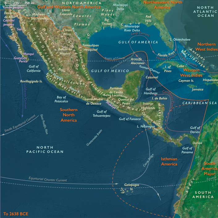
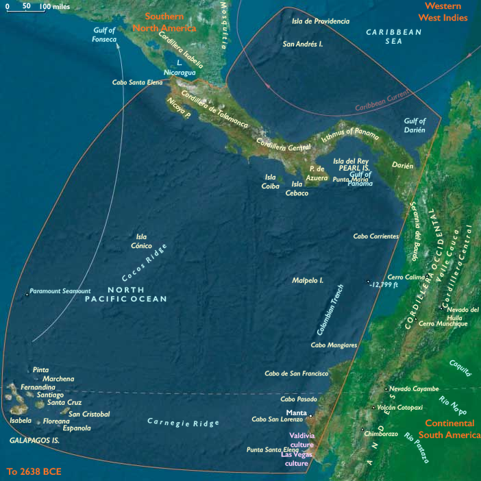
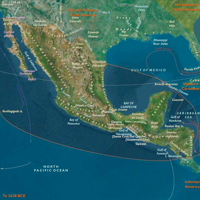
Middle America integrates Southern North America (Mexico → Nicaragua) with Isthmian America (Costa Rica–Panama–Darién and Ecuador’s capes). Volcanic piedmonts and basins step to mangrove estuaries, bar-built lagoons, and cape-bound embayments on the Pacific; karst lowlands and Caribbean lagoons fringe the opposite coast. Short isthmian portages tie seas; interior rivers (Usumacinta–Grijalva–Motagua, Chiriquí–Tuira) bind gardens to fisheries.
Climate & Environmental Shifts
Hypsithermal warmth delivered reliable wet–dry seasonality. Basin lakes and estuaries stabilized; Pacific upwelling kept nearshore fisheries rich; localized dry pulses in rain-shadows were offset by spring-fed seeps, karst aguadas, and perennial mangroves—perfect conditions for semi-sedentary rounds.
Subsistence & Settlement
A continent–isthmus portfolio economy matured:
-
Southern North America: semi-sedentary gardens (teosinte/squash/gourd/chile, tree crops) paired with lake–lagoon fisheries and upland hunts; recurring cave–spring villages and bayside hamlets.
-
Isthmian America: cape-and-lagoon hamlets (Nicoya–Azuero–Manta/Santa Elena) with tended root gardens and palms at freshwater seeps; levee camps in Darién; San Andrés as a provisioning node; Galápagos unpeopled.
Everywhere: drying/smoking, shell and turtle rookeries, and grove curation created dependable food banks.
Technology & Material Culture
Shared land–sea toolkit: polished adzes, manos/metates, nets, basketry, fish weirs, dugouts (and in calm bays sewn-plank builds). Pottery was patchy but growing in isthmian/coastal belts; elsewhere clay served as lining and small objects. Ornaments in shell/seed/stone, pigments, and occasional figurines marked houses and lineages.
Movement & Interaction Corridors
Middle America functioned as braided logistics:
-
Pacific cape circuits—Manta ⇄ Santa Elena ⇄ Nicoya ⇄ Azuero—moved salt, resins, cured fish, shells, fibers.
-
Isthmian pull-overs and portages shuttled goods between Pacific and Caribbean.
-
Interior river spines (Usumacinta–Grijalva–Motagua) ferried stone and pigments to coasts, and salt/fish inland.
These redundant lanes turned storms or local shortfalls into manageable detours.
Cultural & Symbolic Expressions
Capes and caves were sacred thresholds: ancestral canoe cults enacted ritual landings; garden-edge shrines petitioned rain and tuber fertility; feasting middens on beaches and lake margins fixed rights and memory. Stone markers and carved prows signaled tenure over landings, groves, and weirs.
Environmental Adaptation & Resilience
Resilience rested on transported landscapes and social insurance: multi-site tending (cape garden + terrace plot + levee grove), diversified food webs (reef/mangrove + roots/fruits + hunt), storage by smoke/drying, and exchange obligations across kin routes and portages.
Long-Term Significance
By 4,366 BCE, Middle America was an interoceanic corridor civilization-in-embryo: semi-sedentary gardens, fish weirs, canoe freight, and ceremonial governance of routes and landings. These habits—route scheduling, niche engineering, grove curation, and feast-based reciprocity—prepare the ground for later gold–shell–cotton networks, pottery florescence, and the formal seascape polities of the next ages.
Groups
Commodoties
Subjects
Regions
Subregions
Related Events
Showing 10 events out of 69156 total
Years: 6093BCE - 4366BCE
Groups
Commodoties
Subjects
Regions
Subregions