East Africa (7,821 – 6,094 BCE): Early…
7821 BCE to 6094 BCE
East Africa (7,821 – 6,094 BCE): Early Holocene — Monsoon Coasts, Lake Villages, and Corridors of Water
Geographic & Environmental Context
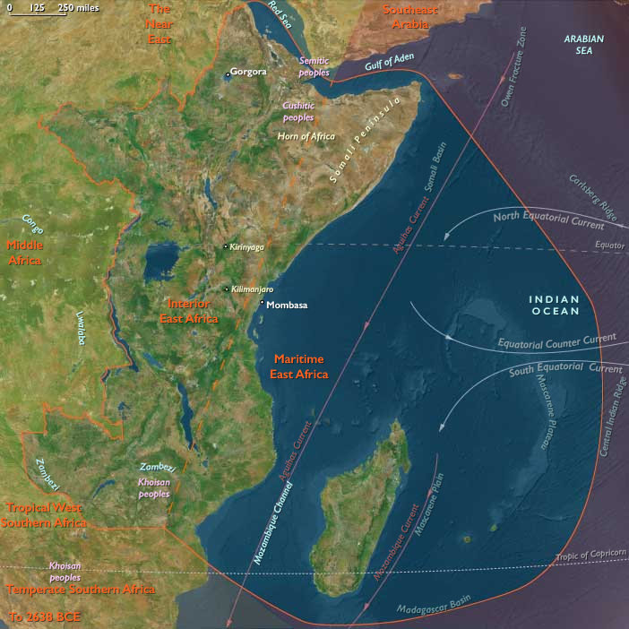
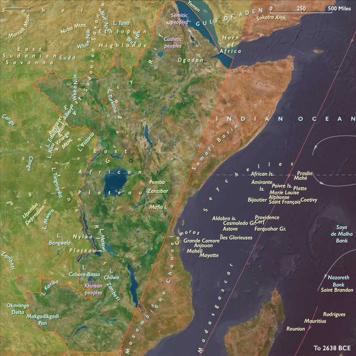
During the Early Holocene, East Africa cohered as a single hydrological world that ran from the Indian Ocean littoral(Somalia → Kenya → Tanzania → N/central Mozambique and near-shore islands) through the Rift Valley belts and Great Lakes to the Ethiopian Highlands and Upper Nile–Sudd.
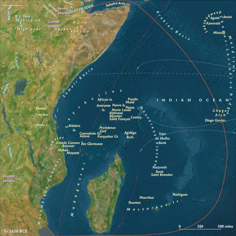
Postglacial sea rise stabilized estuaries, mangrove lagoons, and reef shelves along the Lamu–Zanzibar–Kilwa arc; inland, Victoria, Tanganyika, and Malawi stood near highstand, while Highland headwaters (Lake Tana/Blue Nile) and Rift escarpments fed long, reliable drainages. Madagascar and the outer archipelagos remained unpeopled but figured in the regional seascape as biological outliers.
Climate & Environmental Shifts
The Holocene thermal optimum brought strong, reliable monsoons and sustained warmth:
-
Coasts: steady trades and upwelling supported high reef productivity; mangroves flourished in protected estuaries.
-
Interior: lakes held high, margins fertile; Ethiopian Highlands were green and well watered; floodplains (Upper Nile/Sudd) pulsed predictably.
The result was an exceptional water-positive equilibrium that favored semi-sedentary settlement at lagoons, lake margins, and springs.
Subsistence & Settlement
A continent-spanning broad-spectrum, water-anchored mosaic matured:
-
Maritime belt: semi-sedentary shell-midden villages ringed Lamu, Zanzibar–Pemba–Mafia, and Kilwa embayments. Households combined net- and trap-fishing, reef and intertidal collecting, and turtle hunts with lagoon gardening of wild starches; dugouts enabled short offshore sets and estuary–estuary cabotage.
-
Interior lakes & highlands: lake-edge hamlets on Victoria, Tanganyika, and Malawi focused on netting, weirs, and canoe fisheries, with hippo/crocodile butchery episodic. In the Highlands, people intensified plant management (ensete groves, proto-teff niches, tubers and greens in moist pockets) alongside savanna hunts.
Across both spheres, repeated return to favored nodes—levees, dune bars, springs, and rock shelters—created semi-permanent village fabrics with seasonal spokes.
Technology & Material Culture
Toolkits were tuned to water and storage:
-
Ground-stone axes/adzes, pestles, and grinding slabs for woodwork and plant processing; bone awls and fiber nets; stake weirs, basket traps, and floats.
-
Dugout canoes were ubiquitous on lakes and estuaries; barkcloth and cordage organized drying and transport.
-
Pottery appeared on some fringes late in the span (first for boiling/fermenting fish and plants), but most storage relied on smoking/drying and pit caches.
-
Shell beads and simple ornaments signaled kin and landing-place rights; ochre remained common in domestic and mortuary settings.
Movement & Interaction Corridors
Waterways tied coast and interior into one exchange field:
-
Canoe cabotage linked lagoon villages estuary → estuary along Lamu–Zanzibar–Kilwa;
-
Rift lake routes stitched Victoria–Albert–Edward and Tanganyika–Malawi communities;
-
Blue Nile/Upper Nile channels connected Highland headwaters to the Sudd and, ultimately, the north.
These braided lanes moved dried/smoked fish, shell, salt, fibers, hardwoods, and pigments, creating redundancy when local fisheries or foraging patches dipped.
Cultural & Symbolic Expressions
Ritual mapped tightly onto water and lineage:
-
Coastal middens doubled as ancestral mounds with curated deposits; turtle-season and first-fish feasts renewed access rules.
-
Lake-margin burials with ochre and ornaments, hearth complexes, and feast pits anchored rights to beaches, weirs, and groves.
-
Healing and rain-petition rites clustered at springs and headlands, synchronizing seasonal movements and redistributive obligations.
Environmental Adaptation & Resilience
Security rested on storage + multi-ecotone scheduling + exchange:
-
Smoked/dried fish, rendered oils, and roasted seeds stabilized lean months;
-
Alternation of reef/lagoon ↔ lake/river ↔ highland plots spread risk across habitats and seasons;
-
Kin-linked corridors moved surplus where floods failed or runs were thin, while mangroves and dune ridges buffered storm impact and protected freshwater lenses.
Long-Term Significance
By 6,094 BCE, East Africa had consolidated into a semi-sedentary, water-anchored civilization without agriculture: lagoon villages on the monsoon coast and fishing hamlets around high lakes, joined by canoe and river corridors and underwritten by early plant management in the Highlands.
The operating code—place fidelity to water, portfolio subsistence, storage, and ritual governance of access—set the foundations for later pastoral spread, wet-field taro/rice experiments, and the Indian Ocean exchange spherethat would eventually fuse Africa’s interior and coast into a single economic sea.
Topics
Commodities
Subjects
Regions