Isthmian America (4,365–2,638 BCE) Late Neolithic /…
4365 BCE to 2638 BCE
Isthmian America (4,365–2,638 BCE)
Late Neolithic / Chalcolithic — Interoceanic Gardens, Canoe Corridors, and Cape Networks
Geographic & Environmental Context
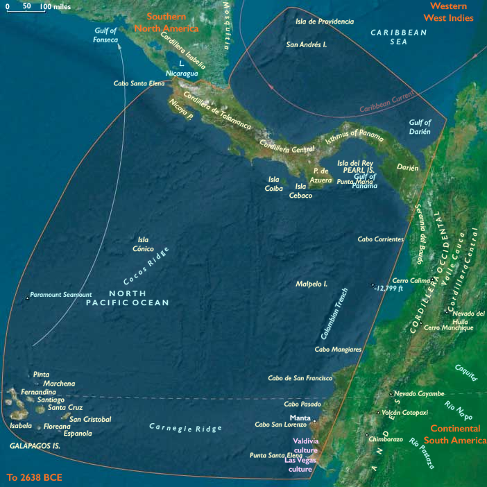
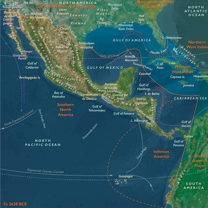
Isthmian America occupied the narrow bridge between North and South America, encompassing Costa Rica, Panama, Darién, the Gulf of Urabá, northern Chocó, the Pacific capes of Ecuador, the San Andrés banks, and the unpeopled Galápagos. Caribbean mangrove lagoons, Pacific embayments, cloud-forest ridges, and navigable rivers created one of the world's most interconnected environmental mosaics. Short portages linked watersheds, while cape-to-cape crossings connected Nicoya, Azuero, Santa Elena, and Manta into a single maritime geography.
Climate & Environmental Shifts
Warm tropical conditions remained broadly stable. Seasonal wet–dry cycles governed river flooding and agricultural schedules, while periodic ENSO-like fluctuations altered Pacific fisheries and rainfall. Mangrove systems expanded around estuaries, coral reefs flourished offshore, and volcanic soils supported increasingly productive garden landscapes.
Subsistence & Settlement
Villages clustered on levees, estuary margins, and river terraces. Early maize, gourds, squash, root crops, palms, and fruit trees formed diverse horticultural systems supplemented by fisheries, shellfish, turtles, and forest hunting. Canoe-oriented settlements maintained fish-drying stations, shell-processing sites, and provisioning camps along major waterways. In Darién and Chocó, garden-forager mosaics linked Caribbean and Pacific resources through dense river networks.
Technology & Material Culture
Groundstone axes, shell tools, fishing gear, basketry, and increasingly diverse pottery characterized daily life. Canoes lengthened and became more seaworthy for inter-cape voyages. Decorative shell ornaments, polished stones, and carved figurines circulated through exchange networks connecting coasts, rivers, and offshore banks.
Movement & Interaction Corridors
Interoceanic portages linked Caribbean and Pacific drainages. Maritime routes connected Nicoya, Azuero, Santa Elena, and Manta, while San Andrés served as a fisheries and navigation outpost. River corridors through Darién and Chocó formed natural exchange highways carrying salt, dried fish, fibers, resins, and prestige goods.
Belief & Symbolism
River mouths, capes, and portages served as ritual thresholds. Shell middens, cairns, and landing-place shrines reinforced rights to fisheries and travel routes. Ancestors were commemorated through feasts, shoreline ceremonies, and ritual gatherings at provisioning centers.
Adaptation & Resilience
Communities balanced gardens, rivers, mangroves, reefs, and forests. Mobility between ecological zones buffered droughts and storms. Exchange obligations redistributed food and materials across environmental disruptions.
Long-Term Significance
By 2,638 BCE, Isthmian America had become a fully integrated interoceanic corridor. The logistical systems, maritime knowledge, and ritual governance of movement established foundations for the later chiefdoms, goldworking traditions, and seaborne exchange systems of the Isthmian world.
Images

Isthmian America in the Late Holocene
Regions
Middle America
View →Subregions