South Polynesia (49,293 – 28,578 BCE): Upper…
49293 BCE to 28578 BCE
South Polynesia (49,293 – 28,578 BCE): Upper Pleistocene I — Oruanui Tephra, Periglacial Shores, and Seabird Realms (No Human Presence)
Geographic & Environmental Context
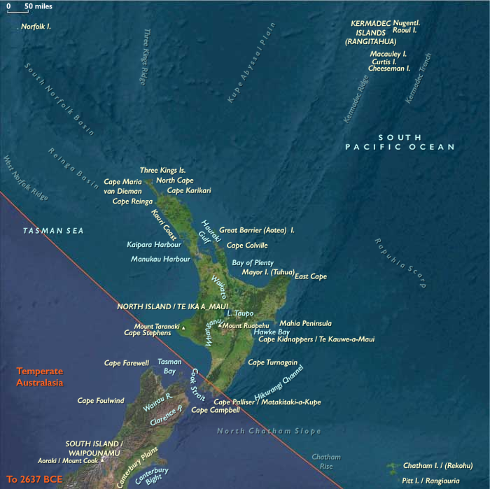
South Polynesia includes New Zealand’s North Island (Aotearoa; excluding its southern coast), the Chatham Islands (Rēkohu), Norfolk Island, and the Kermadec Islands (Raoul and associated islets).
-
Anchors: TVZ caldera complex; Hauraki–Waikato basins; Taranaki cone; Kermadec arc seamounts (Raoul); Norfolk Ridge; Chatham Rise.
-
Sea level lay ~100 m below modern, exposing wider coastal benches around North Island and enlarging strand-plains on Norfolk and Chatham.
Climate & Environmental Shifts
-
Last Glacial conditions: cooler, drier; stronger westerlies; vigorous winter storm tracks.
-
Oruanui eruption (c. 25.5 ka BP) from the Taupō caldera blanketed North Island and outlying ridges in tephra, reshaping lakes, rivers, and soils.
Biota & Baseline Ecology
-
Moa (multiple species) and giant eagles (Haast’s eagle) dominated terrestrial guilds; forests ranged from podocarp–broadleaf (north/windward) to scrub–grassland (leeward).
-
Outer islets and atolls (Kermadec, Norfolk, Chatham stacks) held vast seabird colonies; nearshore reefs supported urchins, paua/abalone, and reef fish.
Long-Term Significance
The Oruanui tephra set long-lived soil and hydrologic templates; exposed coastal plains and intact forests created high baseline productivity later engineered by Polynesian settlers.
Images

South Polynesia in Upper Pleistocene I
Topics
Subjects
Regions
Australasia
View →Subregions