South Polynesia
Region
Polynesia
View →Related Events
Showing 10 events out of 10 total
Central Oceania, the twelfth of the Earth’s regions centered on the South Pacific Ocean, encompasses the Hawaiian Islands, New Zealand’s North Island, and the archipelagos of Western Polynesia, Eastern Melanesia, and Eastern Micronesia. This includes groups such as French Polynesia, Tonga, Niue, the Cook Islands, Fiji, Tokelau, Vanuatu, the eastern Solomon Islands, Nauru, Tuvalu, Samoa, and the Marshall Islands.
Its northwestern boundary separates the Solomon Islands from the easternmost islands of Papua New Guinea, including Bougainville, Buka, and several outlying islands and atolls historically known as the Northern Solomons.
The southeastern boundary divides West Polynesia, which includes the Big Island of Hawaii, from East Polynesia, represented by the Pitcairn Islands and Easter Island.
HistoryAtlas contains 399 entries for Central Oceania from the Paleolithic period to 1899.Narrow results by searching for a word or phrase or select from one or more of a dozen filters.
There is no evidence of human beings having lived in Oceania before about 31,000 BCE.
If they did, they would have lived along the coasts of the various small islands, and evidence would have long since disappeared below the rising seas of the Holocene Epoch.
There is no evidence of settlement in the islands of Oceania during the Neolithic period; it will not be until around three thousand years before the present that the ancestors of the Melanesian and Polynesian peoples will arrive to settle the many tiny, far-flung islands of this vast watery region.
The majority of the far-flung islands of Oceania remain uninhabited, so far as is known, at the beginning of recorded history.
People from Melanesia and Micronesia migrate toward the Polynesian triangle, a region of the Pacific Ocean with three island groups at its corners: Hawaii, Easter Island (Rapa Nui), and New Zealand.
It is often used as a simple way to define Polynesia.
At the center is Tahiti with Samoa to the west.
The Polynesian people, by ancestry, are considered to be a subset of the sea-migrating Austronesian people and the tracing of Polynesian languages places their prehistoric origins in the Malay Archipelago.
There are three theories regarding the spread of humans across the Pacific to Polynesia.
These are outlined well by Kayser et al. (2000) and are as follows:
• Express Train model: A recent (circa three thousand years ago) expansion out of Southeast Asia, predominantly Taiwan, via Melanesia but with little genetic admixture between those migrating and the existing native population, reaching western Polynesian islands around two thousand years ago.
The majority of current genetic, linguistic, and archaeological data supports this theory.
• Entangled Bank model: Supposes a long history of cultural and genetic interactions among southeast Asians, Melanesians, and already-established Polynesians.
• Slow Boat model: Similar to the express-train model but with a longer hiatus in Melanesia along with admixture, both genetically, culturally and linguistically with the local population.
This is supported by the Y-chromosome data of Kayser et al. (2000), which shows that all three haplotypes of Polynesian Y chromosomes can be traced back to Melanesia.
Speakers of Austronesian languages spread throughout the islands of Southeast Asia between circa 3000 and 1000 BCE.
These people, according to linguistic and archaeological evidence, originated from aborigines in Taiwan as tribes whose natives were thought to have arrived through South China at the beginning of the eighth millennium to the edges of western Micronesia and on into Melanesia.
The archaeological record shows well-defined traces of this expansion, which allow the path it took to be followed and dated with a degree of certainty.
It is thought that roughly thirty-five hundred years ago, the Lapita culture appeared in the Bismarck Archipelago, northwest Melanesia.
This culture is argued to have either been developed there or, more likely, to have spread from China/Taiwan.
The most eastern site for Lapita archaeological remains recovered so far through archaeology in Samoa is at Mulifanua on Upolu.
The Mulifanua site, where four thousand two hundred and eighty-eight pottery shards have been found and studied, has a true age of circa three thousand years BP, based on carbon-14 dating.
Within a mere three or four centuries between 1300 and 900 BCE, the Lapita culture spread six thousand kilometers further to the east from the Bismarck Archipelago, until it reached as far as Fiji, Tonga, and Samoa, which were populated around two thousand years ago.
In this region, the distinctive Polynesian culture will develop, sharing common traits in language, customs, and society.
The Maori tribes are fully established in New Zealand's two large islands before the fourteenth century, by which time most of Oceania’s autocthonous inhabitants are in place.
The Dutch begin to explore the region of southwestern Oceania in the early seventeenth century.
Polynesia (1684 – 1827 CE)
Voyaging Chiefdoms, Sacred Landscapes, and the First Global Intrusions
Geography & Environmental Context
Polynesia, comprising four enduring subregions—North Polynesia (the Hawaiian Islands except the Big Island, plus Midway Atoll), West Polynesia (the Big Island, Tonga, Samoa, Tuvalu, Tokelau, the Cook Islands, and French Polynesia), East Polynesia (Rapa Nui and the Pitcairn Islands), and South Polynesia (New Zealand's North Island, the Chathams, and the Kermadecs)—formed a vast oceanic triangle defined by volcanic high islands and low coral atolls. Fertile valleys, extensive reef systems, and lagoons sustained dense populations through intensive agriculture and aquaculture. The Little Ice Age continued to influence rainfall variability and cyclone frequency, producing alternating pulses of abundance and hardship across the tropics.
Climate & Environmental Shifts
Trade-wind patterns brought stable warmth and seasonal rains, but localized droughts—especially on leeward coasts and atolls—stressed food systems. Cyclones periodically ravaged Tuvalu, Tokelau, and the Cook Islands, while volcanic activity in Hawai‘i and seismic swells in the Marquesas altered landscapes.
Subsistence & Settlement
Agriculture and fishing were refined into resilient, region-spanning systems:
-
High-island cultivation: Wet-field taro terraces, dryland sweet-potato plots, and breadfruit orchards anchored subsistence on O‘ahu, Maui, Tahiti, Upolu, and Savai‘i.
-
Fishpond and lagoon management: Coastal loko i‘a in Hawai‘i and reef tenure systems across Samoa and Tonga produced stable protein supplies.
-
Atoll lifeways: Pulaka pits in Tuvalu and Tokelau, coconuts, and preserved breadfruit underpinned survival.
Village clusters aligned along fertile valleys and coasts, centered on marae or heiau temple complexes that integrated political power with sacred geography.
Technology & Material Culture
Across Polynesia, artistry and engineering flourished:
-
Canoe technology: Double-hulled voyaging canoes sustained inter-island networks.
-
Hydraulic works: Irrigation ditches and fishponds demonstrated ecological mastery.
-
Material arts: Feather cloaks and helmets, tapa cloth, tattooing, and fine mats encoded rank and lineage.
-
Architecture: Massive heiau and marae—Taputapuātea on Ra‘iātea, Pu‘ukoholā on Hawai‘i—served as ceremonial and political nexuses.
Movement & Interaction Corridors
Voyaging bound the entire region into a single cultural sphere:
-
Inter-island diplomacy and war: Rivalries between O‘ahu, Maui, and Kaua‘i; Tongan influence through tribute and marriage alliances; Samoan cultural diffusion across western archipelagos.
-
Ritual travel: Pilgrimage to sacred centers like Taputapuātea reaffirmed divine sanction for rulers.
-
European arrivals: From Abel Tasman and Samuel Wallis to James Cook and Louis-Antoine de Bougainville, Western ships entered Polynesian waters, charting islands, trading iron and cloth, and introducing epidemics. Whalers and traders extended these circuits by the early nineteenth century.
Cultural & Symbolic Expressions
Religion, performance, and genealogy sustained cohesion:
-
The kapu and tapu systems ordered society through sacred prohibitions.
-
Kava ceremonies in Tonga and Samoa, Makahiki festivals in Hawai‘i, and the ‘Oro cult in Tahiti expressed the unity of ritual, economy, and hierarchy.
-
Oral genealogies and chant traditions (mele, siva, himene) legitimated chiefly descent from gods.
-
Tattoo and dance became living archives of identity, while marae processions dramatized power and continuity.
Environmental Adaptation & Resilience
Polynesians developed intricate safeguards against ecological shocks:
-
Diversified cropping and stone mulching mitigated drought.
-
Fishponds and reef tenure buffered food shortages.
-
Redistributive tribute systems pooled surpluses across districts.
-
Kinship networks functioned as disaster-relief systems, moving food, tools, and ritual specialists after storms or volcanic events.
Even after the introduction of foreign diseases and firearms, adaptive governance and ritual exchange preserved community stability.
Political & Military Shocks
The late eighteenth and early nineteenth centuries ushered in new conflicts and consolidations:
-
In Hawai‘i, Kamehameha I unified the islands through warfare and diplomacy, forming a centralized kingdom.
-
Tongan monarchs extended influence across western archipelagos; Samoan rivalries balanced matai councils and alliances.
-
European contact disrupted these balances—introducing new weapons, commerce, and missionary influence that began undermining traditional authority.
Transition
Between 1684 and 1827 CE, Polynesia evolved from a self-contained oceanic world of sacred chiefdoms and inter-island networks into a region newly exposed to global exchange. Voyaging, irrigation, and ritual artistry reached their zenith even as epidemics, missionaries, and foreign traders appeared on the horizon. The synthesis of Indigenous resilience and early external intrusion defined this High Modern Age—an era when Polynesian societies stood at once autonomous and increasingly entangled in the world’s widening currents.
South Polynesia (1684–1827 CE): Māori Intensification, Moriori Resilience, and Early European Intrusions
Geography & Environmental Context
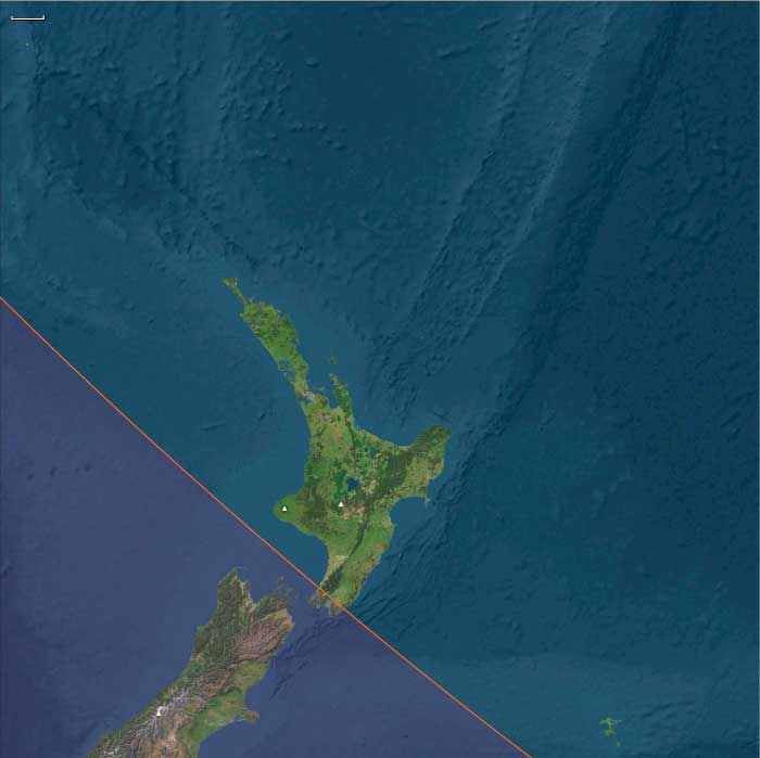
South Polynesia includes New Zealand’s North Island (except its southwestern tip), the Chatham Islands, Norfolk Island, and the Kermadec Islands. Anchors include the Waikato basin, the Bay of Islands, the volcanic spine of the Central Plateau (Tongariro, Taupō, Taranaki), the Northland peninsulas, the Chatham Islands’ cool oceanic plains, Norfolk’s basalt soils and pines, and the volcanic Kermadecs. The subregion spans temperate to subtropical zones, supporting horticulture, rich fisheries, and diverse coastal ecologies.
Climate & Environmental Shifts
The North Island enjoyed reliable rainfall, though droughts periodically afflicted its east coast. Volcanic activity persisted (e.g., Tongariro and White Island eruptions). The Chatham Islands, further east, had cooler, wetter conditions, limiting kūmara cultivation. Norfolk and the Kermadecs were uninhabited but noted by passing Polynesian voyagers and later Europeans. Storms and occasional cyclones swept the coasts, shaping settlement patterns and resource use.
Subsistence & Settlement
-
Māori (North Island): Cultivated kūmara, taro, yams, and gourds; fern root and forest birds supplemented diets. Fishing and shellfish gathering were central. Fortified pā (hilltop strongholds) anchored communities, and large waka (canoes) enabled transport and warfare.
-
Moriori (Chathams): Practiced marine-based subsistence—fishing, birding, root crops, and foraging—with a pacifist ethos that emphasized nonviolence and resource balance.
-
Norfolk & Kermadecs: Uninhabited in this era, but Norfolk’s fertile land and towering pines attracted later European interest; the Kermadecs served as occasional stopovers for voyagers and whalers.
Technology & Material Culture
-
Māori technologies: Double-hulled canoes (waka hourua), intricate wood carving, flax weaving, stone adzes, and greenstone (pounamu) tools and weapons. By the early 19th century, muskets, iron, and European textiles entered Māori material culture.
-
Moriori lifeways: Light canoes adapted to the Chathams’ conditions; plaited mats, wood tools, and fishhooks reflected maritime adaptation.
-
Introductions: European iron nails, axes, and muskets—obtained through trade with whalers and sealers—reshaped Māori society, especially warfare.
Movement & Interaction Corridors
-
Polynesian networks: Inter-iwi exchange flourished across the North Island, while Māori voyagers interacted with the Chathams.
-
European arrival: Abel Tasman (1642) and James Cook (1769) mapped coasts; from the late 18th century, sealers, whalers, and traders frequented the Bay of Islands and Hauraki Gulf.
-
Missionary stations: From 1814, the London Missionary Society established missions in the Bay of Islands, spreading Christianity, literacy, and new crops.
-
Trade: Māori exchanged timber, flax, pork, and food for muskets, iron tools, and cloth.
Cultural & Symbolic Expressions
-
Māori society: Structured by kin groups (iwi, hapū), prestige (mana), and ancestral authority (tapu). Carved meeting houses, oral whakapapa (genealogies), and oratory in marae embodied identity.
-
Moriori ethos: Centered on peace and environmental balance, with communal rituals and oral traditions preserving identity.
-
European influences: Christian teachings and literacy began to take hold, though Māori selectively incorporated them into existing frameworks.
Environmental Adaptation & Resilience
-
Māori: Terracing, kūmara storage pits, and careful microclimate selection expanded horticulture’s reach. Coastal and riverine fisheries buffered against crop failures.
-
Moriori: Relied on fishing and birding to adapt to the Chathams’ cooler climate.
-
Cultural resilience: Kinship and reciprocity stabilized food sharing; oral traditions reinforced stewardship of land and sea.
Political & Military Shocks
-
Māori intertribal conflict: Warfare was endemic but intensified dramatically after the introduction of muskets in the early 19th century, sparking the “Musket Wars” and mass displacements.
-
European incursions: Cook’s voyages (1769–77) opened sustained European contact; whalers and sealers established shore stations, often disrupting local ecologies.
-
Missionaries: Introduced new belief systems and literacy, reshaping cultural landscapes.
-
Norfolk & Kermadecs: Observed by European navigators as potential bases but not yet colonized.
Transition
Between 1684 and 1827, South Polynesia was a dynamic world of Māori horticultural intensification, Moriori maritime resilience, and mounting European contact. The Bay of Islands became a hub of trade and cultural exchange, missions introduced Christianity and literacy, and muskets revolutionized Māori conflict. Norfolk and the Kermadecs remained marginal but strategically noted by explorers. By 1827, the region stood on the threshold of colonization, with Indigenous societies resilient yet deeply altered by global trade, warfare, and missionary influence.
Sir John Call, MP for Callington in 1784 and a partner in the Pybus and Son banking house, had argued the advantages of Norfolk Island in that it is uninhabited and that flax grows there.
The British government includes Norfolk Island as an auxiliary settlement, as proposed by Call, in its plan for colonization of New South Wales in 1786.
The decision to settle Norfolk Island is taken due to the decision by Empress Catherine of Russia to restrict sales of hemp.
Practically all the hemp and flax required by the Royal Navy for cordage and sailcloth is imported from Russia.
Philip Gidley King was born at Launceston, Cornwall, England on April 23, 1758.
Joining the Royal Navy at the age of twelve as captain's servant, he had been commissioned as a lieutenant in 1778.
King had served under Arthur Phillip, who had chose him as second lieutenant on HMS Sirius for the expedition to establish a convict settlement in New South Wales.
On arrival, in January 1788, King had been selected to lead a small party of fifteen convicts and seven free men to set up a settlement at Norfolk Island, nearly a thousand miles (sixteen hundred kilometers) distant, and prepare for its commercial development as a second station for transported convicts.
King and his party land on March 6, 1788, with difficulty, owing to the lack of a suitable harbor, and set about building huts, clearing the land, planting crops, and resisting the ravages of grubs, salt air and hurricanes.
More convicts and soldiers are sent to the island from New South Wales during the first year of the settlement, which is also called "Sydney" like its parent.