Spanish navigator and geographer Juan de la …
Years: 1500 - 1500
Spanish navigator and geographer Juan de la Cosa, having sailed with Christopher Columbus on his second voyage and with Alonso de Ojeda to the northeastern coast of South America in 1499-1500, produces a world map showing the discoveries in the New World.
A line of text on the map says it was made by the Cantabrian cartographer and sailor Juan de la Cosa in 1500 in the Andalusian port city of Puerto de Santa María.
Its rich decoration hints that it was ordered by some powerful member of the court of the Catholic Monarchs, who rules the kingdoms of Castile and Aragon at this time.
This map is the earliest undisputed representation of the Americas.
Some historians have claimed that some of the Antilles appear on earlier maps such as the Pizzigano map of 1424 but there is no consensus about it.
Furthermore, the Vinland map shows part of North America but it is most probably fake.
The La Cosa map shows the lands discovered up to the end of the fifteenth century by Castilian, Portuguese and English expeditions to America.
It also depicts a large fraction of the Old World, according to the style of medieval portolan charts and including news of the arrival of Vasco de Gama to India in 1498.
The map of Juan de la Cosa is the only cartographic work made by an eyewitness of the first voyages of Christopher Columbus to the Indies that has been preserved Possibly as an allusion to Columbus, it contains a large image of Saint Christopher that covers the region where Central America should have appeared.
On the other hand, Cuba is drawn as an island, which contradicts Columbus' opinion that it was a peninsula of Asia.
The map (the earliest such that survives) includes the Caribbean Sea and records John Cabot's voyage to Canada and Vasco da Gama's route to India.
Locations
People
Groups
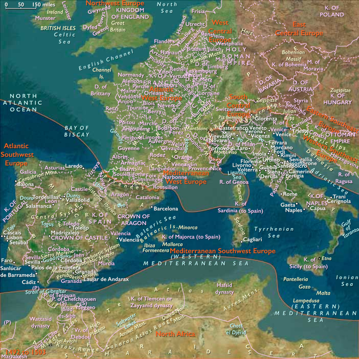
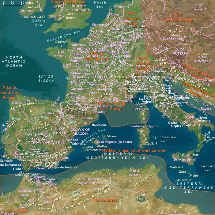
- Aragon, Crown of
- Castile, Crown of
- Portugal, Avizan (Joannine) Kingdom of
- Portuguese Empire
- England, (Tudor) Kingdom of
- Cuba (Spanish Colony)
Topics
Subjects
Regions
Subregions
Years: 1500 - 1500
Locations
People
Groups
- Aragon, Crown of
- Castile, Crown of
- Portugal, Avizan (Joannine) Kingdom of
- Portuguese Empire
- England, (Tudor) Kingdom of
- Cuba (Spanish Colony)
Topics
Subjects
Regions
Subregions