Southern Australasia (1540–1683 CE): Fire Landscapes, Seasonal…
1540 CE to 1683 CE
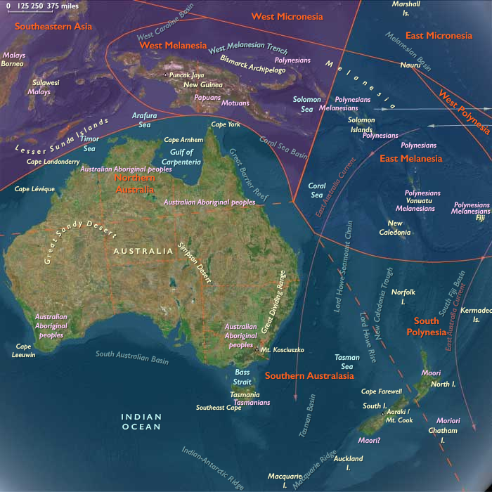
Southern Australasia (1540–1683 CE): Fire Landscapes, Seasonal Rounds, and Greenstone Trails
Geography & Environmental Context
Southern Australasia includes the southern two thirds of Australia—New South Wales, Victoria, South Australia, southern and central Western Australia and Queensland, southern Northern Australia, and Tasmania—together with New Zealand’s South Island and the extreme southwest of the North Island. Anchors include the Murray–Darling Basin, the Great Dividing Range, the Victorian Alps, the Flinders Ranges, the karri forests of southwestern Australia, the Tasmanian highlands, the Canterbury Plains, the Southern Alps, and the fjords of Fiordland in New Zealand. The subregion encompasses riverine plains, temperate forests, semi-arid scrub, alpine zones, and long coastlines rich in estuaries and fisheries.
Climate & Environmental Shifts
The region’s climate ranged from Mediterranean-type regimes in southwestern Australia, to temperate seasonal cycles in southeastern Australia and New Zealand, to cool maritime climates in Tasmania. The Little Ice Age brought colder winters, increased frost risk, and intensified rainfall in parts of New Zealand, while El Niño–Southern Oscillation cycles created alternating droughts and floods across southeastern Australia. Bushfires and seasonal storms regularly reshaped landscapes, reinforcing the importance of mobility and ecological management.
Subsistence & Settlement
Indigenous communities maintained diverse, regionally adapted systems:
-
Southeastern Australia (Victoria, New South Wales): The Gunditjmara constructed extensive stone channels and weirs to trap and farm eels, creating one of the world’s oldest known engineered aquaculture systems. Elsewhere, mobility followed yam harvests, kangaroo hunts, and seed gathering.
-
Tasmania: The Palawa moved seasonally between inland wallaby hunting and coastal seal and bird harvesting, supplemented by shellfish and roots. Firestick farming shaped open hunting grounds.
-
South and Western Australia: Groups harvested yams and tubers, hunted kangaroos and emus, and relied heavily on estuarine fisheries.
-
New Zealand (South Island, southwest North Island): Ngāi Tahu cultivated kūmara in the warmer north, while further south relied on fern root, birds, and seasonal expeditions into Fiordland for pounamu (greenstone), crucial for tools and prestige. Coastal pā (fortified villages) combined horticulture with marine harvests.
Technology & Material Culture
Material culture reflected ecological adaptation:
-
Stone tools included ground-edge axes in Australia and polished pounamu adzes in New Zealand.
-
Fishing technologies—stone weirs, eel traps, woven nets—were highly developed.
-
Canoes and rafts: Bark canoes in Australia, while New Zealanders built large waka taua for warfare and trade.
-
Clothing and ornamentation: Fur and feather cloaks in New Zealand, possum- and kangaroo-skin cloaks in Australia, kelp carriers in Tasmania.
-
Carving and art: Rock engravings in Australia marked ceremonial sites, while carved pounamu ornaments in New Zealand embodied sacred and social meaning.
Movement & Interaction Corridors
-
Australia: Seasonal gatherings at eel harvests, bogong moth hunts in the Alps, and coastal feasts facilitated exchange of ochre, stone, and ritual knowledge. Songlines guided mobility across country, embedding cosmology in geography.
-
Tasmania: Coastal–inland circuits balanced marine and terrestrial resources, reinforcing kin ties.
-
New Zealand: Trails carried pounamu from Fiordland quarries to North Island communities, embedding it in long-distance exchange. Canoe routes linked pā along coasts, sustaining trade and raiding networks.
-
No sustained European presence occurred in this period, but Dutch voyagers sighted southern Australia in the early 1600s, while Tasman charted New Zealand in 1642, leaving both oral memories and new vulnerabilities.
Cultural & Symbolic Expressions
-
Australia: The Dreaming (Tjukurpa) structured cosmology and law, with ceremonies of song, dance, and painting reaffirming ancestral connections. Fire was not just ecological management but also spiritual practice.
-
Tasmania: Rituals tied to hunting, gathering, and seasonal change reinforced kinship bonds; story and performance linked people to land and sea.
-
New Zealand: Whakapapa (genealogy) connected communities to gods and ancestors. Marae life anchored ritual, with haka, chants, and carving reinforcing identity and mana. Pounamu was both sacred and practical, embodying ancestral power.
Environmental Adaptation & Resilience
-
Firestick farming in Australia sustained grasslands, yams, and hunting grounds while reducing wildfire risk.
-
Aquatic engineering—eel channels and fish traps—stabilized food supply in Victoria and along rivers.
-
Food preservation (smoked eels, dried birds, fern root cakes) buffered seasonal shortages.
-
Mobility and diversification enabled adaptation to drought, frost, or flood.
-
Exchange and redistribution through feasts and kin networks created resilience in both ecological and social systems.
Transition
Between 1540 and 1683, Southern Australasia was marked by resilience, ingenuity, and deeply embedded cultural landscapes. Fire, water, and stone framed lifeways: fire maintained ecologies, eel channels and fish traps supported semi-sedentary economies, and pounamu linked New Zealand to ritual and exchange. Though still largely insulated from global intrusions, the first fleeting sightings by Dutch navigators foreshadowed future encounters. This age closed with indigenous societies still rooted in ancestral systems, yet the wider world was beginning to stir just beyond the horizon.
Groups
Topics
Subjects
Regions
Australasia
View →Subregions
