Event
Upper South Asia (28,557–7,822 BCE): Late Pleistocene…
Upper South Asia (28,557–7,822 BCE): Late Pleistocene II — Monsoon Weakening, River Refugia, and the Reorganization of the Subcontinental Interior
Geographic and Environmental Context
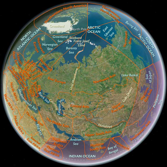
During the interval from 28,557 to 7,822 BCE, Upper South Asia extended from Afghanistan and the Indus basin eastward across northern and central India, Nepal, Bhutan, Bangladesh, and into northwestern Myanmar.
Its principal environmental systems included the Hindu Kush and adjoining Afghan highlands; the Indus and its tributaries; the Baluchistan and northwestern uplands within the atlas boundary; the Thar Desert and its margins; the Punjab plains; the Ganges basin; the Vindhyan and central Indian plateaus; the Himalayan foothills; the Brahmaputra and Bengal lowlands; the Chindwin valley; and the northern Kachin and Arakan mountain margins.
This was not a single climatic province.
It combined glaciated mountain ranges, cold uplands, semi-arid steppe, monsoonal woodland, river plains, seasonal grasslands, tropical forest margins, and vast lowstand coastal landscapes.
Climate and Environmental Shifts
During the Last Glacial Maximum, approximately 24,500–17,000 BCE, much of Upper South Asia was cooler and generally drier than today.
The summer monsoon weakened.
Mountain glaciers expanded in the Hindu Kush, Himalaya, and adjoining high ranges, while snowlines descended.
Across the northwest, dry grassland, scrub, and semi-arid environments expanded.
The Thar Desert became more arid during many phases, though river and lake conditions continued to fluctuate locally.
Farther east, forest cover contracted in some regions but persisted in wetter refugia.
The Ganges and Brahmaputra systems remained broad habitable corridors despite changing rainfall.
After the LGM, temperatures rose and mountain glaciers gradually retreated.
The Indian summer monsoon strengthened unevenly.
River discharge increased in many regions, vegetation expanded, and wetlands became more important.
The Bølling–Allerød, approximately 12,700–10,900 BCE, was defined in the North Atlantic, but South Asian responses were expressed primarily through changing monsoon intensity and regional circulation.
Many records indicate stronger monsoonal conditions relative to the preceding glacial phase.
The Younger Dryas, approximately 10,900–9,700 BCE, coincided with weaker monsoon conditions in many South Asian records.
Some areas became drier, lake levels and river discharge changed, and vegetation contracted locally.
The Thar, Indus, Ganges, Himalayan foothills, and Bengal basin did not respond identically.
After about 9,700 BCE, stronger early-Holocene monsoon systems transformed much of the subregion.
Rivers expanded, wetlands grew, forests and woodland advanced, and some lake basins refilled.
The overall trajectory was from cold, relatively dry glacial environments toward a warmer and increasingly monsoonal early-Holocene world.
Human Presence
Modern humans had occupied South Asia for tens of thousands of years before this band began.
The interval therefore represents long-term continuity through climatic change, not initial settlement.
Human communities occupied river valleys, caves and rockshelters, upland plateaus, lake margins, desert-edge environments, and forest margins.
Population density was uneven.
Reliable water became especially important during dry phases.
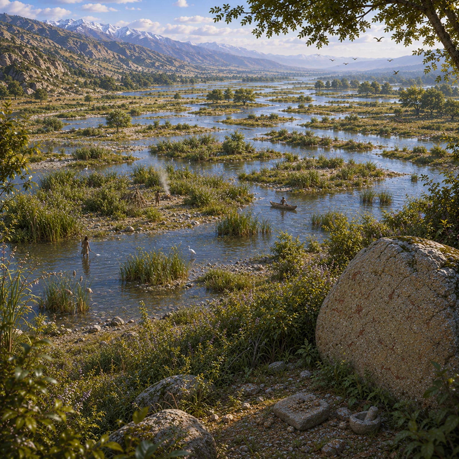
Major rivers repeatedly served as ecological refugia and movement corridors through otherwise unstable landscapes.
Afghanistan and the Hindu Kush
Afghanistan formed the northwestern highland gateway of the subregion.
The Hindu Kush and adjoining ranges experienced expanded glaciation, colder valleys, and stronger seasonal contrasts.
Human occupation concentrated in lower valleys, caves, foothills, and river corridors.
Wild sheep, goats, equids, deer, and smaller game contributed to subsistence, while plant use varied with elevation.
These highlands also connected South Asia with Iran and Central Asia.
They should not be imagined as permanent transcontinental highways.
Movement followed ecological opportunity, seasonal conditions, and passability.
The Indus Basin
The Indus system remained one of the principal arteries of human life.
Its tributaries crossed environments ranging from mountain valleys to semi-arid plains.
Human groups exploited riverine vegetation, freshwater resources, grazing animals, floodplain plants, and nearby uplands.
The lower Indus looked very different from its modern deltaic form.
During low sea level, the coastline lay much farther seaward and broad areas of the modern continental shelf were dry land.
As postglacial seas rose, these lowlands were progressively drowned.
A substantial portion of the Late Pleistocene coastal archaeological record is therefore likely submerged.
Thar and Northwestern Drylands
The Thar Desert and adjoining drylands became more arid during portions of the LGM.
They were never uniformly lifeless.
People occupied palaeolake margins, river channels, springs, foothills, and seasonal wetlands.
Animal communities included combinations of gazelle, antelope, wild cattle, equids, and smaller mammals.
Human mobility was essential because water availability shifted repeatedly.
Desert margins expanded and contracted with monsoon strength.
The northwestern landscape should therefore be understood as a dynamic dryland mosaic rather than a fixed desert.
Central Indian Plateaus
Central India contained extensive uplands, river valleys, and rockshelter landscapes.
The Vindhyan and adjoining regions offered stone raw materials, caves and shelters, grassland, woodland, and seasonal watercourses.
Human communities exploited diverse terrestrial resources.
Lithic traditions changed progressively through the Late Pleistocene rather than through one abrupt technological replacement.
These plateaus also provided refugial landscapes during phases of climatic stress.
Rockshelters preserve especially rich records, but their archaeological visibility should not be mistaken for permanent cave settlement.
The Ganges Basin
The Gangetic plain formed one of the largest riverine systems in the subregion.
Its channels shifted repeatedly, while floodplains, oxbows, wetlands, and seasonal inundation created changing concentrations of resources.
Human communities exploited deer, wild cattle, boar, smaller mammals, fish, turtles, waterbirds, seeds, fruits, tubers, and other foods.
By the close of the band, increasingly diversified riverine foraging is appropriate.
The later fame of Ganges Mesolithic cemeteries and settlements should not be projected wholesale backward into this interval.
Mature later Mesolithic settlement systems still lay ahead.
Himalayan Foothills, Nepal, and Bhutan
The Himalayan foothills created strong ecological gradients between plains and high mountains.
During glacial phases, colder conditions pushed vegetation zones downward.
As warming progressed, forests shifted upslope and changed composition.
Human use likely concentrated in lower valleys, terraces, river corridors, and sheltered foothills.
The highest elevations remained demanding environments and should not be imagined as densely and continuously occupied throughout the band.
Nepal and Bhutan formed part of the transition between the Gangetic lowlands and Tibetan Plateau.
Valleys and lower slopes provided freshwater, forest resources, game, and plant foods.
Postglacial warming opened additional upland habitats.
Because the archaeological record remains relatively sparse, elaborate or uniform technological systems should not be assigned to these mountain populations.
The Brahmaputra–Bengal Lowlands
The Brahmaputra–Ganges–Meghna system created one of South Asia’s most dynamic lowland environments.
During glacial low sea level, the Bay of Bengal coastline lay much farther south.
The modern delta did not yet exist in recognizable form.
Rivers crossed broad exposed plains before reaching the sea.
As sea level rose, lower valleys were drowned, estuaries migrated inland, sediments accumulated rapidly, and wetlands shifted repeatedly.
This constantly reworked the human landscape.
Much archaeological evidence may now lie beneath later alluvium or offshore sediments.
Northwestern Myanmar
The Chindwin valley, northern Arakan, and Kachin margins formed the eastern edge of Upper South Asia.
These landscapes connected the subcontinent with mainland Southeast Asia.
They included humid valleys, limestone and upland shelters, tropical and subtropical forest, and major river corridors.
Human economies differed substantially from those of the Indus or Thar.
Forest plants, small and medium game, river resources, and tropical woodland environments played larger roles.
This sector should be understood as a South Asian–Southeast Asian ecological hinge.
Subsistence and Settlement
For most of the band, Upper South Asian populations remained mobile or seasonally mobile foragers.
Subsistence varied enormously.
Resources included deer, gazelle and antelope, wild cattle, wild sheep and goats in the northwest, boar, smaller mammals, birds, fish, turtles, freshwater shellfish, seeds, nuts, fruits, roots, and tubers.
Different environments encouraged very different seasonal strategies.
No single subsistence model can characterize the subregion.
Repeated use of productive river, lake, or rockshelter settings did not imply permanent village settlement.
Technology and Material Culture
One of the most important technological developments was the increasing importance of small stone implements and microlithic technologies in many areas.
Their chronology was regional.
Microlithic forms appeared before the Holocene in some contexts and became more widespread later.
Small backed pieces could serve as components of composite tools, improving raw-material efficiency and supporting flexible hunting technologies.
This should not be described as one instantaneous subcontinental “microlithic revolution.”
Larger flake and blade tools continued alongside smaller forms.
Grinding and pounding equipment occurred where plant processing was important.
Wood, bamboo, fiber, hide, bone, resin, and other organic materials also formed major parts of everyday technology but preserve poorly.
Plant Intensification Without Farming
Wild plant foods became increasingly important in many environments.
People gathered and processed grasses, seeds, legumes, fruits, nuts, and tubers.
Grinding and pounding equipment could support intensive use of these resources.
Intensive gathering is not the same as cultivation.
By 7,822 BCE, Upper South Asia remained primarily a forager landscape.
The evidence does not support established cereal agriculture across either the Indus or Ganges plains.
Mehrgarh and the Chronological Boundary
The early farming settlement of Mehrgarh belongs after this interval.
Its earliest Neolithic occupation is generally placed in the seventh millennium BCE, beyond 7,822 BCE.
The processes that eventually contributed to village agriculture in the northwestern subcontinent had deeper roots in earlier plant use, hunting, mobility, and exchange.
Mehrgarh itself, however, should not be pulled backward into Late Pleistocene II.
Likewise, there was no established regional economy based on domesticated sheep, goats, or cattle by the close of this band.
Lowstand Coasts and Sea-Level Rise
Postglacial sea-level rise transformed both the Arabian Sea and Bay of Bengal margins.
The Arabian Sea advanced across the lower Indus shelf.
The Bay of Bengal moved inland across broad lowstand plains.
River mouths shifted, estuaries formed, and coastal wetlands developed.
Former human landscapes disappeared beneath the sea.
The archaeological record therefore disproportionately preserves inland sites while much coastal activity remains inaccessible.
Movement and Connectivity
Upper South Asia contained major natural corridors.
These included the Indus, Ganges, Brahmaputra, Narmada and adjoining central routes near the atlas boundary, Kabul and other Afghan river valleys, Himalayan foothill belts, and Chindwin valley.
Mountain passes connected Afghanistan with Central Asia and Iran.
Eastern river and mountain corridors connected the subcontinent with Southeast Asia.
These were pathways of movement, interaction, and ecological opportunity long before formal trade systems existed.
Human Diversity and Population Change
Upper South Asia contained long-established and regionally differentiated populations.
Connections extended west toward Iran, northwest toward Central Asia, north toward Himalayan and Tibetan margins, and east toward Southeast Asia.
The region also retained strong internal continuity.
Postglacial population change involved repeated local expansion, contraction, and interaction rather than one simple replacement event.
Later linguistic identities cannot be securely projected backward into these populations.
Cultural and Symbolic Expressions
Pigment, ornamentation, rock art, deliberate treatment of the dead, and selected objects demonstrate symbolic and social complexity in different parts of Upper South Asia.
South Asia preserves extensive prehistoric rock art, especially in central Indian shelters.
Precise dating of many paintings and engravings remains difficult.
The famous later painted sequences of sites such as Bhimbetka should not be assigned wholesale to this band.
The evidence is best described as longstanding symbolic traditions with uncertain individual chronologies.
Later religious or named ethnographic traditions should not be projected backward into this deep chronology.
Environmental Adaptation and Resilience
Human resilience rested on the ability to use radically different environments.
Northwestern populations moved through arid plains, palaeolakes, and mountain valleys.
Gangetic communities used river and wetland systems.
Central Indian populations occupied plateaus, valleys, and shelter landscapes.
Eastern groups exploited humid forests and river corridors.
As monsoon strength weakened and recovered, people adjusted camp locations, prey choice, plant use, and seasonal mobility.
The common adaptation was ecological flexibility rather than one technological or subsistence package.
Transition
By 7,822 BCE, Upper South Asia had emerged from LGM cold and dryness into a warmer and increasingly monsoonal early-Holocene world.
Mountain glaciers had retreated.
River and wetland systems had expanded across many districts.
The Thar and northwest remained environmentally variable.
Central and eastern landscapes became increasingly wooded.
Microlithic technologies were important in many areas, though never universal.
Human communities exploited increasingly diverse combinations of terrestrial, aquatic, and plant resources.
Yet the subregion remained fundamentally hunter-gatherer.
There were no established farming villages comparable to later Mehrgarh, no regional cereal agriculture, and no pastoral economy.
At the close of the band, Upper South Asia was a vast and deeply inhabited mosaic of mountain valleys, river plains, drylands, forests, wetlands, and submerged former coasts—reorganized by monsoon recovery and sea-level rise, but still a world of flexible foragers rather than farmers.
-
{# Image navigates to the detail page; the magnifying-glass chip is the only Fancybox lightbox trigger (kept a separate sibling — anchors can't nest). #}
 The Great Crossroads
World
-
{# Image navigates to the detail page; the magnifying-glass chip is the only Fancybox lightbox trigger (kept a separate sibling — anchors can't nest). #}
 South Asia
Region
-
{# Image navigates to the detail page; the magnifying-glass chip is the only Fancybox lightbox trigger (kept a separate sibling — anchors can't nest). #}
 Upper South Asia
Subregion