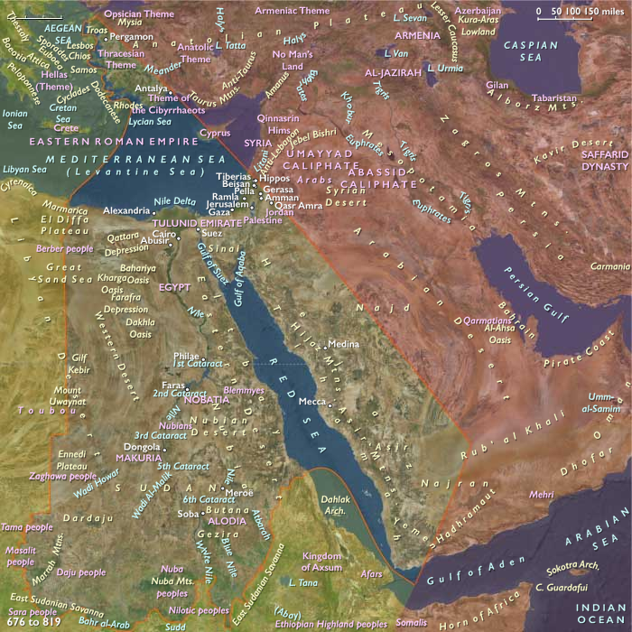
Near East (909 BCE–819 CE) River Kingdoms,…
909 BCE to 819 CE
Near East (909 BCE–819 CE)
River Kingdoms, Maritime Coasts, Sacred Landscapes, and Arabian Caravan Corridors
Geographic and Environmental Context
The Near East comprises Egypt and the Nile Valley; Sudan north of the central Nile bend; Israel; western Jordan; western Saudi Arabia including the Hejaz and Tihāmah; western Yemen; Tyre on the southern Levantine coast; southwestern Cyprus; and the western Anatolian littoral from the Troad through Aeolis, Ionia, Lydia, Caria, Lycia, and Doris.
Its enduring geography is organized around several complementary environmental systems rather than a single civilization.
- the annually renewed Nile floodplain and Delta
- the eastern Mediterranean coast
- the western Anatolian Aegean littoral
- the Sinai, Negev, Arabah, and eastern desert corridors
- the Red Sea coastal route
- the Hejaz oasis chain
- the terraced highlands of western Yemen
- the Nubian Nile corridor
- southwestern Cyprus and its maritime connections
These landscapes remained remarkably stable throughout the entire period while political authority changed repeatedly.
Environmental Systems
The Nile continued to support one of the world's most productive agricultural landscapes through predictable inundation, canal maintenance, basin irrigation, and intensive cultivation.
Across western Anatolia, deeply indented coastlines, protected harbors, fertile river valleys, and nearby islands encouraged dense maritime settlement and continual interaction across the Aegean.
Southern Levantine agriculture depended upon winter rainfall, spring-fed valleys, olive groves, vineyards, grain fields, and careful water management.
Arabian societies adapted through oasis agriculture, wells, cisterns, mountain terraces, and seasonal movement between deserts, uplands, and coastal plains.
Western Yemen remained among Arabia's richest agricultural regions through sophisticated terracing and runoff capture that supported high population densities despite an arid climate.
The Red Sea linked African and Arabian coasts into a single commercial system long before political unification.
Human Adaptation
Communities responded to these contrasting environments through specialized but interconnected economies.
The Nile supported intensive grain agriculture, flax cultivation, papyrus harvesting, orchards, fisheries, river transport, and large permanent settlements.
Western Anatolia combined olive cultivation, vineyards, cereals, fishing, timber, ceramics, and maritime commerce.
The southern Levant balanced mixed farming with pastoralism across ecological gradients from Mediterranean hills to semi-arid steppe.
Arabia depended upon caravan transport, oasis cultivation, incense production, mountain agriculture, camel pastoralism, and seasonal mobility.
Nubia integrated river agriculture with pastoralism, mining, and long-distance exchange along the Nile corridor.
Exchange Networks
Throughout the millennium, the Near East functioned as one of Eurasia's principal crossroads.
The Nile served as one of history's great transportation corridors.
The Aegean connected western Anatolia, Cyprus, Egypt, and the wider Mediterranean.
The Red Sea joined Egypt, Arabia, East Africa, and eventually the Indian Ocean.
Overland caravan routes carried incense, spices, gold, ivory, wine, olive oil, grain, papyrus, glass, textiles, metals, and ceramics between Africa, Arabia, and the Mediterranean.
Rather than replacing one another, these maritime, riverine, and desert networks increasingly overlapped over time.
Institutional Development
Political authority shifted repeatedly, yet institutions accumulated rather than disappearing.
The period witnessed the succession of Iron Age kingdoms, Phoenician city-states, Greek poleis, Persian satrapies, Hellenistic monarchies, Roman provinces, Byzantine administration, and finally the Islamic caliphates.
Religious institutions likewise evolved from ancient Egyptian temples, Levantine sanctuaries, Greek civic cults, and Arabian shrines into Jewish rabbinic communities, Christian patriarchates and monasteries, and ultimately Islamic mosques and scholarly centers.
Urban life expanded gradually through ports, caravan cities, administrative capitals, pilgrimage centers, monasteries, market towns, and agricultural villages rather than solely through monumental capitals.
Long-Term Historical Development
Between 909 BCE and 819 CE the Near East experienced one of history's greatest sequences of political transformation.
Iron Age kingdoms gave way to imperial incorporation under Assyria, Babylon, and Persia.
Greek colonization along western Anatolia was followed by the Hellenistic kingdoms established after Alexander's conquests.
Roman and later Byzantine administration integrated Egypt, the Levant, Cyprus, and western Anatolia into a durable Mediterranean imperial system whose roads, ports, taxation, and urban institutions reshaped regional society.
During Late Antiquity Christianity spread throughout Egypt, the Levant, Cyprus, Nubia, and western Anatolia, creating dense landscapes of churches, monasteries, pilgrimage routes, and episcopal administration.
Beginning in the seventh century, Islam unified Arabia before expanding across the Levant and Egypt, redirecting political authority toward Damascus and later Baghdad while preserving many existing agricultural and commercial systems. Arabic gradually became the principal language of administration and commerce as Islamic institutions became increasingly embedded within older environmental and economic networks.
Throughout these changes, the Nile, the Aegean coast, the Levantine shoreline, the Red Sea, and the Arabian caravan corridors remained the enduring framework upon which every successive civilization depended.
Legacy of the Epoch
By 819 CE the Near East had become a mature interconnected landscape of river agriculture, maritime commerce, caravan exchange, pilgrimage, scholarship, and urban institutions extending from Nubia to western Anatolia and from the Mediterranean to the Arabian highlands.
Its political rulers had changed many times, but its environmental systems, exchange corridors, and patterns of human adaptation had produced one of the world's most continuous historical landscapes. The civilizations of pharaohs, Phoenician merchants, Greek city-states, Persian governors, Hellenistic monarchs, Roman administrators, Byzantine bishops, and early Islamic caliphs all emerged from—and remained constrained by—the same enduring geography.
People
Groups
Commodities
Subjects
Regions
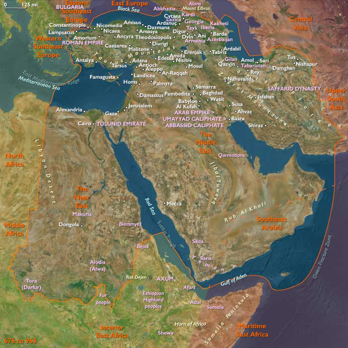
The Near and Middle East
View →Subregions