Srivijaya, Malay kingdom of
State | Defunct
600 CE to 1400 CE
Srivijaya is a powerful ancient thalassocratic Malay empire based on the island of Sumatra, modern day Indonesia, which influences much of Southeast Asia.
Srivijaya is an important center for Buddhist expansion in the 8th to 12th centuries.
In Sanskrit, sri means "fortunate", "prosperous", or "happy" and vijaya means "victorious" or "excellence".
The earliest evidence of its existence dates from the 7th century; a Chinese monk, Yijing, wrote that he visited Srivijaya in 671 for 6 months.
The first inscription in which the name Srivijaya appears also dates from the 7th century, namely the Kedukan Bukit inscription around Palembang in Sumatra, dated 16 June 682 Between late 7th to early 11th century Srivijaya rises to become hegemon in Southeast Asia, involved in close interactions — often rivalries — with neighboring Java, Kambuja and Champa.
Srivijaya's main foreign interest is nurturing lucrative trading rights with China spanning from the Tang to Song eras.
Srivijaya also has religious, cultural and trading links with the Buddhist Pala Empire of Bengal, also having relations with Islamic Caliphate in the Middle East.
The kingdom ceases to exist in the 13th century due to various factors, including the expansion of the Javanese Majapahit empire.
After Srivijaya falls, it is largely forgotten, historians not having even considered that a large united kingdom could have been present in Southeast Asia.
The existence of Srivijaya was only formally suspected in 1918, when French historian George Coedès of the École française d'Extrême-Orient postulated its existence.
The aerial photograph taken in 1984 revealed the remnants of man-made ancient canals, moats, ponds, and artificial islands in Karanganyar site in Palembang suggested the location as Srivijaya urban center.
Several artifacts such as fragments of inscription, Buddhist statues, beads, pottery and Chinese ceramics were found, confirming that the area was once a dense human habitation.
By 1993, Pierre-Yves Manguin had proven that the center of Srivijaya was along the Musi River between Bukit Seguntang and Sabokingking (situated in what is now Palembang, South Sumatra, Indonesia).
In 2013, archaeological research led by University of Indonesia discovered some extensive religious and habitation sites in Muaro Jambi archaeological site, and suggested that the initial center of Srivijaya was located in Muaro Jambi Regency, Jambi Province in Batanghari river bank, instead of Palembang in Musi river bank.
Worlds
The Far East
View →Related Events
Showing 10 events out of 80 total
Southeast Asia (909 BCE – 819 CE): Monsoon Networks, Bronze Drums, and the Birth of Maritime Kingdoms
Regional Overview
By the dawn of the first millennium BCE, Southeast Asia had already begun to crystallize as the great crossroads of the Old World tropics.
Inland, the rice kingdoms of the Mekong, Chao Phraya, and Red River valleys emerged from the metallurgy and village confederations of the Bronze–Iron Age.
Seaward, the Andaman–Malay–Sumatran and Philippine–Bornean worlds turned the monsoon into an empire of routes, connecting India, China, and Oceania.
The entire region was defined by rhythm — the breathing of wind and water — in which farming, trade, and belief all synchronized to the turning of the monsoon.
Geography and Environment
The geography of Southeast Asia forms two great environmental theaters.
On the mainland, broad alluvial plains—Mekong, Chao Phraya, Irrawaddy, Red River—fed dense populations, while surrounding hills and plateaus nurtured metals and forest goods.
The insular and peninsular zones, stretching from the Malay Peninsula to Java, Sumatra, Borneo, Sulawesi, and the Philippine arcs, fused equatorial rainforest with coral coasts and volcanic fertility.
Farther west, the Andaman–Nicobar–Aceh corridor linked Bay of Bengal and Indian Ocean worlds, its islands and capes functioning as the hinges between South and East Asia.
Climatically, a regular monsoon pattern dominated: rains from May to October, dry trade-wind seasons from November to April. This stability made intensive wet-rice cultivation possible and guaranteed predictable sailing cycles—the dual engines of Southeast Asia’s rise.
Societies and Political Development
Mainland Southeast Asia
In the first millennium BCE, Bronze Age chiefdoms such as the Dong Son culture of the Red River valley forged regional identities through warfare, metallurgy, and ceremony. Their massive bronze drums, decorated with solar and aquatic motifs, became symbols of power from Vietnam to Borneo.
By the early centuries CE, irrigated rice systems underpinned early proto-states:
-
Funan in the Mekong delta—an entrepôt absorbing Indian trade and ideas;
-
Dvaravati in the Chao Phraya basin—Mon-speaking city-states blending Buddhism and local animism;
-
early Cham centers along the central Vietnamese coast, the maritime ancestors of later Hindu–Shaiva kingdoms;
-
and upland polities in Myanmar and Laos that balanced trade, salt, and forest exchange.
These societies fused Indigenous agrarian traditions with Indic and Sinic influences carried by merchants, monks, and artisans, producing hybrid languages of kingship and ritual that would define the classical kingdoms of later centuries.
Insular and Maritime Southeast Asia
Across the seas, communities in Java, Sumatra, Borneo, Sulawesi, and the Philippines evolved from Lapita-descended or Austronesian roots into settled horticultural and trading societies.
By the early first millennium CE, Iron-Age ports and coastal chiefdoms had appeared, their rulers mediating between inland farmers and overseas merchants.
On the Malay Peninsula, small harbors such as Kedah and Tambralinga became staging points for India–China traffic.
In Sumatra, fertile volcanic valleys and river deltas supported rice and pepper cultivation, while estuarine towns gathered forest resins, camphor, and gold.
In the Philippines, barangay polities combined boat-based clans with agricultural villages, forming fluid, maritime societies.
Andamanasia
At the western margin, Andamanasia—the Andamans, Nicobars, and northern Sumatran islands—was a liminal zone where Austronesian voyagers, Bay-of-Bengal traders, and forest foragers met.
Aceh and Nias sustained canoe chiefdoms trading resin, shells, and turtle shell for iron and beads from India; the Nicobars became vital relay stations between Sri Lanka and the Malay world.
The Andamans, by contrast, preserved independent hunter-gatherer cultures, holding their forests and reefs against encroachment.
Economy and Exchange
Everywhere, rice was the foundational crop, but economic vitality lay in diversity: rice in the floodplains, millet and tubers in uplands, sago and coconut in the islands, and marine protein along every coast.
Metals—bronze and later iron—spread from mining centers in northern Vietnam and central Thailand through trade networks that reached Sumatra and Java.
The monsoon trade carried spices, resins, camphor, tin, gold, and forest products westward toward India and the Mediterranean, and brought textiles, beads, and ceramics eastward in return.
Between these circuits, the maritime Austronesian seafarers of Borneo, the Philippines, and the Nicobars acted as indispensable intermediaries.
Technology and Material Culture
Iron tools and weapons revolutionized cultivation and warfare, enabling larger fields and more durable architecture.
Pottery traditions diversified; weaving and dyeing reached new complexity.
In navigation, plank-built outrigger canoes evolved into ocean-worthy ships using stitched or doweled planking and early lateen-type sails.
Bronze drums, metal jewelry, and stone statuary embodied both artistry and cosmology—objects that spoke of rain, fertility, and solar power.
Belief and Symbolism
Spiritual life blended animism, ancestor worship, and cosmic dualism with imported Hindu-Buddhist and Chinese cosmologies.
Mountain peaks and rivers were divine; kingship was a sacred covenant between the fertility of land and the order of heaven.
In the islands, sea gods and canoe ancestors received offerings before voyages; in the deltas, spirits of rice and water guarded every harvest.
Temples, bronze drums, and standing stones were not only monuments but acoustic instruments of faith—their sound bridging human and divine worlds.
Adaptation and Resilience
Southeast Asian societies mastered monsoon risk through diversification and redundancy. Double cropping, tank irrigation, and arboriculture mitigated drought.
Trade dualities—coast and interior, wet and dry season—created flexible economies.
When flood or famine struck one zone, maritime mobility rerouted supply and ritual obligation ensured redistribution.
This environmental intelligence, codified in both custom and cosmology, sustained the region’s balance between land and sea.
Regional Synthesis and Long-Term Significance
By 819 CE, Southeast Asia stood as a mature interface between the agrarian civilizations of the Asian continent and the maritime worlds of the Indian Ocean and Pacific.
Its mainland river states were consolidating bureaucratic power through irrigation and writing, while its island chiefdoms managed global trade routes that would soon nurture the empires of Srivijaya and Angkor.
To the west, Andamanasia remained the connective hinge—a patchwork of forager enclaves and canoe polities linking two oceans.
The region’s unity lay not in empire but in pattern: monsoon cycles, rice terraces, and sea lanes repeated across thousands of kilometers.
Its natural divisions—continental floodplains, equatorial archipelagos, and coral-fringed channels—explain why Southeast Asia divides so clearly into its Sundachinese and Andamanasian subregions, each a reflection of the other: one grounded in the earth, the other in the sea.
Sundachina (909 BCE – 819 CE): Iron Age Chiefdoms and Proto-States
Geographic and Environmental Context
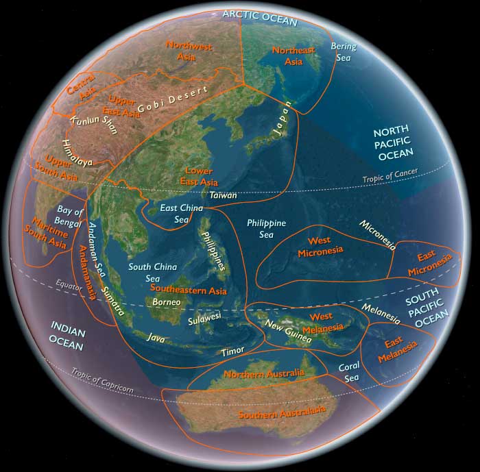
Sundachina includes southern and eastern Myanmar, Thailand, Cambodia, Laos, Vietnam, the Malay Peninsula, Sumatra (excluding Aceh and its western islands), Java, Borneo, Sulawesi, the Philippines, and surrounding archipelagos (Banda, Molucca, Ceram, Halmahera, Sulu seas).
-
Anchors: Mekong (Funan precursor states), Chao Phraya (Dvaravati), Red River (Dong Son chiefdoms), Java–Sumatra, Borneo–Philippines, Sulawesi–Moluccas.
Climate & Environmental Shifts
-
First-millennium monsoons variable but overall stable for agriculture.
Subsistence & Settlement
-
Large-scale rice irrigation; surplus agriculture supported towns.
-
Coastal polities emerged with complex harbors.
-
Trade and tribute economies expanded.
Technology & Material Culture
-
Iron tools; bronze ritual drums and ornaments.
-
Canoes evolved into seagoing vessels.
-
Pottery refined; weaving expanded.
Movement & Interaction Corridors
-
Maritime exchange tied Vietnam–Malay Peninsula–Java–Philippines.
-
Overland links to China and India intensified.
Cultural & Symbolic Expressions
-
Early Hindu-Buddhist influences from India; animist traditions persisted.
-
Bronze drums used in rituals and diplomacy.
Environmental Adaptation & Resilience
-
Irrigated agriculture and diversified economies buffered climate shocks.
Transition
By 819 CE, Sundachina was a landscape of Iron Age chiefdoms and proto-states, soon to evolve into the classical states we describe in 820–963 CE (Khmer, Srivijaya, Dvaravati, early Vietnam).
Sundachina (909–478 BCE)
Iron Age Chiefdoms and River-Valley Communities
Geographic and Environmental Context
Sundachina encompassed the river valleys, coastal lowlands, wetlands, forests, and island systems of mainland and maritime Southeast Asia, including the Mekong, Chao Phraya, Red River, Malay Peninsula, Java, Sumatra, Borneo, Sulawesi, and the Philippines.
Climate and Environmental Conditions
Stable monsoon systems supported expanding rice agriculture, wetland management, and river-based mobility.
Societies and Political Developments
Iron Age chiefdoms emerged across fertile river systems.
Communities remained locally organized through kinship, ritual authority, and regional exchange relationships.
Political power remained decentralized.
Economy and Subsistence
Rice agriculture expanded.
Fishing, wetland harvesting, arboriculture, and river transport formed the foundation of subsistence.
Bronze drums, iron tools, and exchange goods circulated between communities.
Movement and Interaction
River systems functioned as the primary movement corridors.
Maritime interaction remained regional rather than state-directed.
Cultural Expression
Ancestor traditions, animist practices, and bronze-drum ritual systems remained dominant.
Long-Term Significance
By 478 BCE Sundachina consisted of interconnected Iron Age chiefdoms whose agricultural and exchange systems laid the foundation for later proto-states.
Sundachina (477 BCE–243 CE)
Irrigation Expansion and Regional Exchange Networks
Geographic and Environmental Context
Sundachina encompassed the river valleys, coastal lowlands, wetlands, forests, and island systems of mainland and maritime Southeast Asia, including the Mekong, Chao Phraya, Red River, Malay Peninsula, Java, Sumatra, Borneo, Sulawesi, and the Philippines. River valleys, deltas, floodplains, coastal estuaries, and island corridors became increasingly interconnected.
Societies and Political Developments
Chiefdoms grew larger and more stable.
Regional centers emerged around irrigation systems, trade corridors, and fertile agricultural landscapes.
Economy and Exchange
Rice surpluses increased.
Trade linked:
- Red River systems
- Mekong systems
- Chao Phraya systems
- Maritime Southeast Asia
Exchange networks expanded across both land and sea.
Technology and Material Culture
Iron tools became widespread.
Bronze ritual traditions continued.
Seagoing vessels improved.
Cultural Expression
Ritual authority became increasingly organized.
Bronze drums remained important symbols of prestige and diplomacy.
Long-Term Significance
By CE 243 Sundachina possessed increasingly integrated agricultural and exchange landscapes linking mainland and maritime worlds.
Sundachina (244–675 CE)
Proto-States, Ritual Landscapes, and Indianized Networks
Geographic and Environmental Context
Sundachina encompassed the river valleys, coastal lowlands, wetlands, forests, and island systems of mainland and maritime Southeast Asia, including the Mekong, Chao Phraya, Red River, Malay Peninsula, Java, Sumatra, Borneo, Sulawesi, and the Philippines. River valleys, deltas, floodplains, coastal estuaries, and island corridors became increasingly interconnected.
Large river valleys, coastal estuaries, and maritime corridors became increasingly organized around proto-state centers.
Societies and Political Developments
The first recognizable proto-state landscapes emerged.
Early Funan-like systems, Dvaravati precursors, and expanding coastal polities organized regional exchange.
Economy and Exchange
Trade intensified with:
- India
- southern China
- island Southeast Asia
Ports became increasingly important.
Agricultural surpluses supported larger populations.
Cultural Expression
The first substantial Hindu-Buddhist influences appeared.
Animist traditions remained deeply embedded.
Ritual landscapes became more formalized.
Environmental Adaptation
Irrigation systems expanded.
Wetland management became increasingly sophisticated.
Long-Term Significance
By CE 675 Sundachina possessed mature proto-state landscapes built upon trade, agriculture, ritual authority, and expanding international connections.
Hindus from southern India settle Palembang, in southern Sumatra, before 600.
Srivijaya, centered in today’s Palembang, South Sumatra, launches a military expedition against Java, according to the seventh century Kota Kapur inscription; the period coincides with the decline of Tarumanagara.
It is very likely that the Taruma Kingdom is attacked and defeated by Srivijaya around 650 CE.
Tarumanegara's influence over its neighbors begins to decline after this.
Tarumanagara, an early Sundanese Indianized kingdom in Java, is divided in 669 into two kingdoms: Sunda Kingdom and Galuh Kingdom, with the Citarum river as the boundary.
The Galuh Kingdom comprises many vassal kingdoms that cover areas of present-day West and present-day Central Java Provinces.
King Tarusbawa then establishes a new capital of his kingdom near the Cipakancilan river upstream which centuries later will become the city of Pakuan Pajajaran (or shortly called Pakuan or Pajajaran).
King Tarusbawa becomes the predecessor of the Sunda kings.
Zhang Wen Ming, who had become a monk at age fourteen, is an admirer of Faxian and Xuanzang, both famed monks of his childhood.
Renamed Yijing and provided with funding by an otherwise unknown benefactor named Fong, he had decided to visit the renowned Buddhist university of Nālandā, in Bihar, India, to further study Buddhism.
Traveling by a Persian boat out of Guangzhou, he arrives in the capital of the partly Buddhist kingdom of Srivijaya (today's Palembang of Sumatra) after twenty-two days, where he spends the next six months learning Sanskrit grammar and Malay language.
He reports over a thousand Buddhist monks in residence.
He goes on to record visits to the nations of Melayu and Kiteh (Kedah), and in 673 after ten days additional travel reaches the "naked kingdom" (south west of Shu).
Yijing records his impression of the "Kunlun peoples", using an ancient Chinese word for Malay peoples.
"Kunlun people have curly hair, dark bodies, bare feet and wear sarongs."
Sundachina (676–819 CE)
Mature Proto-States and Maritime Exchange Worlds
Geographic and Environmental Context
Sundachina encompassed the river valleys, coastal lowlands, wetlands, forests, and island systems of mainland and maritime Southeast Asia, including the Mekong, Chao Phraya, Red River, Malay Peninsula, Java, Sumatra, Borneo, Sulawesi, and the Philippines. River valleys, deltas, floodplains, coastal estuaries, and island corridors became increasingly interconnected.
Southeastern Asia consisted of highly connected agricultural and maritime worlds linking mainland river systems with island trading networks.
Societies and Political Developments
Proto-states matured.
Political authority became increasingly institutionalized while remaining far less centralized than later Khmer, Srivijaya, or Vietnamese states.
Economy and Trade
Major exchange corridors linked:
- Mekong basin
- Chao Phraya basin
- Red River basin
- Java–Sumatra networks
- Malay Peninsula ports
- Philippine and Bornean maritime routes
Technology and Material Culture
Seagoing vessels expanded in sophistication.
Harbor systems became more organized.
Irrigation landscapes grew increasingly extensive.
Cultural Expression
Hindu-Buddhist influences became more visible.
Ritual landscapes matured.
Yet indigenous religious traditions remained integral.
Environmental Adaptation
Agricultural intensification, irrigation systems, and maritime redistribution networks supported large populations.
Long-Term Significance
By CE 819 Sundachina had become a landscape of mature proto-states, irrigation systems, ritual authority, and maritime exchange networks immediately preceding the classical states of the following age.