Mogollon culture
Culture | Defunct
150 CE to 1500 CE
The Mogollon is one of the four major prehistoric archaeological Oasisamerica culture areas of the American Southwest and Northern Mexico.
The American Indian culture known as the Mogollon lived in the southwest from approximately 150 until sometime between 1400 and 1450.
The name Mogollon comes from the Mogollon Mountains, which were named after Don Juan Ignacio Flores Mogollón, Spanish Governor of New Mexico from 1712-1715.
Worlds
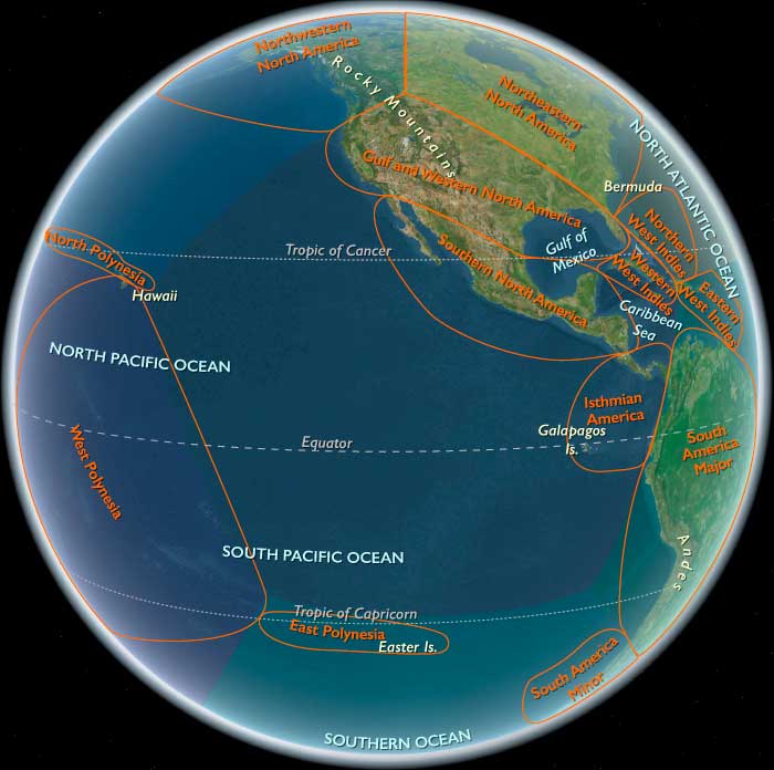
The Far West
View →Related Events
Showing 10 events out of 16 total
Gulf and Western North America (909 BCE – CE 819): Desert Cultures, Coastal Fisheries, and Trade Corridors
Geographic and Environmental Context
Gulf and Western North America includes Mississippi, Louisiana, Arkansas, Texas, Oklahoma, Kansas, New Mexico, Colorado, Wyoming, Arizona, Utah, Nevada, all of California except the far northwest, all of Florida except the extreme northeast, southwestern Georgia, most of Alabama except the far northeast, southwestern Tennessee, Little Egypt in Illinois, southwestern Missouri, most of Nebraska except the far northeast, southeastern South Dakota, southern Montana, southern Idaho, and southeastern Oregon.
-
The subregion encompasses deserts such as the Sonoran and Chihuahuan, fertile river basins like the Lower Mississippi and Rio Grande, the Gulf of Mexico coastline, and Pacific coastal zones in California.
-
Diverse environments supported equally diverse cultural adaptations.
Climate and Environmental Shifts
-
Climates ranged from humid subtropical along the Gulf Coast to arid and semi-arid in the interior deserts, with Mediterranean conditions in coastal California.
-
Seasonal rainfall patterns shaped agricultural and foraging cycles.
-
Droughts, floods, and hurricanes influenced settlement patterns and subsistence strategies.
Societies and Political Developments
-
In the Lower Mississippi Valley, mound-building cultures such as those ancestral to the Coles Creek and later Mississippian traditions were emerging.
-
The Southwest was home to Ancestral Puebloan (Anasazi) forebears in upland zones and Hohokam precursors in desert river valleys.
-
Along the Pacific coast, maritime-oriented communities relied on fishing, shellfish gathering, and trade.
-
Plains-adjacent areas saw mobile hunting and foraging peoples with seasonal camps.
Economy and Trade
-
Agriculture in river valleys produced maize, squash, and beans, supplemented by wild plant gathering and hunting.
-
Gulf Coast communities engaged in fishing, shellfish collection, and the production of shell ornaments.
-
California coastal peoples exploited rich fisheries and traded acorns, shell beads, and stone tools.
-
Inland trade moved obsidian, turquoise, shells, and foodstuffs between ecological zones.
Subsistence and Technology
-
Irrigation canals supported agriculture in desert areas such as the lower Gila River region.
-
Dugout and plank canoes were used for fishing and transport along coasts and large rivers.
-
Ground stone tools, pottery, and woven textiles were produced for daily use and exchange.
Movement and Interaction Corridors
-
The Mississippi River and its tributaries linked Gulf Coast communities to inland markets.
-
The Rio Grande and Colorado River provided access between uplands and lowlands.
-
Coastal routes along both the Gulf and Pacific shores facilitated trade between settlements and with distant regions.
Belief and Symbolism
-
Ritual life often centered on mound complexes, rock art sites, and ceremonial plazas.
-
Symbolic representations of animals, celestial bodies, and fertility themes appeared in pottery and carvings.
-
Ceremonial gatherings reinforced alliances and redistributed surplus resources.
Adaptation and Resilience
-
Communities combined farming, foraging, and fishing to buffer against environmental uncertainty.
-
Seasonal mobility allowed access to varied resource zones.
-
Interregional trade ensured availability of essential and prestige goods even during local shortages.
Long-Term Significance
By CE 819, Gulf and Western North America was a mosaic of interconnected cultures ranging from agricultural chiefdoms to mobile hunter-gatherers, linked by complex trade and communication networks spanning coasts, deserts, and river valleys.
Early Mogollón culture, a tradition of settled agriculturists and ceramics producers, begins to flourish about 100 in the mountain areas of west central New Mexico and east central Arizona.
The Basketmaker II and Mogollón cultures engage in trade.
People of the Late Basket Maker II culture experiment with a crude form of brown pottery in the middle of the period, about CE 200.
Excavated items from this period include good quality, tightly woven baskets; woven yucca bags, sandals and blankets; robes and blankets made of feather and fur; stone projectile points, scrapers and knives; atlatl and throwing spears (the main tools for hunting); bone stitching awls, whistles, and gaming pieces; cord made from yucca and cedar bark; oval-shaped cradles; and stone pipes.
The cultural groups of this period include: the Anasazi of southern Utah, southern Colorado, northern Arizona and northern and central New Mexico; the Hohokam of southern Arizona; and the Mogollon of southeastern Arizona, southern New Mexico and northern Mexico.
The Uto-Aztecan speakers of Arizona’s Mogollón Hills establish maize-growing techniques imported from the South.
The Pueblo and Mogollón cultures have settled in separate areas of central New Mexico by about 800.
Gulf and Western North America (820 – 963 CE): Mound-Builders, Chaco Flourishing, and California’s Canoe Chiefs
Geographic and Environmental Context
Gulf and Western North America includes: Mississippi, Louisiana, Arkansas, Texas, Oklahoma, Kansas, New Mexico, Colorado, Wyoming, Arizona, Utah, Nevada, nearly all of California (except far northwest), Florida (except the Jacksonville corridor), southwestern Georgia, most of Alabama (except Huntsville corner), southwestern Tennessee, southern Illinois (Little Egypt), southwestern Missouri, most of Nebraska (except northeast around Omaha), southeastern South Dakota, southern Montana, southern Idaho, southeastern Oregon.
-
Anchors: Lower Mississippi towns (Plaquemine precursors), Natchez bluffs, Gulf fisheries (Calusa, Pensacola), Southern Plains nodes (early Spiro), Chaco Canyon great houses, Hohokam canals in Salt–Gila basin, Mogollon Rim, Great Basin foragers, California coast (Chumash Channel Islands, Sacramento–San Joaquin wetlands).
Climate and Environmental Shifts
-
Benefited from the Medieval Warm Period: ample rainfall on the Mississippi bottomlands, supporting maize expansion; drought cycles more subdued than in later centuries.
-
Southwest: ideal for canal irrigation and Chaco aggregation.
-
California: steady oak acorn harvests and rich marine productivity.
Societies and Political Developments
-
Mississippian precursors: maize cultivation expanded; Plaquemine and Caddoan mound centers rose in the lower Mississippi.
-
Southern Plains: early mound activity at Spiro foreshadowed its later role.
-
Southwest: Chaco Canyon reached its zenith, with great houses, roads, and ritual centers (850–1130).
-
Hohokam irrigated villages flourished, cultivating maize, cotton, beans.
-
Mogollon and Sinagua villages dotted uplands.
-
California: Chumash chiefdoms expanded; tomol plank canoes connected Channel Islands to mainland.
-
Great Basin: highly mobile foragers harvested seeds, hunted rabbits, and traded obsidian.
Economy and Trade
-
Maize surpluses redistributed at mound centers.
-
Chaco trade: turquoise, macaws, copper bells from Mesoamerica.
-
Hohokam cotton & shells exported widely.
-
Chumash shell beads spread along Pacific.
-
Great Basin obsidian and salt linked desert to Puebloan centers.
Belief and Symbolism
-
Mound cosmologies tied earth/sky/underworld.
-
Chaco ritual kivas, astronomical alignments structured calendars.
-
Chumash cosmology tied celestial navigation to canoe exchange.
Long-Term Significance
By 963, the region contained Mississippian precursors, Chaco’s great houses, Hohokam canals, and Chumash maritime chiefdoms, forming a continental crossroads of exchange and ritual.
Gulf and Western North America (964 – 1107 CE): Mississippian Expansion, Chaco Networks, and Hohokam Intensification
Geographic and Environmental Context
Gulf and Western North America includes: Mississippi, Louisiana, Arkansas, Texas, Oklahoma, Kansas, New Mexico, Colorado, Wyoming, Arizona, Utah, Nevada, nearly all of California (except far northwest), Florida (except the Jacksonville corridor), southwestern Georgia, most of Alabama (except Huntsville corner), southwestern Tennessee, southern Illinois (Little Egypt), southwestern Missouri, most of Nebraska (except northeast around Omaha), southeastern South Dakota, southern Montana, southern Idaho, southeastern Oregon.
-
Anchors: Mississippi mound centers (Cahokia rising east of the Mississippi, Etowah, Moundville, Spiro), Lower Mississippi towns, Chaco Canyon, Hohokam irrigation basin, Great Basin deserts, and California Channel coast.
Climate and Environmental Shifts
-
Warm centuries supported maize boom and mound-building.
-
Chaco Canyon at peak (1050–1130).
-
California’s fisheries and oak savannas highly productive.
Societies and Political Developments
-
Cahokia flourished across the river to the east but influenced Gulf chiefdoms (Etowah, Spiro, Moundville).
-
Natchez/Plaquemine peoples expanded in Lower Mississippi.
-
Spiro mound in Oklahoma grew as ritual–trade hub.
-
Chaco Canyon great houses flourished; extended road system.
-
Hohokam expanded irrigation networks; villages grew denser.
-
Mogollon–Sinagua persisted as mixed-farming towns.
-
Chumash advanced bead currency economy.
-
Great Basin intensified pinyon nut reliance.
Economy and Trade
-
Mississippian exchange: shell gorgets, copper, ceremonial pipes.
-
Chaco: turquoise, obsidian, macaws.
-
Hohokam: cotton, irrigation produce, shell jewelry.
-
California: shell beads as currency; fish and acorns.
-
Great Basin: salt, obsidian into Pueblo markets.
Belief and Symbolism
-
Southeastern Ceremonial Complex imagery (birdman, serpent).
-
Chaco kivas central to ritual.
-
Chumash cosmology elevated canoe chiefs as celestial navigators.
Long-Term Significance
By 1107, Mississippian chiefdoms thrived; Chaco orchestrated vast ritual economies; Hohokam irrigation peaked; Chumash shell currency expanded, tying Pacific to interior exchange.
Gulf and Western North America (1108 – 1251 CE): Mound Apex, Puebloan Shifts, and Pacific Bead Economies
Geographic and Environmental Context
Gulf and Western North America includes: Mississippi, Louisiana, Arkansas, Texas, Oklahoma, Kansas, New Mexico, Colorado, Wyoming, Arizona, Utah, Nevada, nearly all of California (except far northwest), Florida (except the Jacksonville corridor), southwestern Georgia, most of Alabama (except Huntsville corner), southwestern Tennessee, southern Illinois (Little Egypt), southwestern Missouri, most of Nebraska (except northeast around Omaha), southeastern South Dakota, southern Montana, southern Idaho, southeastern Oregon.
-
Anchors: Lower Mississippi centers (Natchez, Plaquemine), Etowah–Moundville–Spiro, Ancestral Pueblo towns (Mesa Verde, Chaco remnants, Kayenta), Hohokam Salt–Gila canals, Great Basin foragers, and California Chumash–Central Valley chiefdoms.
Climate and Environmental Shifts
-
Late Medieval Warm Period supported large harvests until early droughts struck the Southwest (~1200).
-
Mississippi flood cycles affected mound-town stability.
-
California remained agriculturally stable.
Societies and Political Developments
-
Mississippian apex: Cahokia’s zenith (~1200) influenced Gulf networks; Natchez, Etowah, Moundville, and Spiro flourished.
-
Puebloan transition: Chaco in decline; Mesa Verde and other pueblos aggregated into larger cliff dwellings and plazas.
-
Hohokam irrigation continued but faced salinity and water stress.
-
California Chumash: complex chiefdoms expanded canoe trade.
-
Great Basin foragers adjusted mobility under aridity.
Economy and Trade
-
Mississippian exchange: copper, shells, ceremonial art.
-
Pueblo trade: turquoise, pottery, obsidian.
-
Hohokam: cotton textiles, shell ornaments.
-
Chumash: shell beads as currency across Pacific coast.
-
Great Basin: obsidian and salt into Pueblo trade.
Belief and Symbolism
-
Mississippian ceremonial complex at peak.
-
Pueblo IV rituals emerging; katsina cult forming.
-
Chumash canoe cults and celestial bead cosmologies.
Long-Term Significance
By 1251, Gulf & Western North America displayed a dense Mississippian mound world, transitioning Puebloans, stressed Hohokam irrigation, and a thriving Chumash currency economy, prefiguring 14th-century reorganization.
Pueblo people are believed to have descended from the Anasazi, Mogollon, and other ancient peoples.
These influences are seen in the architecture, farming style, and artistry of the Acoma.
The Anasazi abandon their canyon homelands in the early thirteenth century due to climate change and social upheaval.
For upwards of two centuries, migrations have occurred in the area, and Acoma Pueblos emerges by the thirteenth century.
This early founding date makes Acoma Pueblo one of the earliest continuously inhabited communities in the United States.
A Western Keres-speaking community develops a pueblo settlement, from about 1200, at Acoma, located eighty-four miles (one hundred and thirty-five kilometers) west of present Albuquerque.
The pueblo settlement itself is perched atop a sandstone mesa that rises three hundred and fifty-seven feet (one hundred and nine meters) above the valley floor; the community’s irrigated fields of maize, beans, and squash are located below the mesa approximately twelve miles (nineteen kilometer) away at Acomita.
Gulf and Western North America (1252 – 1395 CE): Mississippian Chiefdoms, Pueblo IV Transformations, and Pacific Networks
Geographic and Environmental Context
Gulf and Western North America includes: Mississippi, Louisiana, Arkansas, Texas, Oklahoma, Kansas, New Mexico, Colorado, Wyoming, Arizona, Utah, Nevada, nearly all of California (except far northwest), Florida (except the Jacksonville corridor), southwestern Georgia, most of Alabama (except Huntsville corner), southwestern Tennessee, southern Illinois (Little Egypt), southwestern Missouri, most of Nebraska (except northeast around Omaha), southeastern South Dakota, southern Montana, southern Idaho, southeastern Oregon.
-
Anchors: the Lower Mississippi mound towns (Natchez, Plaquemine, Lower Yazoo), the Gulf Coast plain (Mobile Bay, Pensacola, Calusa in Florida), the Southern Plains (Texas–Oklahoma–Kansas grasslands), the Southwest cultural areas (Pueblo IV towns in New Mexico/Arizona, Hohokam canal villages in the Salt/Gila valleys, Mogollon Rim, Sinagua in central Arizona), the Great Basin (Utah–Nevada), the Rocky Mountain fringes (Colorado Plateau), and the California coast and valleys (Sacramento–San Joaquin, Chumash coast, Channel Islands).
Climate and Environmental Shifts
-
Onset of the Little Ice Age (~1300) brought drier conditions in the Southwest and Great Basin, contributing to Puebloan migrations and reorganization.
-
The Mississippi valley experienced periodic flooding, shaping mound-town settlement cycles.
-
California’s diverse microclimates supported acorn economies, salmon fisheries, and shell bead industries.
Societies and Political Developments
-
Mississippian chiefdoms:
-
Cahokia’s decline left successor towns along the Lower Mississippi and Gulf; Natchez and Plaquemine peoples maintained mound-centered polities.
-
Chiefdoms at Etowah (Georgia) and Spiro (Oklahoma) thrived into this period as ritual and trade hubs.
-
-
Gulf Coast: Calusa in southwest Florida dominated coastal estuaries through fishing and tribute.
-
Southwest:
-
Ancestral Puebloans entered the Pueblo IV era: aggregation into larger towns (Zuni, Hopi mesas, Rio Grande pueblos).
-
Hohokam continued large-scale irrigation in the Salt and Gila basins, though drought and salinization strained systems.
-
Mogollon and Sinagua reorganized into fewer, larger settlements with walled plazas and kivas.
-
-
Great Basin & Rockies: mobile foraging groups adapted to aridity, with intensified seed gathering and pinyon nut use.
-
California:
-
Chumash maintained complex chiefdoms on the Santa Barbara Channel coast, with plank canoes (tomols) connecting Channel Islands to the mainland.
-
Central Valley and Bay Area groups (Miwok, Ohlone ancestors) organized into tribal confederacies supported by salmon runs and acorn harvests.
-
Economy and Trade
-
Mississippian exchange networks circulated shell gorgets, copper plates, stone pipes, and maize surpluses across the Southeast and Plains.
-
Spiro mound (Oklahoma) acted as a ceremonial redistribution hub linking Plains bison products with Mississippian prestige goods.
-
Southwest: turquoise, obsidian, macaws, cotton cloth moved through trade networks reaching into Mesoamerica.
-
California: shell beads (especially Olivella) from the Channel Islands became a pan-regional currency; tomolcanoe trade expanded.
-
Great Basin: salt, obsidian, and rabbit-skin textiles moved between foraging bands and Puebloan centers.
Belief and Symbolism
-
Mississippian Southeastern Ceremonial Complex persisted: birdman, falcon dancer, underworld serpent imagery linked to elite regalia.
-
Pueblo IV ritual life centered on kiva ceremonies, katsina cults, and painted murals.
-
Chumash cosmology tied canoe voyaging and bead exchange to the celestial order.
-
Calusa ritual chiefs wielded power through ancestor shrines and sacred war bundles.
Adaptation and Resilience
-
Mississippian chiefdoms shifted centers frequently to adapt to flooding, soil depletion, or factional conflict.
-
Puebloans aggregated for defense and water management, creating plazas and mesa-top towns.
-
California economies diversified: acorn granaries, salmon fisheries, and shell currency insulated against shocks.
-
Great Basin foragers broadened subsistence with pine nuts and small-game hunting.
Long-Term Significance
By 1395, Gulf & Western North America had diversified political landscapes:
-
Mississippian mound towns anchored the Southeast and lower Mississippi.
-
Spiro and Etowah linked Plains to Mississippian ritual economies.
-
Pueblo IV communities and Hohokam canal towns restructured the Southwest.
-
Chumash chiefdoms and California bead economies integrated Pacific coastal peoples.
-
Across all zones, the subregion acted as a continental hinge: maize, turquoise, copper, shells, and ritual ideologies flowed between Mesoamerica, the Plains, the Mississippi world, and the Pacific coast.