Roman Empire, Western (Ravenna)
State | Defunct
402 CE to 476 CE
The Western Roman Empire refers to western half of the Roman Empire.
Administrative division of the sprawling Empire into West and East with co-emperors for each begins under Diocletian in 285 and is periodically abolished and recreated for the next two centuries until final abolishment by Zeno in 480.
By this time there is little effective control left in the Western Empire.A Western Roman Empire exists intermittently in several periods between the 3rd and 5th centuries, after Diocletian's Tetrarchy and the reunifications associated with Constantine the Great and Julian the Apostate (324–363).
Theodosius I divides the Empire upon his death (in 395) between his two sons.
Eighty-five years later, Zeno recognizes the reality of the Western Empire's reduced domain (Imperial control had been lost over even the Italian Peninsula) after the death of Western Emperor Julius Nepos and rules as sole emperor.The rise of Odoacer of the Foederati to rule over Italy in 476 was popularized by eighteenth century historian Edward Gibbon as a demarcating event for the end of the Western Empire and is still used today to mark the transition from Antiquity to the Middle Ages.The ongoing struggle between the rising Papacy and the retreating empire leads the Pope to unilaterally declare the Frankish King Charlemagne to be the successor of the Western Emperors in 800.
This new imperial line will evolve in time into the Holy Roman Empire, but is in no meaningful sense an extension of Roman traditions or institutions.
After 924 it is also a primarily Germanic empire that contains little of the former territory of the Western Roman Empire.
Worlds
The Middle of The Earth
View →Related Events
Showing 10 events out of 507 total
This period is therefore referred to as the Roman Iron Age.
The Roman provinces, whose frontiers stop short of Denmark, nevertheless maintain trade routes and relations with Danish or proto-Danish peoples, as attested by finds of Roman coins.
The earliest known runic inscription dates back to about CE 200.
In recent times some of these bog bodies have emerged very well-preserved, providing valuable information about the religion and people who lived in Denmark during this period.
Some of the most well-preserved bog bodies from the Nordic Iron Age are the Tollund Man and the Grauballe Man.
The Germanic Iron Age begins with the fall of the Roman Empire and the rise of the Celtic and Germanic kingdoms in Western Europe.
It is followed, in Northern Europe and Scandinavia, by the Viking Age.
During the decline of the Roman Empire, an abundance of gold flows into Scandinavia; there are excellent works in gold from this period.
Gold is used to make scabbard mountings and bracteates.
After the Western Roman Empire falls, gold becomes scarce and Scandinavians begin to make objects of gilded bronze, with decorative figures of interlacing animals.
In the EGIA, the decorations tended to be representational—the animal figures are rather faithful anatomically; in the LGIA, they will tend to be more abstract or symbolic—intricate interlaced shapes and limbs.
The LGIA in the eighth century blends into the Viking Age and the proto-historical period, with legendary or semi-legendary oral tradition recorded a few centuries later in the Gesta Danorum, heroic legend and sagas, and an incipient tradition of primary written documents in the form of runestones.
Depletion of cultivated land in the last century BCE seems to have contributed to increasing migrations in northern Europe and increasing conflict between Teutonic tribes and Roman settlements in Gaul.
Roman artifacts are especially common in finds from the first century.
It seems clear that some part of the Danish warrior aristocracy served in the Roman army.
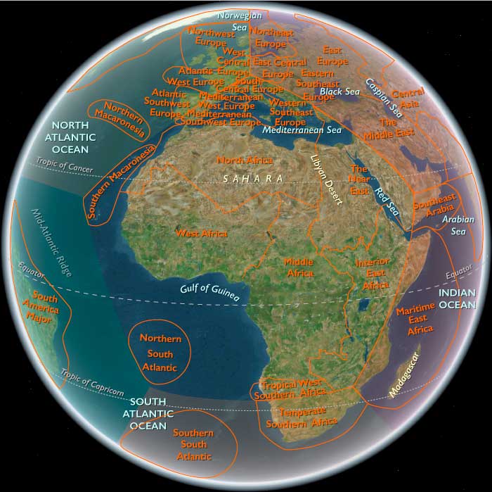
Southwest Europe (909 BCE – 819 CE): From Roman Seas to Mountain Kingdoms
Regional Overview
Between the wine-dark coasts of the western Mediterranean and the storm-swept bays of the Atlantic, Southwest Europe bridged the worlds of classical empire and early medieval kingdom.
From the Po Valley and Sicilian ports to the Cantabrian uplands and Galician headlands, it was a region of deep historical layering — Roman legacies enduring beneath Lombard strongholds, Visigothic courts, and the early Christian monarchies of Iberia.
By the early ninth century CE, the Mediterranean and Atlantic spheres were diverging yet intertwined: one turning toward the Byzantine–Islamic maritime system, the other toward Carolingian and Asturian frontiers that would shape Europe’s western destiny.
Geography and Environment
Southwest Europe is defined by its dual maritime faces — the Mediterranean littoral of Italy, Sicily, Sardinia, and southeastern Iberia, and the Atlantic–Cantabrian rim of northern Spain and Portugal.
Volcanic uplands, mountain arcs (the Apennines and Cantabrians), and fertile basins like the Po Valley and Douro formed alternating belts of abundance and refuge.
A Mediterranean climate dominated the south and east: wet winters, hot summers, and dependable harvests of grain, vines, and olives.
Along the Atlantic, milder and wetter conditions favored forests, pastures, and fisheries.
Rivers — Po, Tiber, Douro, Tagus, and Ebro — were arteries of settlement and trade, linking inland towns to their maritime outlets.
Societies and Political Developments
Mediterranean Core: From Empire to Maritime Republics
In Italy and the central Mediterranean, the dissolution of Roman order yielded a mosaic of powers.
Byzantine administrators retained control over southern Italy, Sicily, and Malta, while Lombard duchies dominated the interior.
Ports such as Naples, Venice, and Palermo emerged as autonomous or semi-autonomous nodes in the seaborne networks that connected Europe to the Byzantine and Islamic worlds.
Further west, Visigothic Hispania maintained tenuous unity until the early eighth century, when the Umayyad conquest (711 CE) reshaped Iberia’s Mediterranean coast.
Atlantic Uplands: Christian Refuge and Frontier Consolidation
North of the Ebro, the Kingdom of Asturias consolidated resistance in the mountain bastions of Galicia and León.
Its rugged geography favored small, defensible communities and itinerant courts rather than expansive bureaucracy.
Along the Galician and Portuguese coasts, fishing villages and riverine settlements survived upheaval by turning outward — trading timber, salt, and grain northward to Brittany and the Channel.
These Atlantic zones preserved older Roman and Celtic traditions while integrating Christian monasticism and the emerging pilgrimage cult of St. James, whose shrine at Compostela would later knit western Christendom together.
Economy and Trade
The region’s economy remained diverse and regionally specialized.
-
Mediterranean Southwest Europe continued the Roman pattern of intensive agriculture: grain, vines, olives, and citrus along irrigated lowlands, complemented by pottery, glassware, textiles, and metalwork in coastal workshops.
-
Maritime commerce bound the Tyrrhenian and Adriatic cities to North Africa, the Levant, and Byzantine Greece, exchanging oil, wine, salt, and spices.
-
In Atlantic Southwest Europe, mixed farming and transhumant pastoralism supported highland communities, while fisheries, salt pans, and shipyards sustained coastal trade.
The Rhone and Po valleys served as inland corridors to Central Europe, while the Douro and Tagus linked Iberia’s uplands to the Atlantic.
Technology and Material Culture
Roman engineering remained the skeleton of the landscape: aqueducts, roads, and terraced farms continued in use long after imperial authority waned.
In the Lombard and Byzantine zones, stone fortifications and church complexes dominated townscapes.
Shipbuilding flourished: Mediterranean galleys with lateen sails and Atlantic cogs adapted to rougher seas both expanded in sophistication.
Water mills powered flour production in Alpine and Galician valleys, while terraced vineyards and olive groves reclaimed slopes once abandoned during late antiquity.
Belief and Symbolism
Christianity unified this fragmented world while expressing regional diversity.
The Papacy in Rome and the monasteries of Monte Cassino and Cluny (just beyond this region’s northern edge) revitalized learning and administration.
In Iberia, Christian identity crystallized through resistance to Islamic rule; monasteries in Asturias and Galicia became bastions of literacy and art.
Across the Mediterranean coasts, Byzantine mosaics and basilicas echoed Rome’s sacred heritage, while Sicilian and Sardinian churches absorbed eastern iconography.
In all lands, sacred geography — from the pilgrim roads of Compostela to the tombs of saints and martyrs — replaced imperial capitals as centers of meaning.
Adaptation and Resilience
The fusion of agricultural stability, maritime trade, and religious cohesion gave Southwest Europe remarkable resilience.
The Mediterranean cities adapted through commerce and diplomacy, sustaining continuity amid invasion; the Atlantic uplands relied on self-sufficiency, kinship, and geography to survive as Christian enclaves.
Environmental flexibility — terrace farming, irrigation, diversified herding — ensured survival through droughts and political shocks alike.
Regional Synthesis and Long-Term Significance
By 819 CE, Southwest Europe embodied the meeting of three worlds:
-
The Byzantine–Mediterranean East, linked through Italian ports and island fortresses;
-
The Islamic South, newly established in Iberia and Sicily;
-
The Frankish and Christian North, consolidating in the Pyrenees and the Loire.
This region’s mountain refuges, fortified coasts, and enduring cities preserved Roman infrastructures while incubating new cultural forms — Christian monastic learning, Lombard law, and seafaring enterprise.
It was here, along these seas and uplands, that Europe’s western Mediterranean civilization survived the disintegration of empire and prepared for the revival of the medieval Mediterranean world that would follow.
Mediterranean Southwest Europe (909 BCE – CE 819): Maritime Cities, Mountain Frontiers, and Cultural Crossroads
Geographic and Environmental Context
Mediterranean Southwest Europe includes Italy (together with Sardinia and Sicily), Malta, Southeastern Spain, and the Balearic Islands.
-
The subregion features the Italian Peninsula, volcanic uplands such as Mount Etna and Vesuvius, the Apennines, fertile river plains like the Po Valley, and extensive Mediterranean coastlines.
-
Its strategic islands and ports made it a focal point for maritime trade and naval power in the central and western Mediterranean.
Climate and Environmental Shifts
-
A Mediterranean climate with wet winters and dry summers favored vineyards, olive groves, and grain cultivation.
-
Seasonal rainfall variability could impact agricultural yields, prompting the use of irrigation in some areas.
-
Volcanic activity occasionally disrupted local economies but also enriched soils.
Societies and Political Developments
-
The early medieval centuries saw the transition from Late Roman provincial governance to the Byzantine administration in parts of southern Italy and the islands, and the rise of Lombard rule in much of the peninsula.
-
Coastal Spain experienced both Visigothic and, after 711 CE, Umayyad control.
-
Maritime cities such as Naples, Venice, and Palermo became vital trade hubs, with varying degrees of autonomy under larger political powers.
-
Malta and the Balearics were contested by Byzantine, North African, and Iberian interests.
Economy and Trade
-
Agriculture produced grain, wine, olive oil, fruits, and vegetables for local use and export.
-
Craft industries produced pottery, glassware, and metalwork.
-
Maritime trade linked the subregion to North Africa, the Levant, and Atlantic Europe, carrying goods such as spices, textiles, and precious metals.
-
The Po Valley and other fertile plains supplied surplus grain to urban markets.
Subsistence and Technology
-
Terrace farming on steep slopes maximized cultivation of vines and olives.
-
Roman-era aqueducts and irrigation systems remained in use in many areas.
-
Shipbuilding flourished in coastal cities, with vessels adapted for both trade and warfare.
Movement and Interaction Corridors
-
The Mediterranean Sea served as the principal conduit for commerce and cultural exchange.
-
Alpine passes connected northern Italy to transalpine trade routes into West Central Europe.
-
Coastal shipping routes linked Italian and Spanish ports to island markets and North African harbors.
Belief and Symbolism
-
Christianity was the dominant faith, with the Papacy in Rome exerting significant spiritual and political influence.
-
Monasteries, cathedrals, and churches served as cultural centers, preserving classical learning and fostering the arts.
-
Religious architecture and mosaics reflected a blend of Roman, Byzantine, and local traditions.
Adaptation and Resilience
-
Economic diversity across agriculture, trade, and crafts provided resilience against localized crises.
-
Coastal defenses and fortified hill towns protected against raids, especially from seaborne attackers.
-
Control of strategic straits and ports ensured influence over maritime traffic.
Long-Term Significance
By CE 819, Mediterranean Southwest Europe was a maritime and cultural hub bridging western Europe, the Byzantine world, and North Africa, maintaining continuity with its Roman past while adapting to shifting political realities.
North Africa (909 BCE – 819 CE) Early Iron and Antiquity — Phoenicians and Carthage, Numidian–Mauretanian Kingdoms, Rome, Garamantes, and Late Antique Transitions
Geographic and Environmental Context
North Africa includes Morocco, Algeria, Tunisia (Ifriqiya), Libya (Tripolitania–Fezzan–Cyrenaica), and Western Sahara.Anchors: the Atlas ranges (High/Middle/Anti-Atlas; Tell Atlas; Aurès), the Tell and Sahel coasts (Atlantic Morocco, Rif/Alboran, Kabylia, Ifriqiya, Syrte/Gulf of Sidra, Cyrenaica), the Saharan platforms and sand seas (Erg Chech, Grand Erg Occidental & Oriental, Tanezrouft), the oases and basins (Tafilalt, Draâ, Touat–Gourara–Tidikelt, M’zab, Wadi Igharghar, Fezzan (Wadi al-Ajyal, Ubari and Murzuq dunes)), and the trans-Saharan corridors toward Lake Chad, Niger Bend, and the Nile.
-
Coasts: Phoenician and later Punic ports (Carthage, Utica, Hippo Regius, Leptis Magna, Sabratha, Oea/Tripoli, Lixus, Mogador); Greek Cyrenaica (Cyrene).
-
Interior: Garamantes in Fezzan; Numidia (Aurès–Constantine) and Mauretania (Rif–Atlas) uplands.
Climate & Environmental Shifts
-
Mediterranean coasts temperate; interior arid but stable around engineered oases.
Societies & Political Developments
-
Phoenician colonization (from 9th–8th c. BCE) culminated in Carthage (trad. 814 BCE); Punic hegemony fostered trade and urbanism.
-
Numidian and Mauretanian kingdoms crystallized (2nd–1st c. BCE), later client to Rome; Cyrenaica Greek cities flourished in the east.
-
Rome created Africa Proconsularis, Numidia, Mauretania Caesariensis/Tingitana, Tripolitania, Cyrenaica; roads, aqueducts, ports (grain, olive oil, garum).
-
Garamantes (ca. 500 BCE–500 CE) dominated Fezzan, controlling desert trade with foggaras, walled towns, and chariot/camel trails.
-
Late Antiquity: Vandals (5th c. CE) seized coastal Africa; Byzantines reconquered (6th c.); Berberconfederacies expanded inland; Islamic polities advanced in the 7th–8th c. CE, establishing Kairouan and early dynasties; by the 8th–9th c., Idrisids rose in Morocco.
Economy & Trade
-
Coastal exports: grain, olive oil, wine, salted fish, purple dye; interior trade: salt, dates, gold, slaves, ivory; oasis produce and transshipment (Fezzan, Touat).
-
Caravan systems matured between Fezzan ↔ Niger Bend/Lake Chad and Tripolitania/Cyrenaica ↔ Nile.
Technology & Material Culture
-
Iron widespread; Roman engineering (roads, bridges, aqueducts; port moles).
-
Oasis technologies: foggaras/khettaras, cisterns, terrace gardens; wheel-made ceramics, glass.
-
Urban mosaics, Punic and Roman inscriptions; desert fortlets and tumuli fields.
Belief & Symbolism
-
Punic religion (Baal Hammon–Tanit) across ports; Greek/Roman polytheism then Christianity in cities; Judaism in port communities;
-
Amazigh (Berber) cults of springs, mountains, and ancestors persisted; Garamantian funerary landscapes extensive; Islam spread in the late centuries of this epoch.
Environmental Adaptation & Resilience
-
Coastal breadbasket + oasis waterworks + caravan redundancy ensured stability; mixed agrarian–pastoral portfolios buffered shocks.
Transition
By 819 CE, North Africa was a polycentric frontier: Punic–Roman urban legacies, Garamantian oasis know-how, and rising Islamic–Amazigh polities formed the launching pad for the 9th–14th-century Almoravid, Almohad, Marinid/Hafsid/Zayyanid transformations to come.
Northwest Europe (909 BCE – CE 819): Maritime Kingdoms, Monastic Centers, and Atlantic Trade
Geographic and Environmental Context
Northwest Europe includes Iceland, Ireland, the United Kingdom, western Norway, and western Denmark.
-
The subregion faces the North Atlantic Ocean and North Sea, with rugged coasts, fjords, and numerous islands.
-
Its maritime position fosters connections to the Baltic Sea, North Sea basin, and Atlantic trade routes.
Climate and Environmental Shifts
-
A temperate maritime climate moderated by the North Atlantic Drift brought mild winters and cool summers, though storms were frequent.
-
Shorter growing seasons in northern zones encouraged reliance on pastoralism and fishing.
-
Occasional climatic shifts, including colder intervals in the early medieval centuries, impacted crop yields and seafaring conditions.
Societies and Political Developments
-
In the British Isles, Celtic kingdoms such as Dal Riata, Dyfed, and Gwynedd coexisted with Anglo-Saxon kingdoms including Wessex, Mercia, and Northumbria.
-
Pictish polities in northern Scotland maintained distinct cultural and artistic traditions.
-
Norwegian and Danish coastal societies were evolving toward the seafaring culture that would define the Viking Age.
-
Irish monasteries became influential centers of learning, missionary activity, and manuscript production, extending their reach across the North Atlantic.
Economy and Trade
-
Agriculture combined cereal farming with cattle, sheep, and pig husbandry, adapted to local soils and climates.
-
Fishing for cod, herring, and shellfish was vital for coastal and island communities.
-
Trade moved wool, salted fish, iron tools, and quernstones, with imports including wine, glassware, and luxury goods from Francia, the Mediterranean, and Scandinavia.
-
Ireland and parts of Britain exported slaves as part of the wider North Sea economy.
Subsistence and Technology
-
Plough agriculture spread in fertile lowlands, while upland and island communities relied more heavily on livestock.
-
Shipbuilding in clinker-built styles advanced in both Norse and Anglo-Saxon contexts, enabling open-sea voyages.
-
Metalworking produced high-quality weapons, tools, and ornate jewelry, often in Insular art styles.
Movement and Interaction Corridors
-
Sea lanes connected the British Isles to Scandinavia, Francia, and the Iberian Peninsula.
-
Coastal settlements and river estuaries served as trade and communication hubs.
-
Long-distance voyaging linked western Norway and the British Isles to Iceland and other North Atlantic islands.
Belief and Symbolism
-
Celtic and Germanic pagan traditions persisted alongside the spread of Christianity, which by this period had established firm roots in most of the subregion.
-
Monastic scriptoria produced illuminated manuscripts, blending religious devotion with elaborate artistic expression.
-
Standing stones, crosses, and earthworks served as cultural markers of identity and faith.
Adaptation and Resilience
-
Maritime orientation allowed communities to shift economic focus between fishing, trade, and raiding depending on conditions.
-
Diverse subsistence strategies buffered against localized crop failures.
-
Political alliances and dynastic marriages helped consolidate power in fragmented landscapes.
Long-Term Significance
By CE 819, Northwest Europe had become a maritime crossroads linking the British Isles, Scandinavia, and the wider North Atlantic world, with monastic culture, seafaring skills, and regional trade networks setting the stage for the Viking Age.
North of the Danube, various German tribes were already extending their territory by the first century CE.
By the latter half of the second century CE, they were making devastating incursions into Roman territories.
Nevertheless, Roman arms and diplomacy had maintained relative stability until the late fourth century, when other Germanic tribes, including the Ostrogoths, Visigoths, and Vandals, were able to establish settlements in Roman territory south of the Danube.
The Roman province of Noricum gradually becomes indefensible, and much of the Christian, Romanized population evacuates the region in 488.
The Ostrogoths invade Italy in 493, seize control of what remains of the western half of the Roman Empire, and bring the Roman era in the eastern Alps to an end.
The second through the sixth centuries is a period of change and destruction in which eastern and western Germanic tribes leave their native lands and settle in newly acquired territories.
This period of Germanic history, which later supplies material for heroic epics, includes the downfall of the Roman Empire and results in a considerable expansion of habitable area for the Germanic peoples.
However, with the exception of those kingdoms established by Franks and Anglo-Saxons, Germanic kingdoms founded in such other parts of Europe as Italy and Spain are of relatively short duration because they are assimilated by the native populations.
The conquest of Roman Gaul by Frankish tribes in the late fifth century becomes a milestone of European history; the Franks will become the founders of a civilized German state.