Western Southeast Europe (964 – 1107 CE):…
964 CE to 1107 CE
Western Southeast Europe (964 – 1107 CE): Basil II’s Balkans, Croatian–Hungarian Ties, and Communal Dalmatia
Geographic and Environmental Context
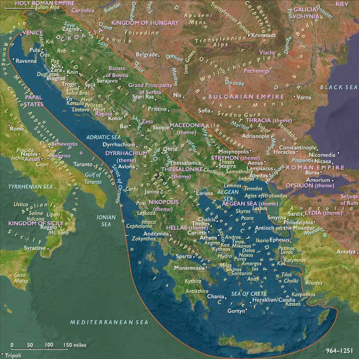
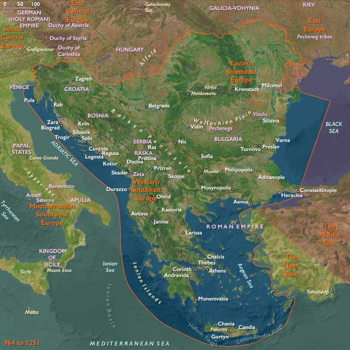
Western Southeast Europe includes Greece (outside Thrace), Albania, Montenegro, North Macedonia, Kosovo, most of Bosnia, southwestern Serbia, most of Croatia, and Slovenia.
-
Coastal lowlands and islands along the Adriatic (Dalmatia, the Ionian isles) met the Dinaric and Pindus mountains’ karst and upland pastures.
-
Interior corridors—Morava–Vardar, Drina–Sava, and the Via Egnatia from Dyrrachium (Durres) to Thessaloniki—linked the Aegean and Adriatic to the central Balkans.
-
River valleys and Mediterranean basins of Attica, Boeotia, Peloponnese, and Epiros anchored Byzantine agrarian themes.
Climate and Environmental Shifts
-
Warm conditions persisted; viticulture and herding thrived along coast-and-upland belts; river ice-free seasons lengthened shipping cycles.
Societies and Political Developments
-
Byzantium under Basil II (r. 976–1025) dismantled the First Bulgarian Empire (1018), restoring imperial control across Macedonia, Kosovo, and Greece outside Thrace; the catepanates and themes stabilized taxation and law.
-
Croatia remained a kingdom but, after dynastic ebb, entered a personal union with Hungary (1102), while coastal communes negotiated with Venice.
-
Serbian principalities (Raška, Zeta) oscillated between Byzantine and local autonomy; Vukan’s line rose late in the period.
-
Dalmatian communes—Zadar, Split, Trogir, Kotor, Ragusa—balanced Byzantine, Venetian, and Hungarian pressures, codifying statutes and expanding harbors.
-
Epirus and Achaea (within this Greece definition) remained Byzantine; local aristocracies accrued weight in the Komnenian ascent on our period’s horizon.
Economy and Trade
-
Silver and iron from inland Bosnia/Serbia moved to Dalmatia; salt pans (e.g., Pag) underwrote fiscal systems.
-
Adriatic convoys—often Venetian—linked Dalmatia to Apulia, Ancona, and Constantinople; Via Egnatia fed Dyrrhachium and inland markets.
Subsistence and Technology
-
Stone fortifications proliferated (coastal walls, inland strongholds); shipyards built cogs and galleys; notarial records standardized credit.
Movement and Interaction Corridors
-
Adriatic lanes: Venice–Dalmatia–Apulia.
-
Vardar–Morava axis integrated Skopje and Niš with Aegean and Danubian worlds.
-
Sava–Drava tied Croatia/Slovenia to Central Europe.
Belief and Symbolism
-
Orthodox monasteries (e.g., Ohrid as an ecclesiastical hub) flourished; Latin mendicants expanded in Dalmatia.
-
Relic cults and processions legitimized communal and princely authority.
Adaptation and Resilience
-
Triangular diplomacy—Byzantine, Hungarian, Venetian—kept corridors open.
-
Communal statutes/consulates lowered risk for merchants.
Long-Term Significance
By 1107, Byzantine administration was restored inland; Croatia–Hungary alignment, Serbian consolidation, and Dalmatian communal strength set the stage for 12th-century transformations.
Images

Western Southeast Europe (with civilization) ©2024-25 Electric Prism, Inc. All rights reserved.
People
Groups
Topics
Commodities
Subjects
Regions
Southeast Europe
View →Subregions